Category Archives: Maps
Tongariro Northern Circuit and Tongariro Alpine Crossing
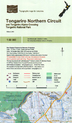
Tongariro Northern Circuit and Tongariro Alpine Crossing in the Tongariro National Park at 1:60,000 in a series of contoured and GPS compatible maps from NewTopo NZ Ltd, with exceptionally vivid presentation of the terrain, routes clearly highlighted, and symbols to show locations of various facilities. The overprint highlights the two circuits, plus adjoining local routes.
Tongariro NP: Ruapehu Round the Mountain Track
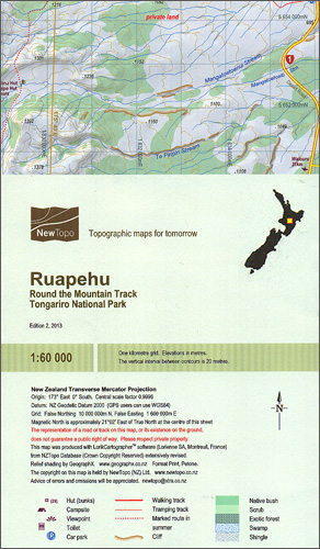
Round the Mountain Track around Mount Ruapehu in the Tongariro National Park presented at 1:60,000 in a series of contoured and GPS compatible maps from NewTopo NZ Ltd, with exceptionally vivid presentation of the terrain, routes clearly highlighted, and symbols to show locations of various facilities. The map highlights the circuit, indicating its waking and
Marlborough Sounds: Queen Charlotte Track
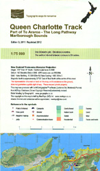
Queen Charlotte Track in the Marlborough Sounds, part of the Te Araroa long-distance trail, at 1:75,000 in a series of contoured and GPS compatible maps from NewTopo NZ Ltd, with exceptionally vivid presentation of the terrain, routes clearly highlighted and symbols to show locations of various facilities. The overprint highlights the course of the route,
Kepler Track
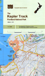
The 76-km long Kepler Track in the Fiordland National Park on New Zealand’s South Island at 1:55,000 in a series of contoured and GPS compatible maps from NewTopo NZ Ltd, with exceptionally vivid presentation of the terrain, routes clearly highlighted, and symbols to show locations of various facilities. Contour interval is 20m.Maps in the series
Lake Taupo
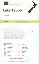
Lake Taupo and the surrounding area on New Zealand’s North Island at 1:65,000 in a series of contoured and GPS compatible maps from NewTopo NZ Ltd, with exceptionally vivid presentation of the terrain, routes clearly highlighted, and symbols to show locations of various facilities. In addition to the NZ national grid lines also has latitude
Tongariro NP: Mount Ruapehu
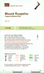
Mount Ruapehu area in the Tongariro National Park on New Zealand’s North Island at 1:40,000 in a series of contoured and GPS compatible maps from NewTopo NZ Ltd, with exceptionally vivid presentation of the terrain, routes clearly highlighted, and symbols to show locations of various facilities. The map is annotated in several places with notes
Heaphy Track
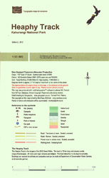
The 78-km long Heaphy Track in the Kahurangi National Park on New Zealand’s South Island at 1:55,000 in a series of contoured and GPS compatible maps from NewTopo NZ Ltd, with exceptionally vivid presentation of the terrain, routes clearly highlighted, and symbols to show locations of various facilities. The map also shows shorter tracks in
Mt Arthur and the Cobb Valley
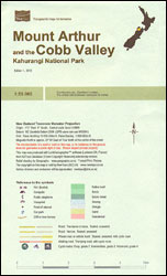
Mount Arthur and the Cobb Valley in the Kahurangi National Park on New Zealand’s South Island at 1:55,000 in a series of contoured and GPS compatible maps from NewTopo NZ Ltd, with exceptionally vivid presentation of the terrain, routes clearly highlighted, and symbols to show locations of various facilities. The map shows walking and tramping
Marlborough Sounds
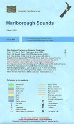
Marlborough Sounds region at the northern tip of New Zealand’s South Island at 1:130,000 in a series of contoured and GPS compatible maps from NewTopo NZ Ltd, with exceptionally vivid presentation of the terrain, routes clearly highlighted, and symbols to show locations of various facilities. The map shows a selections of local hiking tracks, indicating
Rees-Dart Circuit
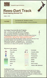
Rees-Dart Circuit in the Mount Aspiring National Park on New Zealand’s South Island at 1:40,000 in a series of contoured and GPS compatible maps from NewTopo NZ Ltd, with exceptionally vivid presentation of the terrain, routes clearly highlighted, and symbols to show locations of various facilities. In addition to the NZ national grid lines also
Routeburn, Greenstone and Caples Tracks
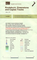
Routeburn, Greenstone and Caples Tracks in the southern part of New Zealand’s South Island at 1:40,000 in a series of contoured and GPS compatible maps from NewTopo NZ Ltd, with exceptionally vivid presentation of the terrain, routes clearly highlighted, and symbols to show locations of various facilities. In addition to the three routes the map
Rakiura / Stewart Island – North West Circuit Rakiura NP
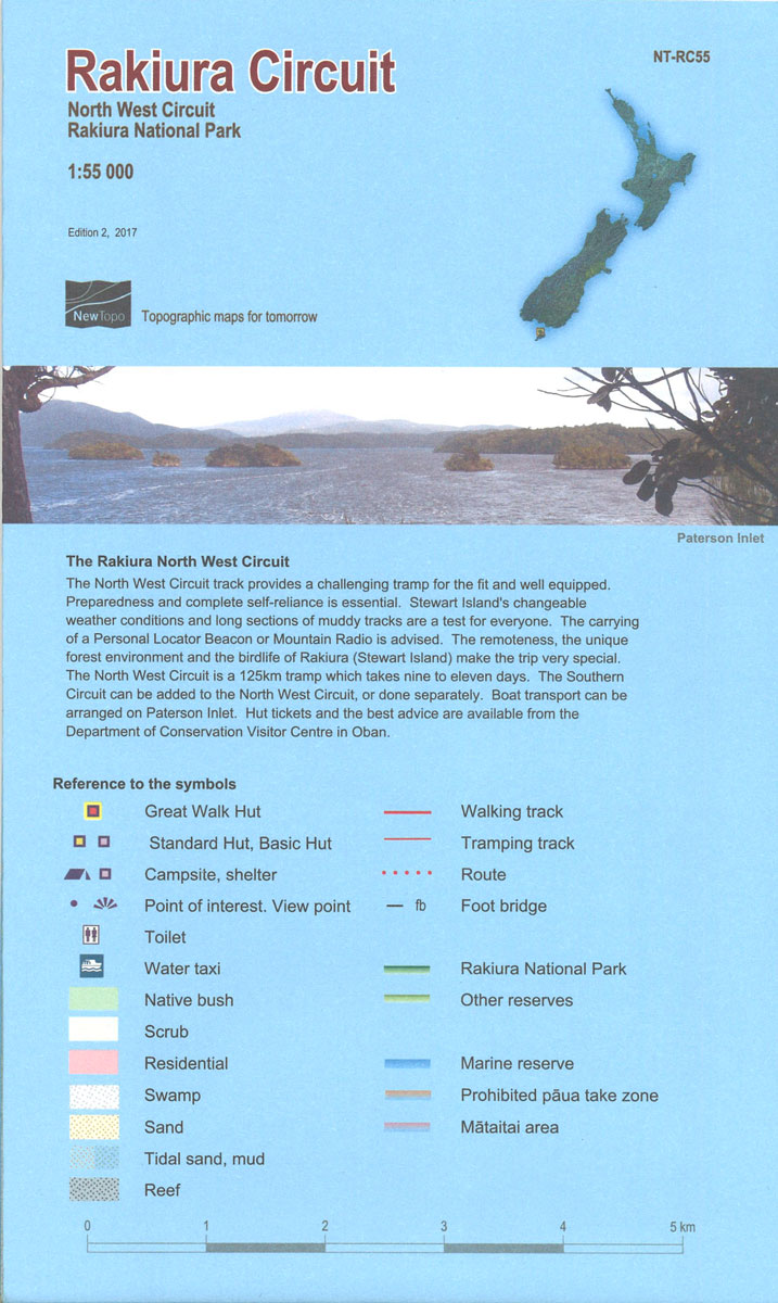
The 125-km North West Circuit plus the adjoining Southern Circuit on the Rakiura / Stewart Island at 1:55,000 in a series of contoured and GPS compatible maps from NewTopo NZ Ltd, with exceptionally vivid presentation of the terrain, routes clearly highlighted, and symbols to show locations of various facilities. The map also shows other local
Tibet Geographical Edition Wall Map
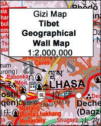
Tibet Road Edition Wall Map at 1:2,000,000 from Gizi Map, size 124 x 84cm )49″ x 33″ approx), presenting the region with bold altitude colouring to show its topography. Names of many settlements are shown in two or three versions: in the Latin alphabet transliteration of the Chinese and the Tibetan versions, plus for larger
World Global Mapping Physical Wall Map LARGE ENCAPSULATED
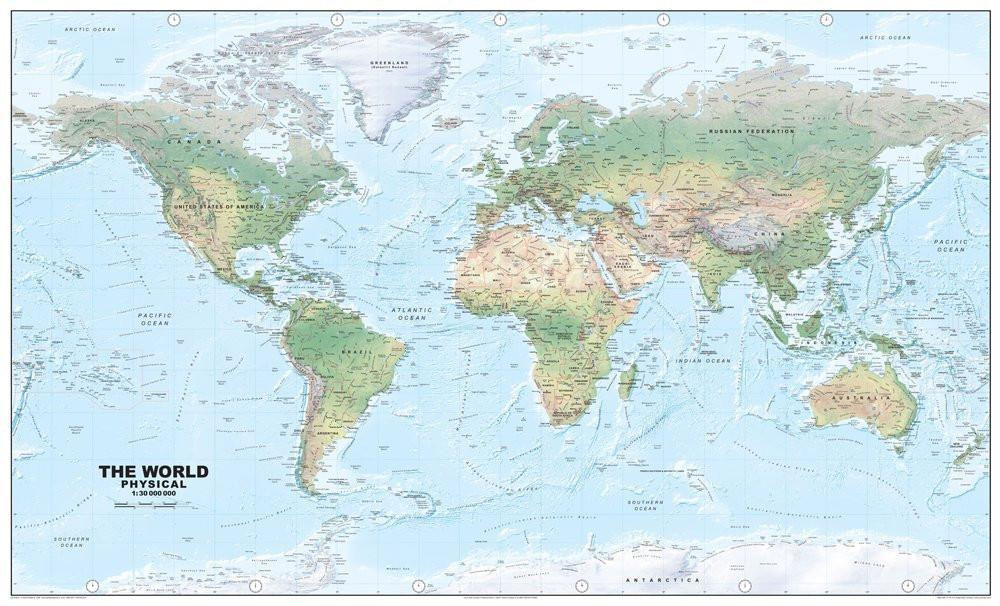
This map accurately depicts relief and terrain detail through a unique blend of digital elevation modelling and realistic surface representation – some 80 million spot heights have been processed to create the hill shading. All major physical features are identified including mountains, rivers, islands, capes and bays. A beautiful map.
Cape Reinga Coastal Walkway
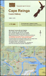
Cape Reinga Coastal Walkway along the northernmost tip of New Zealand’s North Island at 1:75,000 in a series of contoured and GPS compatible maps from NewTopo NZ Ltd, with exceptionally vivid presentation of the terrain, routes clearly highlighted, and symbols to show locations of various facilities. In addition to the NZ national grid lines also
Yemen – Gulf of Aden Wall Map
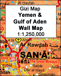
Yemen – Gulf of Aden Wall Map at 1:1,250,000 from Gizi Maps, size 125 x 89cm (49″ x 35″ approx), with excellent presentation of the topography, a street plan of central Sana’a and enlargements of the environs of the capital and Aden, plus the Aden Peninsula.The map has the publisher’s characteristic bold altitude colouring and
Aotea / Great Barrier Island
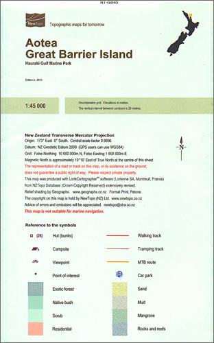
Aotea (Great Barrier Island) at 1:45,000 in a series of contoured and GPS compatible maps from NewTopo NZ Ltd, with exceptionally vivid presentation of the terrain, routes clearly highlighted, and symbols to show locations of various facilities. The map highlights the island’s walking, tramping and mountain bike routes. Symbols show locations of huts, campsites, viewpoints,
India Road Edition Wall Map
India Road Edition Wall Map at 1:2,000,000 from Gizi Map, size 86 x 124cm (34″ x 49″ approx). Coverage includes the whole of Nepal and Bangladesh plus large sections of Burma/Myanmar, Pakistan and Afghanistan. The eastern states of India, the Maldives, and the Andaman and Nicobar Islands are shown on insets.The map presents the region’s
Tongariro Alpine Crossing
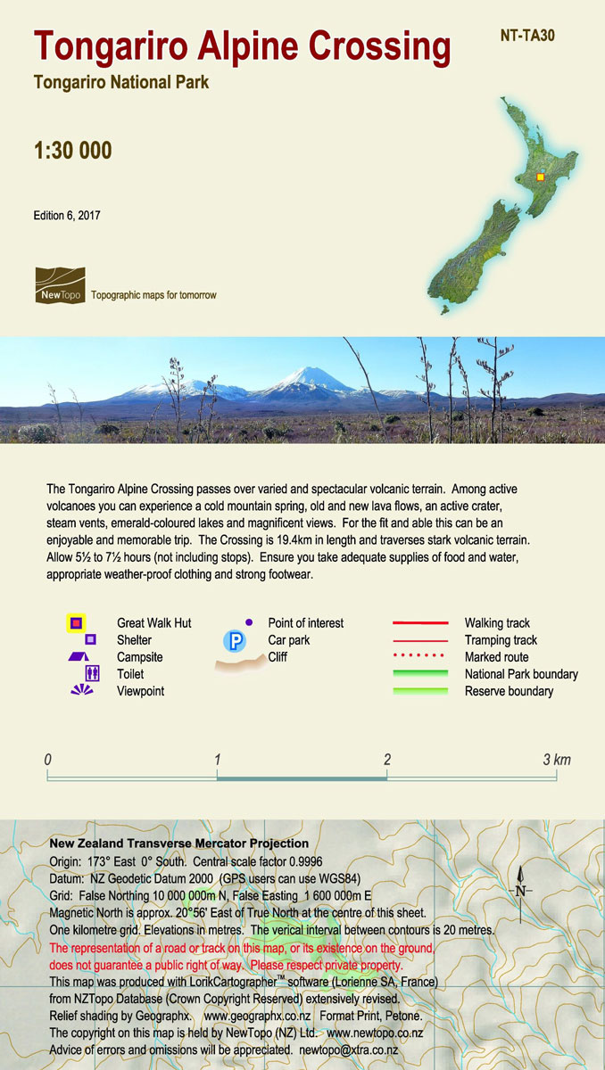
Tongariro Alpine Crossing in the Tongariro National Park at 1:30,000 in a series of contoured and GPS compatible maps from NewTopo NZ Ltd, with exceptionally vivid presentation of the terrain, routes clearly highlighted, and symbols to show locations of various facilities. The route is highlighted – indicating walking, tramping and waymarked section and junctions with
Libya Geographical Edition Wall Map
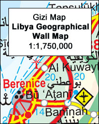
Libya Geographical Edition Wall Map at 1:1.750,000 from Gizi Map, size 97 x 87cm (38″ x 34″ approx), with bold altitude colouring to show its topography, oil and gas wells and pipelines, water aqueducts, ancients sites and other places of interest, etc. Names of larger towns and selected smaller locations, as well as of many