Category Archives: Maps
Freixo de Espada a Cinta

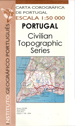
Topographic survey of Portugal at 1:50,000 from the Instituto Geogrรกfico Portuguรชs, the country’s civilian survey organisation. The maps have contours at 25m intervals and in addition to the standard features shown on topographic mapping at this scale also indicate various types of vegetation (vineyards, olive groves, etc). Each sheet covers an area of 32 x
Peniche

Topographic survey of Portugal at 1:50,000 from the Instituto Geogrรกfico Portuguรชs, the country’s civilian survey organisation. The maps have contours at 25m intervals and in addition to the standard features shown on topographic mapping at this scale also indicate various types of vegetation (vineyards, olive groves, etc). Each sheet covers an area of 32 x
Lourinha

Topographic survey of Portugal at 1:50,000 from the Instituto Geogrรกfico Portuguรชs, the country’s civilian survey organisation. The maps have contours at 25m intervals and in addition to the standard features shown on topographic mapping at this scale also indicate various types of vegetation (vineyards, olive groves, etc). Each sheet covers an area of 32 x
Alobaca

Topographic survey of Portugal at 1:50,000 from the Instituto Geogrรกfico Portuguรชs, the country’s civilian survey organisation. The maps have contours at 25m intervals and in addition to the standard features shown on topographic mapping at this scale also indicate various types of vegetation (vineyards, olive groves, etc). Each sheet covers an area of 32 x
Drakensberg

Map No. 2928, Drakensberg, in South Africa’s official topographic survey at 1:250,000 from the country’s national survey organization, the Chief Directorate of Surveys and Mapping. The maps have altitude colouring and contours at 50m or 100m intervals, depending on the map edition, plus spot heights. Deserts, marshes, dry pans, perennial and seasonal water features, etc,
Vila Real

Topographic survey of Portugal at 1:50,000 from the Instituto Geogrรกfico Portuguรชs, the country’s civilian survey organisation. The maps have contours at 25m intervals and in addition to the standard features shown on topographic mapping at this scale also indicate various types of vegetation (vineyards, olive groves, etc). Each sheet covers an area of 32 x
Castelo de Paiva

Topographic survey of Portugal at 1:50,000 from the Instituto Geogrรกfico Portuguรชs, the country’s civilian survey organisation. The maps have contours at 25m intervals and in addition to the standard features shown on topographic mapping at this scale also indicate various types of vegetation (vineyards, olive groves, etc). Each sheet covers an area of 32 x
Alenquer

Topographic survey of Portugal at 1:50,000 from the Instituto Geogrรกfico Portuguรชs, the country’s civilian survey organisation. The maps have contours at 25m intervals and in addition to the standard features shown on topographic mapping at this scale also indicate various types of vegetation (vineyards, olive groves, etc). Each sheet covers an area of 32 x
Tel Aviv – Yafo / Jaffa Topo 7/8 HEBREW

One of the titles in a series of maps from the Israeli Survey, in Hebrew – with some Roman alphabet equivalents, providing coverage of the whole of the West Bank and the Gaza Strip (pre-1967 boundaries are not shown). Most sheets were revised in the late 1990s – early 2000s, and although the areas of
Alijo

Topographic survey of Portugal at 1:50,000 from the Instituto Geogrรกfico Portuguรชs, the country’s civilian survey organisation. The maps have contours at 25m intervals and in addition to the standard features shown on topographic mapping at this scale also indicate various types of vegetation (vineyards, olive groves, etc). Each sheet covers an area of 32 x
Yeriho / Jericho Topo 9 HEBREW

One of the titles in a series of maps from the Israeli Survey, in Hebrew – with some Roman alphabet equivalents, providing coverage of the whole of the West Bank and the Gaza Strip (pre-1967 boundaries are not shown). Most sheets were revised in the late 1990s – early 2000s, and although the areas of
Yerushalayim / Jerusalem Topo 11/12 HEBREW

One of the titles in a series of maps from the Israeli Survey, in Hebrew – with some Roman alphabet equivalents, providing coverage of the whole of the West Bank and the Gaza Strip (pre-1967 boundaries are not shown). Most sheets were revised in the late 1990s – early 2000s, and although the areas of
Arad Topo 15/16 HEBREW

One of the titles in a series of maps from the Israeli Survey, in Hebrew – with some Roman alphabet equivalents, providing coverage of the whole of the West Bank and the Gaza Strip (pre-1967 boundaries are not shown). Most sheets were revised in the late 1990s – early 2000s, and although the areas of
Nizzana Topo 17 HEBREW

One of the titles in a series of maps from the Israeli Survey, in Hebrew – with some Roman alphabet equivalents, providing coverage of the whole of the West Bank and the Gaza Strip (pre-1967 boundaries are not shown). Most sheets were revised in the late 1990s – early 2000s, and although the areas of
Sede Boqer Topo 18 HEBREW

One of the titles in a series of maps from the Israeli Survey, in Hebrew – with some Roman alphabet equivalents, providing coverage of the whole of the West Bank and the Gaza Strip (pre-1967 boundaries are not shown). Most sheets were revised in the late 1990s – early 2000s, and although the areas of
Dimona Topo 19/20 HEBREW

One of the titles in a series of maps from the Israeli Survey, in Hebrew – with some Roman alphabet equivalents, providing coverage of the whole of the West Bank and the Gaza Strip (pre-1967 boundaries are not shown). Most sheets were revised in the late 1990s – early 2000s, and although the areas of
Mizpe Ramon Topo 21 HEBREW

One of the titles in a series of maps from the Israeli Survey, in Hebrew – with some Roman alphabet equivalents, providing coverage of the whole of the West Bank and the Gaza Strip (pre-1967 boundaries are not shown). Most sheets were revised in the late 1990s – early 2000s, and although the areas of
En Yahav Topo 22 HEBREW

One of the titles in a series of maps from the Israeli Survey, in Hebrew – with some Roman alphabet equivalents, providing coverage of the whole of the West Bank and the Gaza Strip (pre-1967 boundaries are not shown). Most sheets were revised in the late 1990s – early 2000s, and although the areas of
Har Saggi Topo 23 HEBREW

One of the titles in a series of maps from the Israeli Survey, in Hebrew – with some Roman alphabet equivalents, providing coverage of the whole of the West Bank and the Gaza Strip (pre-1967 boundaries are not shown). Most sheets were revised in the late 1990s – early 2000s, and although the areas of
Yotvata Topo 25 HEBREW

One of the titles in a series of maps from the Israeli Survey, in Hebrew – with some Roman alphabet equivalents, providing coverage of the whole of the West Bank and the Gaza Strip (pre-1967 boundaries are not shown). Most sheets were revised in the late 1990s – early 2000s, and although the areas of


