Category Archives: Maps
Mount Gongga Glaciers

Mount Gongga Glaciers on a detailed, contoured map at 1:25,000 published by the Chinese Institute of Glaciology and based on surveys carries out in early 1980s and aerial photography from December 1996. The map has contours at 20m intervals, enhanced by shading, plus graphics and/or colouring for exposed rock, scree, moraine, crevasses, vegetation, etc. Place
Africa: Gall & Inglis Map c.1854 SMALL
Small size version of a cloth-backed reproduction by Old Folding Maps of a map Africa in the middle of the 19th century published by the Edinburgh-based Gall & Inglis. Most of its coastal regions as well as the western parts of the Sahara have already been explored, but the interior of the continent was still
Geological Map of the World, Sheet 1: Physiography, Volcanoes, Astroblemes

A Geological Map of the World by the CGMW, designed to show the earth’s physiography while highlighting volcanoes and meteoric impact craters. This is sheet 1 of a pair of complementary geological maps, each annotated in English and French and accompanied by a booklet of extensive explanatory notes.Colour tinting represents land altimetry and ocean bathymetry,
Paris: Plan de Paris et ses Fortifications c.1844 SMALL

Small size, cloth-backed version of the Plan de Paris et ses Fortifications originally published by Auguste Logerot around 1844. The plan shows the city within its old outer walls (roughly corresponding to the present day Boulevard Pรฉriphรฉrique), highlighted on the map together with the older inner walls and gates in colour. Coverage extends out to
Stanfords Western Hemisphere Wall Map c.1877 LARGE

The Western Hemisphere in the third quarter of the 19th century presented on a reproduction of a beautiful wall map (size 88 x 106cm / 35″ x 42″ approx) with cartography which will appeal instantly to all who love browsing through old atlases. The original map was drawn by Stanford’s Geographical Establishment and ‘published under
World on Mercator`s Projection by James Wyld c.1861 MEDIUM

Medium size cloth-backed version of a reproduction by Old Folding Maps of ‘The World on Mercator’s Projection” map published by James Wyld in 1861. The map presents the world with international borders highlighted in colour. Hachures indicate main mountain ranges and the map includes plenty of place names, particularly in the coastal regions and in
Paris: Plan de Paris et ses Fortifications c.1844 MEDIUM

Medium size, cloth-backed version of the Plan de Paris et ses Fortifications originally published by Auguste Logerot around 1844. The plan shows the city within its old outer walls (roughly corresponding to the present day Boulevard Pรฉriphรฉrique), highlighted on the map together with the older inner walls and gates in colour. Coverage extends out to
Ireland: A New Map by William Faden c.1797 MEDIUM
Cloth-backed medium size version of A New Map of Ireland originally published by William Faden around 1797 and dedicated to ‘His Majesty King George the Third, The Patron and Promoter of every useful science”. Counties are in different colours, with the divisions into Ulster, Connaught, Leinster and Munster also marked. A pretty vignette of a
India c.1838 MEDIUM

A cloth-backed map of India ‘Constructed with great care and research from all the latest authorities and intended more particularly to facilitate a reference to the Civil and Military Stations. Dedicated to Sir James Rivett Carnac Bart, Chairman of the Court of Directors of the Honourable The East India Company, Arranged under the direction of
Italy: Stanfords Map of Italy 1859 MEDIUM

Medium size, cloth-backed version of a map of Italy originally published by Edward Stanford on 2nd May 1859 (the founder of our company liked to be precise!). The map catches the country in an interesting stage of its history, just before the unification, and still shows the individual states: the Kingdom of Piedmont – Sardinia,
London: A New Map of London by Robert Laurie & James Whittle c.1800 MEDIUM

Medium size, cloth-backed version of a reproduction by Old Folding Maps of A New Map of London around 1800, published by Robert Laurie and James Whittle. The map shows the capital with its main streets and access roads already coloured in as on present-day mapping. Also highlighted are London’s parks and other open green spaces,
London: Daniel Paterson`s 24 Miles Round London with Seats of Gentry and Nobility c.1791 MEDIUM
Medium size version of a cloth-backed reproduction by Old Folding Maps of Daniel Paterson`s ‘24 Miles Round London” map published in 1791. The map presents the countryside around the capital in a circular format with colouring highlighting ‘seats of nobility and gentry”. Each coloured-in location is numbered and four lists placed in the corners of
Mogg`s Strangers Guide to London c.1837

Medium size, cloth-backed version of a reproduction by Old Folding Maps of Edward Mogg`s ‘Stranger`s Guide to London, Exhibiting all the various Alterations & Improvements complete to the Present Time” published in January 1837. The map shows London with ‘a list of 500 of the principal places with references to their situation on the above
London: Cruchley`s 12 Miles Round London c.1826 SMALL

Cloth-backed, small size version of a reproduction by Old Folding Maps of Cruchley`s ‘12 Miles Round London” map published in 1826. The map stands out from the large selection of historical mapping of the capital by presenting it exactly as indicated in the title ‘“ on a circular map extending within a 12-mile radius from
London: Urbium Londini et West Monasterii c.1736 MEDIUM
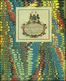
Medium size version of a cloth-backed reproduction by Old Folding Maps of ‘Urbium Londini et West Monasterii c.1736″, an exceptionally detailed and unusual map of London published by the Nuremberg-based German company Homann Heirs, successors to the famous cartographer Johann Homann. The map presents a long stretch of the Thames from the Limehouse Dock to
London: Bromley (Southern Sheet) Borough Map – Stanfords Print on Demand

Bromley (Southern Sheet) in the Stanfords Maps of London Boroughs (PRINT ON DEMAND/FLAT MAPS) is produced in-house by the digital department at our Long Acre store and has been designed by laying a bespoke, tailored borough map onto on a base map using Ordnance Survey Street View mapping. The borough area is represented by a
London: Havering (Northern Sheet) Borough Map – Stanfords Print on Demand

Havering (Northern Sheet) in the Stanfords Maps of London Boroughs (PRINT ON DEMAND/FLAT MAPS) is produced in-house by the digital department at our Long Acre store and has been designed by laying a bespoke, tailored borough map onto on a base map using Ordnance Survey Street View mapping. The borough area is represented by a
London: Havering (Southern Sheet) Borough Map – Stanfords Print on Demand

Havering (Southern Sheet) in the Stanfords Maps of London Boroughs (PRINT ON DEMAND/FLAT MAPS) is produced in-house by the digital department at our Long Acre store and has been designed by laying a bespoke, tailored borough map onto on a base map using Ordnance Survey Street View mapping. The borough area is represented by a
Stanfords Tube & Railway Map (Central London) – VERSION A
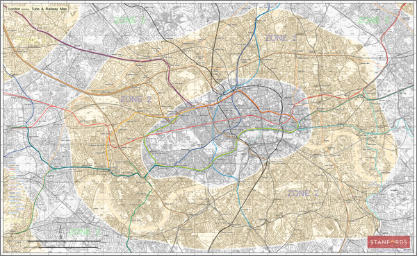
London Central Tube & Railway Map with all tube lines, DLR, Overground, and Railway Network services in the Stanfords Tube Maps (PRINT ON DEMAND/FLAT MAPS) series, covering zones 1 to 2, and partially zones 3 and 4. The map is produced in-house by the digital department at our London store and has been designed by


