Category Archives: Maps
Phuthaditjaba

Map No. 2828, Phuthaditjaba, in South Africa’s official topographic survey at 1:250,000 from the country’s national survey organization, the Chief Directorate of Surveys and Mapping. The maps have altitude colouring and contours at 50m or 100m intervals, depending on the map edition, plus spot heights. Deserts, marshes, dry pans, perennial and seasonal water features, etc,
Matehuala
Topographic mapping from Mexico’s national survey agency, Instituto Nacional de Estadรญstica, Geografรญa e Informรกtica. The maps have contours at 20m intervals with relief shading and indicate various types of terrain and vegetation, e.g. dense vegetation, cultivated areas, swamps, sand dunes, salt pans, etc. UTM grid is at 10km intervals, with latitude and longitude shown by
Concepcion del Oro

Topographic mapping from Mexico’s national survey agency, Instituto Nacional de Estadรญstica, Geografรญa e Informรกtica. The maps have contours at 20m intervals with relief shading and indicate various types of terrain and vegetation, e.g. dense vegetation, cultivated areas, swamps, sand dunes, salt pans, etc. UTM grid is at 10km intervals, with latitude and longitude shown by
Juan Aldama

Topographic mapping from Mexico’s national survey agency, Instituto Nacional de Estadรญstica, Geografรญa e Informรกtica. The maps have contours at 20m intervals with relief shading and indicate various types of terrain and vegetation, e.g. dense vegetation, cultivated areas, swamps, sand dunes, salt pans, etc. UTM grid is at 10km intervals, with latitude and longitude shown by
Vaigattbogen
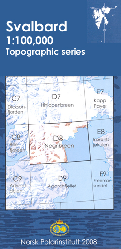
One of the titles in the topographic survey of the Svalbard group still published only in a black and white version, without geographical names. These maps cover parts of the northern and north-eastern Spitzbergen, Nordaustlandet, Edgeรธya and some of the small islands.The western coast, central and southern part of Spitzbergen, plus two small islands of
Hinlopenbreen

One of the titles in the topographic survey of the Svalbard group still published only in a black and white version, without geographical names. These maps cover parts of the northern and north-eastern Spitzbergen, Nordaustlandet, Edgeรธya and some of the small islands.The western coast, central and southern part of Spitzbergen, plus two small islands of
Negribreen

One of the titles in the topographic survey of the Svalbard group published in a colour version, available for the western coast, central and southern part of Spitzbergen, plus two small islands of Svenskรธya and Kongsรธya. The map has contours at 25-metre intervals, bold relief shading and spot heights, and shows settlements, roads and tracks,
Austfjorden

One of the titles in the topographic survey of the Svalbard group still published only in a black and white version, without geographical names. These maps cover parts of the northern and north-eastern Spitzbergen, Nordaustlandet, Edgeรธya and some of the small islands.The western coast, central and southern part of Spitzbergen, plus two small islands of
St Louis IGN Map

One of the titles in a series of topographic maps covering much of north-west Africa, produced as part of the IMW* project in 1960’s. Each map covers an area spanning 6ยฐ in longitude and 4ยฐ in latitude. There is some variation in colouring and the depiction of terrain, but hill-shading, spot heights and contours are
Cape Town

Map No. 3318, Cape Town, in South Africa’s official topographic survey at 1:250,000 from the country’s national survey organization, the Chief Directorate of Surveys and Mapping. The maps have altitude colouring and contours at 50m or 100m intervals, depending on the map edition, plus spot heights. Deserts, marshes, dry pans, perennial and seasonal water features,
Queretaro

Topographic mapping from Mexico’s national survey agency, Instituto Nacional de Estadรญstica, Geografรญa e Informรกtica. The maps have contours at 20m intervals with relief shading and indicate various types of terrain and vegetation, e.g. dense vegetation, cultivated areas, swamps, sand dunes, salt pans, etc. UTM grid is at 10km intervals, with latitude and longitude shown by
Urubamba

One of the maps in the topographic survey of Peru from the country’s national survey organization, Instituto Geogrรกfico Nacional. Contours are at 25m intervals and colouring/symbols indicate different types of terrain and vegetation. Some of the maps may contain small blank spaces representing as yet unmapped areas. Each sheet covers 30’ latitude by 30’ longitude.
Guadalajara

Topographic mapping from Mexico’s national survey agency, Instituto Nacional de Estadรญstica, Geografรญa e Informรกtica. The maps have contours at 20m intervals with relief shading and indicate various types of terrain and vegetation, e.g. dense vegetation, cultivated areas, swamps, sand dunes, salt pans, etc. UTM grid is at 10km intervals, with latitude and longitude shown by
St. Johnsfjorden

One of the titles in the topographic survey of the Svalbard group published in a colour version, available for the western coast, central and southern part of Spitzbergen, plus two small islands of Svenskรธya and Kongsรธya. The map has contours at 25-metre intervals, bold relief shading and spot heights, and shows settlements, roads and tracks,
Tre Kroner

One of the titles in the topographic survey of the Svalbard group published in a colour version, available for the western coast, central and southern part of Spitzbergen, plus two small islands of Svenskรธya and Kongsรธya. The map has contours at 25-metre intervals, bold relief shading and spot heights, and shows settlements, roads and tracks,
Postmasburg

Map No. 2822, Postmasburg, in South Africa’s official topographic survey at 1:250,000 from the country’s national survey organization, the Chief Directorate of Surveys and Mapping. The maps have altitude colouring and contours at 50m or 100m intervals, depending on the map edition, plus spot heights. Deserts, marshes, dry pans, perennial and seasonal water features, etc,
Grahamstown

Map No. 3326, Grahamstown, in South Africa’s official topographic survey at 1:250,000 from the country’s national survey organization, the Chief Directorate of Surveys and Mapping. The maps have altitude colouring and contours at 50m or 100m intervals, depending on the map edition, plus spot heights. Deserts, marshes, dry pans, perennial and seasonal water features, etc,
Carhuรกs

One of the maps in the topographic survey of Peru from the country’s national survey organization, Instituto Geogrรกfico Nacional. Contours are at 25m intervals and colouring/symbols indicate different types of terrain and vegetation. Some of the maps may contain small blank spaces representing as yet unmapped areas. Each sheet covers 30’ latitude by 30’ longitude.


