Category Archives: Maps
Ilawa Lake District
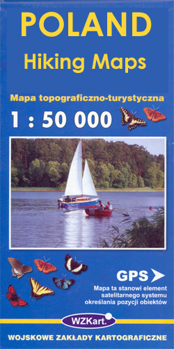
Ilawa Lake District (Pojezierze Ilawskie) at 1:50,000 in a series of recreational maps from Poland’s Army Cartographic Service. The maps use as their base the military topographic survey, with contours at intervals varying from 5m to 20m according to the terrain and contoured depths shown on lakes. An overprint highlights waymarked hiking, cycling and canoeing
Tuchola Forest

Tuchola Forest (Bory Tucholskie) at 1:50,000 in a series of recreational maps from Poland’s Army Cartographic Service. The maps use as their base the military topographic survey, with contours at intervals varying from 5m to 20m according to the terrain and contoured depths shown on lakes. An overprint highlights waymarked hiking, cycling and canoeing routes.
Mragowo Lake District

Mragowo Lake District (Pojezierze Mragowskie) at 1:50,000 in a series of recreational maps from Poland’s Army Cartographic Service. The maps use as their base the military topographic survey, with contours at intervals varying from 5m to 20m according to the terrain and contoured depths shown on lakes. An overprint highlights waymarked hiking, cycling and canoeing
Tatra Tourist Attractions (Dookola Tatr)

The Tatra Mountains in Poland and Slovakia on an overview road map at 1:100,000 from Cartomedia showing access to the mountains on both sides of the border and highlighting picturesque locations and other places of interest, plus street plans of Nowy Targ in Poland and Poprad and Liptovskรฝ Mikulรกลก in Slovakia. Coverage extends from Nowy
Oder Estuary (Zalew Szczecinski)

Oder Estuary with the town Zalew Szczecinski/Szczecin at 1:50,000 in a series of recreational maps from Polish Army Cartographic Service. The maps use as their base the military topographic survey, with contours at intervals varying from 5m to 20m according to the terrain and contoured depths shown on lakes. An overprint highlights waymarked hiking, cycling
Tatra Mountains PL/SK
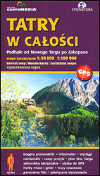
Tatra Mountains, both the Polish and the Slovak side of the border, at 1:50,000 on a contoured and GPS compatible map from CartoMedia, with the overprint for waymarked trails also indicating hiking times in both directions, details of mountain huts, etc. On the Polish side the main map extends north of Zakopane to Bialy Dunajec,
Lake Sulejowskie and Environs

Lake (Jezioro) Sulejowskie in a series of recreational maps from Poland’s Army Cartographic Service. The maps use as their base the military topographic survey, with contours at intervals varying from 5m to 20m according to the terrain and contoured depths shown on lakes. An overprint highlights waymarked hiking, cycling and canoeing routes. A wide range
Szczecin and Environs

Szczecin and environs in a series of recreational maps from Polish Army Cartographic Service. The maps use as their base the military topographic survey, with contours at intervals varying from 5m to 20m according to the terrain and contoured depths shown on lakes. An overprint highlights waymarked hiking, cycling and canoeing routes. A wide range
Beskid Niski: Eastern Part

The eastern part of Beskid Niski in a series of recreational maps from Poland’s Army Cartographic Service. The maps use as their base the military topographic survey, with contours at intervals varying from 5m to 20m according to the terrain and contoured depths shown on lakes. An overprint highlights waymarked hiking, cycling and canoeing routes.
Beskid Niski: Western Part

The western part of Beskid Niski in a series of recreational maps from Poland’s Army Cartographic Service. The maps use as their base the military topographic survey, with contours at intervals varying from 5m to 20m according to the terrain and contoured depths shown on lakes. An overprint highlights waymarked hiking, cycling and canoeing routes.
Kaszuby Lake District: Southern Part

The southern part of the Kaszuby Lake District in a series of recreational maps from Poland’s Army Cartographic Service. The maps use as their base the military topographic survey, with contours at intervals varying from 5m to 20m according to the terrain and contoured depths shown on lakes. An overprint highlights waymarked hiking, cycling and
Kaszuby Lake District: Northern Part

The northern part of the Kaszuby Lake District in a series of recreational maps from Poland’s Army Cartographic Service. The maps use as their base the military topographic survey, with contours at intervals varying from 5m to 20m according to the terrain and contoured depths shown on lakes. An overprint highlights waymarked hiking, cycling and
Olsztyn Lake District: Western Part

Olsztyn Lake District: Western Part (Pojezierze Olsztynskie) at 1:50,000 in a series of recreational maps from Poland’s Army Cartographic Service. The maps use as their base the military topographic survey, with contours at intervals varying from 5m to 20m according to the terrain and contoured depths shown on lakes. An overprint highlights waymarked hiking, cycling
Olsztyn Lake District: Eastern Part

Olsztyn Lake District: Eastern Part (Pojezierze Olsztynskie) at 1:50,000 in a series of recreational maps from Poland’s Army Cartographic Service. The maps use as their base the military topographic survey, with contours at intervals varying from 5m to 20m according to the terrain and contoured depths shown on lakes. An overprint highlights waymarked hiking, cycling
Baltic Coast: Gdynia – Hel Peninsula – Nadmorski Regional Park

The Nadmorski Regional Park on the Baltic coast, stretching from the outskirts of Gdynia to the tip of the Hel Peninsula, on a detailed map at 1:50,000 from EKO-GRAF, with street plans of the regions main towns and popular holiday resorts.On one side the park is presented on three separate panels at 1:50,000: Gdynia to
K2 and Baltoro Glacier
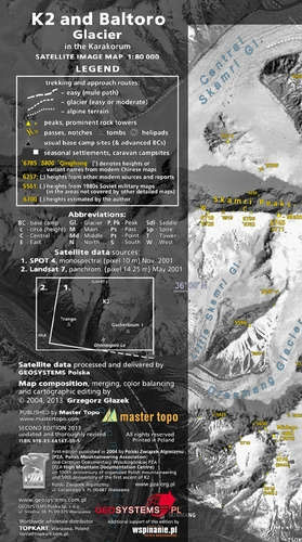
Stunning satellite image of the K2 and the Baltoro Glacier in the Karakoram at 1:80,000, produced by the Polish Mountaineering Association and annotated with names of peaks, glaciers and passes, numerous spot heights, trekking and approach routes, base camps and seasonal settlements. Centered on the peak of K2, coverage extends from the Sughet Jangal (‘Yinhongtan
Lรณdz and Environs

Lรณdz and its environs at 1:50,000 in a series of recreational maps from Poland’s Army Cartographic Service WZKart. The maps use as their base the military topographic survey, with contours at intervals varying from 5m to 20m according to the terrain and contoured depths shown on lakes. An overprint highlights waymarked hiking, cycling and canoeing
Klodzko Region 2-Map Set

Klodzko and Environs (Ziemia Klodzka) at 1:50,000 in a series of recreational maps from Poland’s Army Cartographic Service. The maps use as their base the military topographic survey, with contours at intervals varying from 5m to 20m according to the terrain and contoured depths shown on lakes. An overprint highlights waymarked hiking, cycling and canoeing
Drawsko Pomorskie Lake District

Drawsko Pomorskie Lake District (Pojezierze Drawskie) at 1:50,000 in a series of recreational maps from Poland’s Army Cartographic Service. The maps use as their base the military topographic survey, with contours at intervals varying from 5m to 20m according to the terrain and contoured depths shown on lakes. An overprint highlights waymarked hiking, cycling and
Poznan and Environs

Poznan and environs in a series of recreational maps from Poland’s Army Cartographic Service. The maps use as their base the military topographic survey, with contours at intervals varying from 5m to 20m according to the terrain and contoured depths shown on lakes. An overprint highlights waymarked hiking, cycling and canoeing routes. A wide range


