Category Archives: Maps
Poland`s Tourist Attractions Map

Road map of Poland designed to highlight the country’s various tourist attractions, with 161 sights prominently highlighted and cross-referenced to their descriptions on the reverse side, plus enlargements showing popular tourist regions in greater detail.The main map covers Poland at 1:685,000, with the 161 selected sights numbered and many also highlighted by small drawings. The
Bydgoszcz and Torun Environs ExpressMap Tourist Map
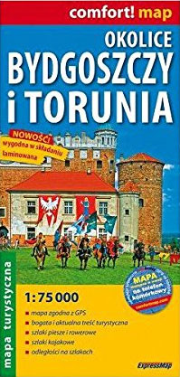
The environs of Bydgoszcz and Torun in a series covering Poland’s best hiking areas on waterproof and tear-resistant, laminated maps, specially designed to withstand repeated re-folding and even the worst weather conditions. Each map is double-sided and has clear, well presented cartography with a contoured base (20m interval) and, where appropriate, relief shading, graphic relief
Warsaw Southern Environs

Warsaw`s southern environs in a series of detailed maps of Poland’s most popular recreational areas, showing waymarked hiking and cycling routes and various types of overnight accommodation, including local hotels, youth hostels, shelters and mountain huts, campsites, camping on local farms, etc. The maps also show various sport and recreational facilities: swimming pools, equestrian and
Miedzyrzecz Fortified Region: the Land of Bunkers and Bats
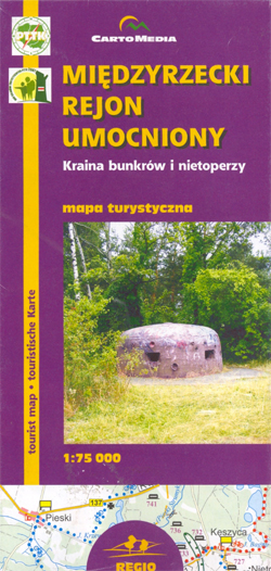
Miedzyrzecz Fortified Region on a detailed recreational map of this fascinating area of western Poland with underground military fortifications build by Germany in the late 1930s and extended in 1945, now part of one of Europe’s largest bat reserves.The map covers an area of approximately 22.5 x 26km (14×17 miles), centred on a town of
Kazimierz Dolny and Environs
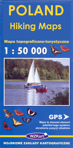
Kazimierz Dolny and Environs at 1:50,000 in a series of recreational maps from Poland’s Army Cartographic Service. The maps use as their base the military topographic survey, with contours at intervals varying from 5m to 20m according to the terrain and contoured depths shown on lakes. An overprint highlights waymarked hiking, cycling and canoeing routes.
Drawienski (Drawno) National Park

Drawienski (Drawno) National Park at 1:50,000 in a series of recreational maps from Poland’s Army Cartographic Service. The maps use as their base the military topographic survey, with contours at intervals varying from 5m to 20m according to the terrain and contoured depths shown on lakes. An overprint highlights waymarked hiking, cycling and canoeing routes.
Klodzko and Environs

Klodzko and Environs (Ziemia Klodzka) at 1:50,000 in a series of recreational maps from Poland’s Army Cartographic Service. The maps use as their base the military topographic survey, with contours at intervals varying from 5m to 20m according to the terrain and contoured depths shown on lakes. An overprint highlights waymarked hiking, cycling and canoeing
Mazury Great Lakes: Southern Part

The southern part of the Great Lakes area of the Mazury Lake District in a series of recreational maps from Poland’s Army Cartographic Service. The maps use as their base the military topographic survey, with contours at intervals varying from 5m to 20m according to the terrain and contoured depths shown on lakes. An overprint
Mazury Great Lakes: Northern Part

The northern part of the Great Lakes area of the Mazury Lake District in a series of recreational maps from Poland’s Army Cartographic Service. The maps use as their base the military topographic survey, with contours at intervals varying from 5m to 20m according to the terrain and contoured depths shown on lakes. An overprint
Tatras Central: Zakopane – Kasprowy Wierch (Tatry Reglowe)
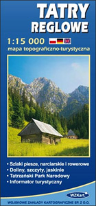
The central part of the Tatra Mountains on an exceptionally detailed, contoured and GPS compatible map at 1:15,000 from WZKart – Poland’s Army Cartographic Service. Coverage in the northern part of the map starts at Gubalwka just north of Zakopane, extending along the peaks from Smerczynski Wierch to Swinica, so includes some of the most
Tatras Eastern: Swinica – Rysy (Tatry Wschodnie)

The eastern part of the Tatra Mountains on an exceptionally detailed, contoured and GPS compatible map at 1:15,000 from WZKart – Poland’s Army Cartographic Service. Coverage extends from the eastern outskirts of Zakopane, Murzasichle and Male Ciche to the highest part of the Polish Tatras from the peak of Swinica to Rysy.Contours are at 10m
Bialowieza / Puszcza Bialowieska National Park
Puszcza Bialowieska – Bialowieza National Park at 1:50,000 in a series of recreational maps from Poland’s Army Cartographic Service. The maps use as their base the military topographic survey, with contours at intervals varying from 5m to 20m according to the terrain and contoured depths shown on lakes. An overprint highlights waymarked hiking, cycling and
Tatras Western: Koscielisko and the Western Valleys (Tatry Zachodnie)

The western part of the Tatra Mountains on an exceptionally detailed, contoured and GPS compatible map at 1:15,000 from WZKart – Poland’s Army Cartographic Service. Coverage starts to Koscielisko, just west of Zakopane, to show the area’s two beautiful valleys: Koscieliska and Chocholowska, and extends across the border to include northern approaches to the main
Ilawa Lake District

Ilawa Lake District (Pojezierze Ilawskie) at 1:50,000 in a series of recreational maps from Poland’s Army Cartographic Service. The maps use as their base the military topographic survey, with contours at intervals varying from 5m to 20m according to the terrain and contoured depths shown on lakes. An overprint highlights waymarked hiking, cycling and canoeing
Tuchola Forest

Tuchola Forest (Bory Tucholskie) at 1:50,000 in a series of recreational maps from Poland’s Army Cartographic Service. The maps use as their base the military topographic survey, with contours at intervals varying from 5m to 20m according to the terrain and contoured depths shown on lakes. An overprint highlights waymarked hiking, cycling and canoeing routes.


