Category Archives: Maps
Biebrza National Park ENGLISH

Biebrzanski National Park, Poland’s prime nature and bird watching area along the marshes of the Biebrza River, on a detailed map in an English language edition with extensive text describing hiking, cycling and water trails, places of interest, etc.The map shows the whole of the Biebrzanski National Park at 1:100,000, extending out across the surrounding
Gdansk Panorama Plan

Hand-drawn panorama map of Gdansk, offering a bird’s-eye view of Poland’s principal seaport. Every building is lovingly recreated from the Church of Our Lady to the city’s vast docks; 36 of Gdansk’s most famous landmarks are highlighted and described in detail on the map’s reverse. Drawn by artist Ruben Atoyan, a magnifier is enclosed to
Bialowieza Forest (Polish part)
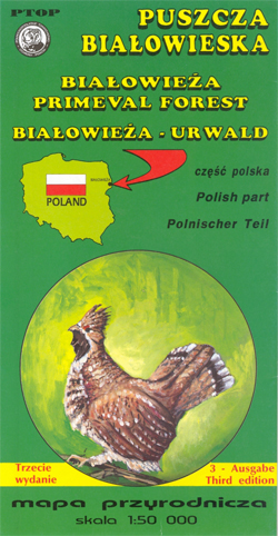
Detailed map for hiking and bird spotting in the Polish part of the Bialowieza Forest straddling the border between Poland and Belarus, the largest remaining part of ancient forests which used to cover vast areas of Europe and the last remaining habitat of the European bison. The area is also one of the centres of
El Moncayo Editorial Piolet
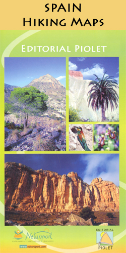
El Moncayo area at 1:30,000 in a series of GPS compatible maps from Editorial Piolet with cartography based on Spain’s civilian topographic survey overprinted with hiking routes and other tourist information. In addition to local and long-distance hiking paths the overprint also indicates cycling and mountain-bike routes.Hiking maps in the Editorial Piolet series, unless indicated
Kaliningrad

Street names are given in Latin and Cyrillic script.Symbols are explained in Polish, German, Russian and English.Monuments and public buildings are highlighted on the map as well as museums, hotels, hospitals and post offices.An insert map at a scale of 1:500,000 shows the main routes of access to the city.
Cami de l`Ossa – Andorra Editorial Piolet

The Bear Trail, Camรญ de l`ร“ssa, a circular hiking route in Andorra on a contoured and GPS compatible map at 1:15,000 from Editorial Piolet, with eight additional recommended walks from Encamp. The map has contours at 10m intervals enhanced by bold relief shading. The overprint also indicates other waymarked paths, hotels, campsites, mountain refuges, various
La Ruta del Caracremada Editorial Piolet

La Ruta del Caracremada, a hiking circuit in the Catalan Pyrenees just north-west of Berga, presented at 1:30,000 in a series of GPS compatible maps from Editorial Piolet with cartography based on Spain’s civilian topographic survey overprinted with hiking routes and other tourist information. The route which traces the footsteps of Ramon Vila Capdevila, Catalan
Ighil Mgoun Editorial Piolet

Ighil Mgoun range in the central part of Morocco’s High Atlas Mountains on a detailed, GPS compatible, contoured map at 1:60,000 from Editorial Piolet, Contours at 20m intervals are enhanced by bold relief shading, with numerous spot heights and names of valleys, etc.The map is centred on Tabant and shows local roads, track and trails,
Niepolomice – Puszcza Niepolomicka

Puszcza Niepolomicka and the town of Niepolomice in a series of detailed maps of Poland’s most popular recreational areas, showing waymarked hiking and cycling routes and various types of overnight accommodation, including local hotels, youth hostels, shelters and mountain huts, campsites, camping on local farms, etc. The maps also show various sport and recreational facilities:
Hiking Alt Camp Editorial Piolet

Alt Camp area north of Tarragona, around Vals and Montblanc, on a contoured and GPS compatible map at 1:40,000 from Editorial Piolet. Topography is presented by contours at 10m intervals with plenty of additional spot heights. An overprint highlights waymarked local and long distance routes and symbols show various facilities and places of interest including
Beskid Slaski

Beskid Slaski in a series of detailed maps of Poland’s most popular recreational areas, showing waymarked hiking and cycling routes and various types of overnight accommodation, including local hotels, youth hostels, shelters and mountain huts, campsites, camping on local farms, etc. The maps also show various sport and recreational facilities: swimming pools, equestrian and watersport
Mazowiecki Regional Park

Mazowiecki Regional Park in a series of detailed maps of Poland’s most popular recreational areas, showing waymarked hiking and cycling routes and various types of overnight accommodation, including local hotels, youth hostels, shelters and mountain huts, campsites, camping on local farms, etc. The maps also show various sport and recreational facilities: swimming pools, equestrian and
Pogรณrze Ciezkowickie

Pogรณrze Ciezkowickie in a series of detailed maps of Poland’s most popular recreational areas, showing waymarked hiking and cycling routes and various types of overnight accommodation, including local hotels, youth hostels, shelters and mountain huts, campsites, camping on local farms, etc. The maps also show various sport and recreational facilities: swimming pools, equestrian and watersport
Bialystok +7 (Bielsk Podlaski, Drohiczyn, Hajnowka, Lapy, Siemiatycze, Sokolka, Suprasl)

Bialystok +7 (Bielsk Podlaski, Drohiczyn, Hajnรณwka, Lapy, Siemiatycze, Sokรณlka and Suprasl) at 1:17,000 from Demart, Poland’s leading publisher of high quality street plans, showing public transport routes with line numbers and stops, coach connections, petrol stations, hotels, campsites, youth hostels, places of interest, etc.Demart’s street plans are designed to cover the larger town(s) as its
Berlin Street Plan & Panorama Map
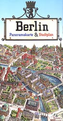
Berlin from Terra Nostra on a double-sided map combining a conventional street plan of the city’s central districts, highlighting numerous sights, with a beautifully drawn 3-D panorama map of the centre presenting all the buildings drawn with full architectural detail.On one side is a conventional street plan of Berlin’s central districts extending from the Olympic
Krakow City Centre and Panorama TerraNostra Map

Krakรณw from Terra Nostra with two plans in one map: a beautiful 3-D panorama drawing of the city’s historic heart with all its buildings shown with full architectural details, plus a conventional street plan of the central districts.On one side is a conventional street plan covering central Krakรณw, extending well beyond the Old Town, to
Lakes Mamry, Swiecajty, Stregiel, Kirsajty and the Northern Part of Dargin
Lakes Mamry, Swiecajty, Stregiel, Kirsajty and the northern part of Lake Dargin in the Masurian Lake District at 1:25,000 on a waterproof and tear-resistant sailing map from the Warsaw-based Centrum Kartografii. On water, in addition to depths the map also indicates stone reef, shores lined with stones or vegetation, buoys and where appropriate the direction
Lakes Kisajno, Dobskie and the Southern Part of Dargin
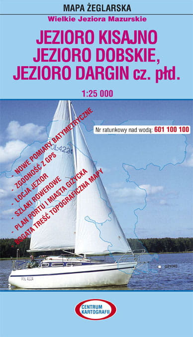
Lakes Kisajno, Dobskie and the southern part of Dargin in the Masurian Lake District at 1:25,000 on a waterproof and tear-resistant sailing map from the Warsaw-based Centrum Kartografii. On water, in addition to depths the map also indicates stone reef, shores lined with stones or vegetation, buoys and where appropriate the direction of sailing, prohibition
Lake Ros

Lake Ros in the Masurian Lake District at 1:20,000 on a waterproof and tear-resistant sailing map from the Warsaw-based Centrum Kartografii. On water, in addition to depths the map also indicates stone reef, shores lined with stones or vegetation, buoys and where appropriate the direction of sailing, prohibition of outdoor motors, mooring places, etc. Areas


