Category Archives: Maps
Santa Comba Dao
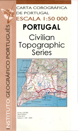
Topographic survey of Portugal at 1:50,000 from the Instituto Geogrรกfico Portuguรชs, the country’s civilian survey organisation. The maps have contours at 25m intervals and in addition to the standard features shown on topographic mapping at this scale also indicate various types of vegetation (vineyards, olive groves, etc). Each sheet covers an area of 32 x
Vila Pouca de Aguiar
Topographic survey of Portugal at 1:50,000 from the Instituto Geogrรกfico Portuguรชs, the country’s civilian survey organisation. The maps have contours at 25m intervals and in addition to the standard features shown on topographic mapping at this scale also indicate various types of vegetation (vineyards, olive groves, etc). Each sheet covers an area of 32 x
Corani

One of the maps in the topographic survey of Peru from the country’s national survey organization, Instituto Geogrรกfico Nacional. Contours are at 25m intervals and colouring/symbols indicate different types of terrain and vegetation. Some of the maps may contain small blank spaces representing as yet unmapped areas. Each sheet covers 30’ latitude by 30’ longitude.
Agardhfjellet
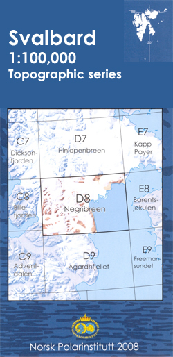
One of the titles in the topographic survey of the Svalbard group published in a colour version, available for the western coast, central and southern part of Spitzbergen, plus two small islands of Svenskรธya and Kongsรธya. The map has contours at 25-metre intervals, bold relief shading and spot heights, and shows settlements, roads and tracks,
Dadapakhar
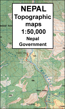
Dadapakhar, sheet no. 2785-08, in the topographic survey of Nepal at 1:50,000 published by the Nepali Government in the late 1990s and early 2000s and produced from remote sensing data by Finnish cartographers as part of that country’s international aid program. The maps cover 15’ x 15’ quadrangles.IMPORTANT ‘“ PLEASE NOTE BEFORE ORDERING: AVAILABILITY: although,
Langtang Lirung
Langtang Lirung, sheet no. 2885-11, in the topographic survey of Nepal at 1:50,000 published by the Nepali Government in the late 1990s and early 2000s and produced from remote sensing data by Finnish cartographers as part of that country’s international aid program. The maps cover 15’ x 15’ quadrangles.IMPORTANT ‘“ PLEASE NOTE BEFORE ORDERING: AVAILABILITY:
Rasuwagadhi
Rasuwagadhi, sheet no. 2885-10, in the topographic survey of Nepal at 1:50,000 published by the Nepali Government in the late 1990s and early 2000s and produced from remote sensing data by Finnish cartographers as part of that country’s international aid program. The maps cover 15’ x 15’ quadrangles.IMPORTANT ‘“ PLEASE NOTE BEFORE ORDERING: AVAILABILITY: although,
Grandola
Topographic survey of Portugal at 1:50,000 from the Instituto Geogrรกfico Portuguรชs, the country’s civilian survey organisation. The maps have contours at 25m intervals and in addition to the standard features shown on topographic mapping at this scale also indicate various types of vegetation (vineyards, olive groves, etc). Each sheet covers an area of 32 x
Gota
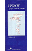
Topographic survey of Faroe Islands at 1:20,000 prepared by the Danish national mapping agency Kort og Matrikelstyrelsen. The islands’ topography is vividly presented by contours at 5 metre intervals, enhanced by relief shading plus colouring and/or graphics for different types of terrain or vegetation (scree, boulders, etc). The maps show all the detail expected of
Ganesh Himal 2885-09
Ganesh Himal, sheet no. 2885-09, in the topographic survey of Nepal at 1:50,000 published by the Nepali Government in the late 1990s and early 2000s and produced from remote sensing data by Finnish cartographers as part of that country’s international aid program. The maps cover 15’ x 15’ quadrangles.IMPORTANT ‘“ PLEASE NOTE BEFORE ORDERING: AVAILABILITY:
Vestmanna
Topographic survey of Faroe Islands at 1:20,000 prepared by the Danish national mapping agency Kort og Matrikelstyrelsen. The islands’ topography is vividly presented by contours at 5 metre intervals, enhanced by relief shading plus colouring and/or graphics for different types of terrain or vegetation (scree, boulders, etc). The maps show all the detail expected of
Kollafjordur
Topographic survey of Faroe Islands at 1:20,000 prepared by the Danish national mapping agency Kort og Matrikelstyrelsen. The islands’ topography is vividly presented by contours at 5 metre intervals, enhanced by relief shading plus colouring and/or graphics for different types of terrain or vegetation (scree, boulders, etc). The maps show all the detail expected of
Runavik
Topographic survey of Faroe Islands at 1:20,000 prepared by the Danish national mapping agency Kort og Matrikelstyrelsen. The islands’ topography is vividly presented by contours at 5 metre intervals, enhanced by relief shading plus colouring and/or graphics for different types of terrain or vegetation (scree, boulders, etc). The maps show all the detail expected of
Nordradalur
Topographic survey of Faroe Islands at 1:20,000 prepared by the Danish national mapping agency Kort og Matrikelstyrelsen. The islands’ topography is vividly presented by contours at 5 metre intervals, enhanced by relief shading plus colouring and/or graphics for different types of terrain or vegetation (scree, boulders, etc). The maps show all the detail expected of
Torshavn
Topographic survey of Faroe Islands at 1:20,000 prepared by the Danish national mapping agency Kort og Matrikelstyrelsen. The islands’ topography is vividly presented by contours at 5 metre intervals, enhanced by relief shading plus colouring and/or graphics for different types of terrain or vegetation (scree, boulders, etc). The maps show all the detail expected of
Barhabise
Barhabise, sheet no. 2785-04, in the topographic survey of Nepal at 1:50,000 published by the Nepali Government in the late 1990s and early 2000s and produced from remote sensing data by Finnish cartographers as part of that country’s international aid program. The maps cover 15’ x 15’ quadrangles.IMPORTANT ‘“ PLEASE NOTE BEFORE ORDERING: AVAILABILITY: although,
Machupicchu
One of the maps in the topographic survey of Peru from the country’s national survey organization, Instituto Geogrรกfico Nacional. Contours are at 25m intervals and colouring/symbols indicate different types of terrain and vegetation. Some of the maps may contain small blank spaces representing as yet unmapped areas. Each sheet covers 30’ latitude by 30’ longitude.
Abancay
One of the maps in the topographic survey of Peru from the country’s national survey organization, Instituto Geogrรกfico Nacional. Contours are at 25m intervals and colouring/symbols indicate different types of terrain and vegetation. Some of the maps may contain small blank spaces representing as yet unmapped areas. Each sheet covers 30’ latitude by 30’ longitude.
Tenosique
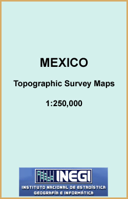
Topographic mapping from Mexico’s national survey agency, Instituto Nacional de Estadรญstica, Geografรญa e Informรกtica. The maps have contours at 20m intervals with relief shading and indicate various types of terrain and vegetation, e.g. dense vegetation, cultivated areas, swamps, sand dunes, salt pans, etc. UTM grid is at 10km intervals, with latitude and longitude shown by
Tjornuvรญk
Topographic survey of Faroe Islands at 1:20,000 prepared by the Danish national mapping agency Kort og Matrikelstyrelsen. The islands’ topography is vividly presented by contours at 5 metre intervals, enhanced by relief shading plus colouring and/or graphics for different types of terrain or vegetation (scree, boulders, etc). The maps show all the detail expected of