Category Archives: Maps
Zorita CNIG Topo 731
Topographic coverage of mainland Spain at 1:50,000 in the MTN50 (Mapa Topogrรกfico Nacional) series from the Centro Nacional de Informaciรณn Geografica, the country’s civilian survey organization. The maps have contours at 20m intervals, enhanced by relief shading, plus colouring and/or graphics to show different types of terrain, vegetation or land use. Boundaries of national parks
Beceite CNIG Topo 521
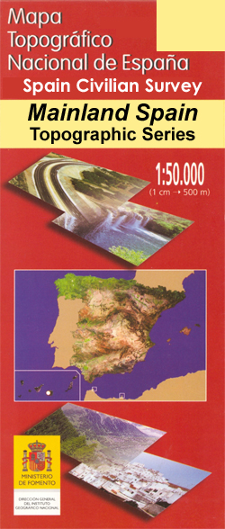
Topographic coverage of mainland Spain at 1:50,000 in the MTN50 (Mapa Topogrรกfico Nacional) series from the Centro Nacional de Informaciรณn Geografica, the country’s civilian survey organization. The maps have contours at 20m intervals, enhanced by relief shading, plus colouring and/or graphics to show different types of terrain, vegetation or land use. Boundaries of national parks
Castaรฑar de Ibor CNIG Topo 681
Topographic coverage of mainland Spain at 1:50,000 in the MTN50 (Mapa Topogrรกfico Nacional) series from the Centro Nacional de Informaciรณn Geografica, the country’s civilian survey organization. The maps have contours at 20m intervals, enhanced by relief shading, plus colouring and/or graphics to show different types of terrain, vegetation or land use. Boundaries of national parks
Quinto CNIG Topo 413
Topographic coverage of mainland Spain at 1:50,000 in the MTN50 (Mapa Topogrรกfico Nacional) series from the Centro Nacional de Informaciรณn Geografica, the country’s civilian survey organization. The maps have contours at 20m intervals, enhanced by relief shading, plus colouring and/or graphics to show different types of terrain, vegetation or land use. Boundaries of national parks
Pinos Puente CNIG Topographic Map 1009-I
Topographic coverage of mainland Spain at 1:25,000 published by the Centro Nacional de Informaciรณn Geograficรก, the country’s civilian survey organization. The maps have contours at 10m intervals and colouring and/or graphics to show different types of vegetation or land use. Boundaries of national parks and other protected areas are marked. In addition to all the
Pina de Ebro CNIG Topo 412
Topographic coverage of mainland Spain at 1:50,000 in the MTN50 (Mapa Topogrรกfico Nacional) series from the Centro Nacional de Informaciรณn Geografica, the country’s civilian survey organization. The maps have contours at 20m intervals, enhanced by relief shading, plus colouring and/or graphics to show different types of terrain, vegetation or land use. Boundaries of national parks
Deifontes CNIG Topographic Map 1009-II

Topographic coverage of mainland Spain at 1:25,000 published by the Centro Nacional de Informaciรณn Geograficรก, the country’s civilian survey organization. The maps have contours at 10m intervals and colouring and/or graphics to show different types of vegetation or land use. Boundaries of national parks and other protected areas are marked. In addition to all the
Puerto del Rosario CNIG Topo 1090
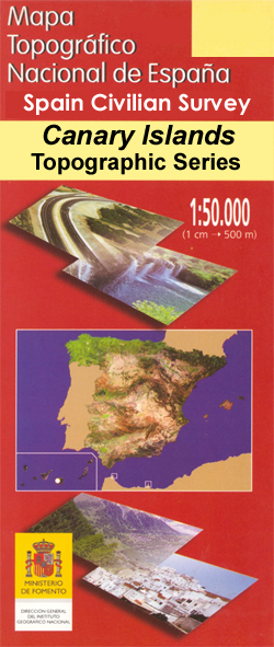
Puerto del Rosario area of Fuerteventura, map No. 1090 in the topographic coverage of the Canary Islands at 1:50,000 from the Instituto Geogrรกfico Nacional – Centro Nacional de Informaciรณn Geograficรก, Spain’s civilian survey organization. Maps in the MTN50 (Mapa Topogrรกfico Nacional) series begun in late 1990s have contours at 20m intervals enhanced by relief shading,
Santa Fe CNIG Topographic Map 1009-III

Topographic coverage of mainland Spain at 1:25,000 published by the Centro Nacional de Informaciรณn Geograficรก, the country’s civilian survey organization. The maps have contours at 10m intervals and colouring and/or graphics to show different types of vegetation or land use. Boundaries of national parks and other protected areas are marked. In addition to all the
Mapamundi de Luis XIV de Francia 1688
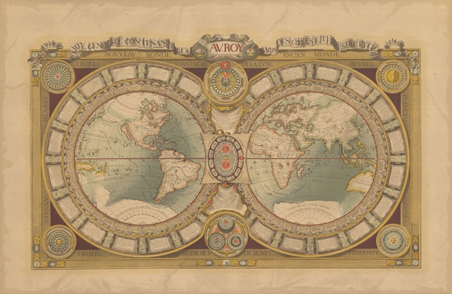
Coloured reproduction from the IGN-CNIG – Spain’s Civilian Survey organization of a map of the world prepared in 1688 by Jacques Jaugeon, French scholar and royal typographer during the reign of King Louis XIV. The map presents the world in two hemispheres, surrounded by allegorical figures representing the constellations and definitions of geographical terms (meridians,
Granada NorteCNIG Topographic Map 1009-IV

Topographic coverage of mainland Spain at 1:25,000 published by the Centro Nacional de Informaciรณn Geograficรก, the country’s civilian survey organization. The maps have contours at 10m intervals and colouring and/or graphics to show different types of vegetation or land use. Boundaries of national parks and other protected areas are marked. In addition to all the
Castilla-la-Mancha Autonomous Region 400K CNIG Physical Road Map
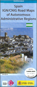
Castilla-la-Mancha Autonomous Region of Spain at 1:400,000 in a series of physical road maps from IGN/CNIG – the country’s civilian survey organization, with an excellent presentation of the topography through relief shading and altitude colouring, plenty of names of mountain ranges, peaks, etcRelief shading is enhanced by bright altitude colouring, with plenty of names of
La Aldea del Obispo CNIG Topo 679
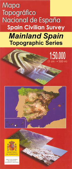
Topographic coverage of mainland Spain at 1:50,000 in the MTN50 (Mapa Topogrรกfico Nacional) series from the Centro Nacional de Informaciรณn Geografica, the country’s civilian survey organization. The maps have contours at 20m intervals, enhanced by relief shading, plus colouring and/or graphics to show different types of terrain, vegetation or land use. Boundaries of national parks
Yeste CNIG Topo 866
Topographic coverage of mainland Spain at 1:50,000 in the MTN50 (Mapa Topogrรกfico Nacional) series from the Centro Nacional de Informaciรณn Geografica, the country’s civilian survey organization. The maps have contours at 20m intervals, enhanced by relief shading, plus colouring and/or graphics to show different types of terrain, vegetation or land use. Boundaries of national parks
El Roque 25K Fuerteventura CNIG Topographic Survey Map No. 1086-I

Topographic coverage of the Canary Islands at 1:25,000 published by the Instituto Geogrรกfico Nacional ‘“ Centro Nacional de Informaciรณn Geografica, the country’s civilian survey organization. The maps have contours at 10m intervals and colouring and/or graphics to show different types of vegetation or land use. Boundaries of national parks and other protected areas are marked.
Corralejo 25K Fuerteventura CNIG Topographic Survey Map No. 1086-II

Topographic coverage of the Canary Islands at 1:25,000 published by the Instituto Geogrรกfico Nacional ‘“ Centro Nacional de Informaciรณn Geografica, the country’s civilian survey organization. The maps have contours at 10m intervals and colouring and/or graphics to show different types of vegetation or land use. Boundaries of national parks and other protected areas are marked.
El Cotillo CNIG Topo 1086-3

Topographic coverage of the Canary Islands at 1:25,000 published by the Instituto Geogrรกfico Nacional ‘“ Centro Nacional de Informaciรณn Geografica, the country’s civilian survey organization. The maps have contours at 10m intervals and colouring and/or graphics to show different types of vegetation or land use. Boundaries of national parks and other protected areas are marked.
La Oliva 25K Fuerteventura CNIG Topographic Survey Map No. 1086-IV

Topographic coverage of the Canary Islands at 1:25,000 published by the Instituto Geogrรกfico Nacional ‘“ Centro Nacional de Informaciรณn Geografica, the country’s civilian survey organization. The maps have contours at 10m intervals and colouring and/or graphics to show different types of vegetation or land use. Boundaries of national parks and other protected areas are marked.
Casalarreina CNIG Topo 169
Topographic coverage of mainland Spain at 1:50,000 in the MTN50 (Mapa Topogrรกfico Nacional) series from the Centro Nacional de Informaciรณn Geografica, the country’s civilian survey organization. The maps have contours at 20m intervals, enhanced by relief shading, plus colouring and/or graphics to show different types of terrain, vegetation or land use. Boundaries of national parks


