Category Archives: Maps
Apurimac

One of the titles in a series of maps of the administrative departments of Peru, with topography shown by altitude colouring and spot heights. Most maps also indicate cultivated areas. Scales vary considerably, given different sizes of the departments. Railways and four different types of roads and dirt tracks are shown, as well as local
Huancavalica

One of the titles in a series of maps of the administrative departments of Peru, with topography shown by altitude colouring and spot heights. Most maps also indicate cultivated areas. Scales vary considerably, given different sizes of the departments. Railways and four different types of roads and dirt tracks are shown, as well as local
Huanuco

One of the titles in a series of maps of the administrative departments of Peru, with topography shown by altitude colouring and spot heights. Most maps also indicate cultivated areas. Scales vary considerably, given different sizes of the departments. Railways and four different types of roads and dirt tracks are shown, as well as local
Junin

One of the titles in a series of maps of the administrative departments of Peru, with topography shown by altitude colouring and spot heights. Most maps also indicate cultivated areas. Scales vary considerably, given different sizes of the departments. Railways and four different types of roads and dirt tracks are shown, as well as local
La Libertad

One of the titles in a series of maps of the administrative departments of Peru, with topography shown by altitude colouring and spot heights. Most maps also indicate cultivated areas. Scales vary considerably, given different sizes of the departments. Railways and four different types of roads and dirt tracks are shown, as well as local
Lambayeque

One of the titles in a series of maps of the administrative departments of Peru, with topography shown by altitude colouring and spot heights. Most maps also indicate cultivated areas. Scales vary considerably, given different sizes of the departments. Railways and four different types of roads and dirt tracks are shown, as well as local
Moquegua

One of the titles in a series of maps of the administrative departments of Peru, with topography shown by altitude colouring and spot heights. Most maps also indicate cultivated areas. Scales vary considerably, given different sizes of the departments. Railways and four different types of roads and dirt tracks are shown, as well as local
Pasco

One of the titles in a series of maps of the administrative departments of Peru, with topography shown by altitude colouring and spot heights. Most maps also indicate cultivated areas. Scales vary considerably, given different sizes of the departments. Railways and four different types of roads and dirt tracks are shown, as well as local
Piura

One of the titles in a series of maps of the administrative departments of Peru, with topography shown by altitude colouring and spot heights. Most maps also indicate cultivated areas. Scales vary considerably, given different sizes of the departments. Railways and four different types of roads and dirt tracks are shown, as well as local
San Martin

One of the titles in a series of maps of the administrative departments of Peru, with topography shown by altitude colouring and spot heights. Most maps also indicate cultivated areas. Scales vary considerably, given different sizes of the departments. Railways and four different types of roads and dirt tracks are shown, as well as local
Tacna

One of the titles in a series of maps of the administrative departments of Peru, with topography shown by altitude colouring and spot heights. Most maps also indicate cultivated areas. Scales vary considerably, given different sizes of the departments. Railways and four different types of roads and dirt tracks are shown, as well as local
Peso da Regua
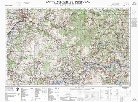
Topographic survey of Portugal at 1:50,000 from the Instituto Geogrรกfico do Exรฉrcito, the country’s military survey organisation. The maps have contours at 20m intervals and in addition to the standard features shown on topographic mapping at this scale also indicate various types of terrain or vegetation (sand, terraces, rocks, woodlands, vineyards, etc). Each sheet covers
Ichuรฑa

One of the maps in the topographic survey of Peru from the country’s national survey organization, Instituto Geogrรกfico Nacional. Contours are at 25m intervals and colouring/symbols indicate different types of terrain and vegetation. Some of the maps may contain small blank spaces representing as yet unmapped areas. Each sheet covers 30’ latitude by 30’ longitude.
Almeida

Topographic survey of Portugal at 1:50,000 from the Instituto Geogrรกfico do Exรฉrcito, the country’s military survey organisation. The maps have contours at 20m intervals and in addition to the standard features shown on topographic mapping at this scale also indicate various types of terrain or vegetation (sand, terraces, rocks, woodlands, vineyards, etc). Each sheet covers
Campo de Maior

Topographic survey of Portugal at 1:50,000 from the Instituto Geogrรกfico do Exรฉrcito, the country’s military survey organisation. The maps have contours at 20m intervals and in addition to the standard features shown on topographic mapping at this scale also indicate various types of terrain or vegetation (sand, terraces, rocks, woodlands, vineyards, etc). Each sheet covers
Cabeceiras de Basto

Topographic survey of Portugal at 1:50,000 from the Instituto Geogrรกfico do Exรฉrcito, the country’s military survey organisation. The maps have contours at 20m intervals and in addition to the standard features shown on topographic mapping at this scale also indicate various types of terrain or vegetation (sand, terraces, rocks, woodlands, vineyards, etc). Each sheet covers
Moimenta da Beira

Topographic survey of Portugal at 1:50,000 from the Instituto Geogrรกfico do Exรฉrcito, the country’s military survey organisation. The maps have contours at 20m intervals and in addition to the standard features shown on topographic mapping at this scale also indicate various types of terrain or vegetation (sand, terraces, rocks, woodlands, vineyards, etc). Each sheet covers
Castro Daire

Topographic survey of Portugal at 1:50,000 from the Instituto Geogrรกfico do Exรฉrcito, the country’s military survey organisation. The maps have contours at 20m intervals and in addition to the standard features shown on topographic mapping at this scale also indicate various types of terrain or vegetation (sand, terraces, rocks, woodlands, vineyards, etc). Each sheet covers
Vila Nova de Foz Coa

Topographic survey of Portugal at 1:50,000 from the Instituto Geogrรกfico do Exรฉrcito, the country’s military survey organisation. The maps have contours at 20m intervals and in addition to the standard features shown on topographic mapping at this scale also indicate various types of terrain or vegetation (sand, terraces, rocks, woodlands, vineyards, etc). Each sheet covers
Greenland
General map with simple elevation tinting on the ice free areas and 500m contours on the ice covered area. Bathymetric contours are also included. Various sized symbols classify settlements according to population size. Airfields, abandoned settlements and regional boundaries area also indicated. The map coverage extends to include Ellesmere Island, Iceland and most of Svalbard.Latitude


