Category Archives: Maps
Alto Sil

Alto Sil area in the Cordillera Cantabrica on the border of Asturias and Leรณn on a detailed, contoured, GPS compatible map at 1:50,000 from Calecha highlighting numerous waymarked hiking trails, various types of tourist accommodation, etc.Cartographic information is based on the Spanish military survey, with contour lines at 20m intervals, plus relief shading and names
Toledo

Toledo, including a detailed enlargements of its Old Town highlighting historic sights and four special routes with English language descriptions, on an indexed street plan from Telstar Distrimapas, Spain’s leading publisher of city maps.On one side is an indexed street plan of the whole city at 1:6,650 with a separate inset extending it to include
Palma de Mallorca

Palma de Mallorca on an indexed street plan at 1:10,500 from Telstar Distrimapas, Spain’s leading publisher of city maps, with an enlargement showing the city centre in greater detail, plus an indexed road map of Mallorca on the reverse.On one side is an indexed street plan of the city indicating locations of car parks, taxi
Spain Autonomous Regions CNIG Wall Map
Administrative regions of Spain shown in colours on a wall map at 1:2,000,000, size 86.5 x 68cm (34″ x 27″ approx), from IGN/CNIG – the country’s civilian survey organization, with relief shading to indicate the topography, plus a decorative panel of regional flags with facts-&-figures. The map shows the regions in lovely bright colours with
Granada Sur CNIG Topo 1026
Topographic coverage of mainland Spain at 1:50,000 in the MTN50 (Mapa Topogrรกfico Nacional) series from the Centro Nacional de Informaciรณn Geografica, the country’s civilian survey organization. The maps have contours at 20m intervals, enhanced by relief shading, plus colouring and/or graphics to show different types of terrain, vegetation or land use. Boundaries of national parks
Spain CNIG Physical Wall Map
Administrative provinces of Spain shown in bright colours on a wall map at 1:2,250,000, size 70 x 50cm (27.5″ x 20″ approx), from IGN/CNIG – the country’s civilian survey organization, plus a panel of regional flags. Each province is presented in a different colour and the map also shows boundaries and names of administrative regions.
Caminos de Santiago / Ways of St. James on the Iberian Peninsula CNIG Overview Map
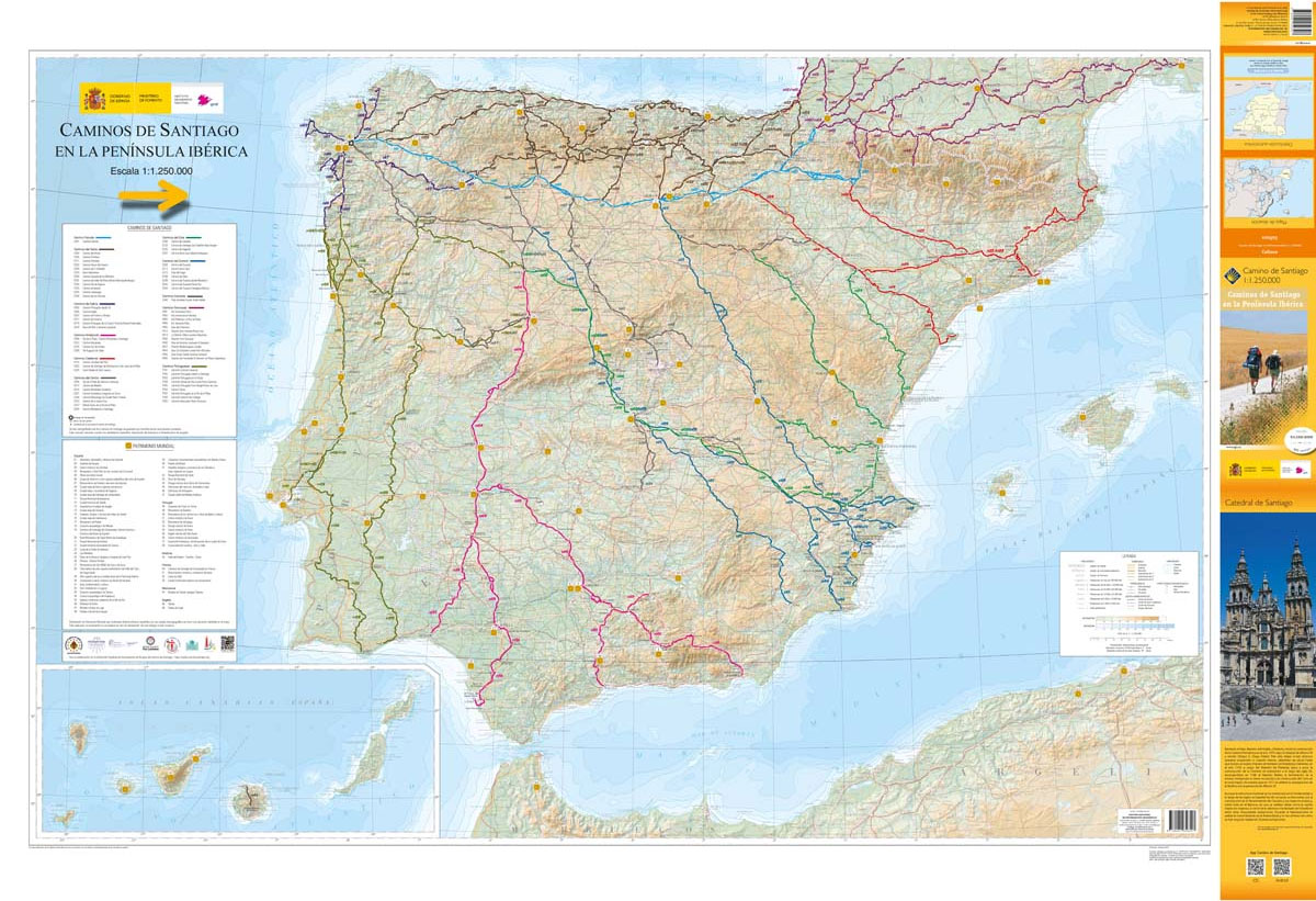
All roads leading to Santiago de Compostela in the Iberian Peninsula are represented on this Caminos de Santiago / The Way of St. James Map. Routes highlighted on a physical map of the Iberian Peninsula at 1:1,250,000 from IGN/CNIG, Spain civilian topographic survey organization. The base map with altitude colouring and relief shading provides an
Picos de Europa National Park 3-Map and Guide Set CNIG SPANISH
Picos de Europa – English edition, on a set of three double-sided, contoured and GPS-compatible maps at 1:25,000 from the Spanish civilian survey organization, prominently highlighting numerous hiking and sightseeing routes, plus a 240-page English language guide with route descriptions, etc.The maps have cartography of Spain’s civilian topographic survey at 1:25,000 with contours at 10m
Llanes CNIG Topo 32
Topographic coverage of mainland Spain at 1:50,000 in the MTN50 (Mapa Topogrรกfico Nacional) series from the Centro Nacional de Informaciรณn Geografica, the country’s civilian survey organization. The maps have contours at 20m intervals, enhanced by relief shading, plus colouring and/or graphics to show different types of terrain, vegetation or land use. Boundaries of national parks
Durcal CNIG Topo 1041
Topographic coverage of mainland Spain at 1:50,000 in the MTN50 (Mapa Topogrรกfico Nacional) series from the Centro Nacional de Informaciรณn Geografica, the country’s civilian survey organization. The maps have contours at 20m intervals, enhanced by relief shading, plus colouring and/or graphics to show different types of terrain, vegetation or land use. Boundaries of national parks
Valencia Province 200K CNIG Map No. 45
Contoured, GPS-compatible, indexed road map at 1:200,000 from CNIG – Spain’s civilian survey organization, with exceptionally informative presentation of the landscape and highlighting for facilities and places of interest including campsites and paradors.Maps in CNIG’s 200K Provincial Series provide an excellent picture the topography through contours at 100m intervals enhanced by relief shading, spot heights
Alicante Province 200K CNIG Map No. 3
Contoured, GPS-compatible, indexed road map at 1:200,000 from CNIG – Spain’s civilian survey organization, with exceptionally informative presentation of the landscape and highlighting for facilities and places of interest including campsites and paradors.Maps in CNIG’s 200K Provincial Series provide an excellent picture the topography through contours at 100m intervals enhanced by relief shading, spot heights
Murcia CNIG Topo 934

Topographic coverage of mainland Spain at 1:50,000 in the MTN50 (Mapa Topogrรกfico Nacional) series from the Centro Nacional de Informaciรณn Geografica, the country’s civilian survey organization. The maps have contours at 20m intervals, enhanced by relief shading, plus colouring and/or graphics to show different types of terrain, vegetation or land use. Boundaries of national parks
Madrid and Surroundings CNIG Map

Topographic map of the Greater Madrid area from IGN ‘“ CNIG with the same cartography as the organization’s civilian version of the topographic survey of Spain but proving wider coverage than the standard sheet in the 1:50,000 survey series.The map has all the information expected of the topographic mapping at this scale – detailed presentation


