Category Archives: Maps
Eysturoy Island (11 map set – Nos. 312/410/411/412/413/510/509/511/512/610/611)
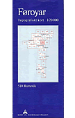
Topographic survey of Faroe Islands at 1:20,000 prepared by the Danish national mapping agency Kort og Matrikelstyrelsen. The islands’ topography is vividly presented by contours at 5 metre intervals, enhanced by relief shading plus colouring and/or graphics for different types of terrain or vegetation (scree, boulders, etc). The maps show all the detail expected of
NGS Executive Political World Wall Map 3-SHEET SET, ENCAPSULATED

Encapsulated version of the extra large, 296 x 193cm (9ft 8″ x 6ft 4″) political map of the world in the NGS Executive series which offers current information presented in elegant antique style. Countries are in rich but muted colours and oceans in beige, with additional panels and framing in shades of brown.An unusual feature
Cologne in 3-D Street Plan

Unusual, very attractive street plan of Cologne offering a bird’s-eye view of the city with every building drawn to scale with full architectural detail, from street arcades to rooftops and inner courtyards. All buildings, including the city’s famous cathedral and other churches, are all presented in great detail. The plan, drawn in 2011, covers Cologne
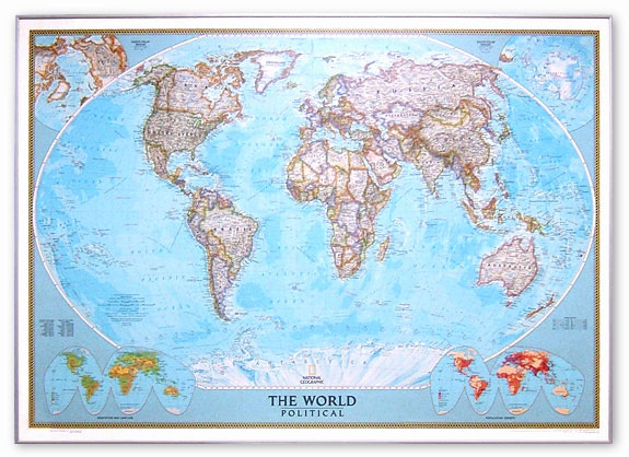
World NGS Classic Wall Map 3-SHEET SET ENCAPSULATED

NGS Classic political map of the world, extra large 3-sheet set: 279 x 193cm (9ft 2″ x 6ft 4″ approx) ‘“ encapsulated version, with the publishers’ characteristic lay-out providing an attractive alternative to the more conventional world maps, countries in white but defined by different colour borders, oceans in bright blue, plus interesting additional features.
Frankfurt am Main Bird`s Eye View Street Plan

Unusual, very attractive street plan of Frankfurt offering a bird’s-eye view of the city with every building drawn to scale with full architectural detail, from street arcades to rooftops and inner courtyards. The skyscrapers of the ‘Mainhattan” banks, the MesseTurm or the residential areas of Sachsenhausen are all presented in great detail. The plan, drawn
Jharkhand
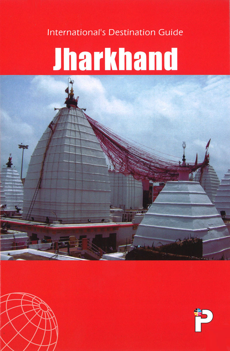
Indian state of Jharkhand on road map from the Delhi-based International Publications, showing many small towns and villages. Unless indicated to the contrary in the individual description, maps in this series present the state with its constituent districts in different colours and also show the division of districts into talukas. Town symbols indicate both district
Munich in 3-D Street Plan

Unusual, very attractive street plan of Munich offering a bird’s-eye view of the city with every building drawn to scale with full architectural detail, from street arcades to rooftops and inner courtyards. The plan, drawn in 2013, covers the city centre from the central railway station to the English Gardens and from the museums islands
K2 and Baltoro Glacier Wall Map
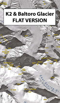
A wall map with a stunning satellite image of the K2 and the Baltoro Glacier in the Karakoram at 1:80,000, size 99 x 68cm (39″ x 27″ approx), produced by the Polish Mountaineering Association and annotated with names of peaks, glaciers and passes, numerous spot heights, trekking and approach routes, base camps and seasonal settlements.
Hamburg in 3-D Street Plan

Unusual, very attractive street plan of Hamburg offering a bird’s-eye view of the city with every building drawn to scale with full architectural detail, from street arcades to rooftops and inner courtyards. The buildings and the port area are all presented in great detail. The plan, drawn in 2012, covers the city centre and the
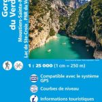
Petreto-Bicchisano – Zicavo – PNR de la Corse SINGLE-SIDED, WATERPROOF IGN TOP25 Map 4253OT

Topographic survey of France at 1:25,000 in IGN`s excellent TOP25 / Sรฉrie Bleue series. All the maps are GPS compatible, with a 1km UTM grid plus latitude and longitude lines at 5’ intervals. Contours are at 5m intervals except for mountainous areas where the maps have contours at 10m intervals, vividly enhanced by hill shading
Algeria Geographical Wall Map

Algeria Geographical Wall Map at 1:2,500,000 from Gizi Map, size 98 x87cm (38″x 34″ approx.), with bright altitude colouring vividly presenting the country’s topography. Names of larger towns, provinces and selected topographic features are also shown in the Arabic alphabet; all other place names are in the Latin alphabet. Where appropriate, alternative versions of place
Algeria Road Edition Wall Map

Algeria Raod Edition Wall Map at 1:2,500,000, size 98x87cm (38″x34″ approx), from Gizi Map, with relief shading used to present the country’s topography. Names of larger towns, provinces and selected topographic features are also shown in the Arabic alphabet; all other place names are in the Latin alphabet. Where appropriate, alternative versions of place names
Tel Aviv – Jaffa Street Plan HEBREW

Index street plan of Tel Aviv from the Israeli national mapping agnecy. The plan covers the city from Sede Dov Airport and the southern part of the University in the north to Yafo (Jaffa) in the south, and east to Givatayim and Ramat Gan (Bnei Brak is not included). All place names are in Roman
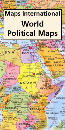
World Maps International Political Wall Map MEDIUM PIN-BOARD FRAMED with flags

Framed, 103 x 72cm (3ft 4’’ x 2ft 4’’ approx.) version of the medium size political map of the world from Maps International mounted on *pin board*. Countries are shown in bright vivid colours against light blue oceans. Country names are in large, clearly legible print. English versions of all city names are used throughout.
World Maps International Political Wall Map MEDIUM MAGNETIC-BOARD FRAMED with flags
Framed, 103 x 72cm (3ft 4’’ x 2ft 4’’ approx.) version of the medium size political map of the world from Maps International mounted on *magnetic board* to which magnetic makers can be attached. Countries are shown in bright vivid colours against light blue oceans. Country names are in large, clearly legible print. English versions
World Maps International Political Wall Map SMALL PIN-BOARD FRAMED with flags

Framed, 70 x 52cm (28″ x 21″ approx.), version of the small political map of the world from Maps International mounted on *pin board*. Countries are shown in bright vivid colours against light blue oceans. Country names are in large, clearly legible print. English versions of all city names are used throughout. Within USA, Canada
World Maps International Political Wall Map SMALL MAGNETIC-BOARD FRAMED with flags

Framed, 70 x 52cm (28″ x 21″approx.), version of the small political map of the world from Maps International mounted on *magnetic board* to which magnetic makers can be attached. Countries are shown in bright vivid colours against light blue oceans. Country names are in large, clearly legible print. English versions of all city names
World Maps International Political Wall Map LARGE PIN-BOARD FRAMED with flags

Framed, 136 x 100cm (4ft 5’’ x 3ft 4’’ approx.) version of the large political map of the world from Maps International mounted on *pin board*. Countries are shown in bright vivid colours against light blue oceans. Country names are in large, clearly legible print. English versions of all city names are used throughout. Within
World NGS Classic Wall Map STANDARD SIZE, PIN BOARD, FRAMED
NGS Classic political map of the world, standard version mounted on pin board and with high quality aluminium frame ‘“ size 112.5 x 79cm (3ft 9″ x 2ft 7″ approx), with the publishers’ characteristic lay-out providing an attractive alternative to the more conventional world maps, countries in white but defined by different colour borders, oceans
World Maps International Political Wall Map LARGE MAGNETIC-BOARD FRAMED with flags

Framed, 136 x 100cm (4ft 5’’ x 3ft 4’’ approx.) version of the large political map of the world from Maps International mounted on *magnetic board* to which magnetic makers can be attached. Countries are shown in bright vivid colours against light blue oceans. Country names are in large, clearly legible print. English versions of