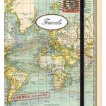
Category Archives: Maps
Flag of Taiwan (Republic of China)
Flags are a great way to show some national pride, pay homage to a fondly remembered visit abroad, celebrate a special occasion, or simply decorate the wall of your room.Flags measure 5’x 3’ (152.4 x 91.44cm), are made from 100% polyester and come with two brass eyelets for fastening.
Flag of Mongolia

Flags are a great way to show some national pride, pay homage to a fondly remembered visit abroad, celebrate a special occasion, or simply decorate the wall of your room.Flags measure 5’x 3’ (152.4 x 91.44cm), are made from 100% polyester and come with two brass eyelets for fastening.
Flag of Oman
Flags are a great way to show some national pride, pay homage to a fondly remembered visit abroad, celebrate a special occasion, or simply decorate the wall of your room.Flags measure 5’x 3’ (152.4 x 91.44cm), are made from 100% polyester and come with two brass eyelets for fastening.
Flag of Laos
Flags are a great way to show some national pride, pay homage to a fondly remembered visit abroad, celebrate a special occasion, or simply decorate the wall of your room.Flags measure 5’x 3’ (152.4 x 91.44cm), are made from 100% polyester and come with two brass eyelets for fastening.
World Maps International Political Wall Map LARGE MAGNETIC-BOARD FRAMED without flags
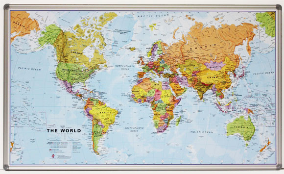
Smaller version of the framed and mounted on magnetic board, large political map of the world from Maps International, with its size reduced to 136 x 86cm (4ft 5’’ x 2ft 10″ approx.) by removing the decorative panel of flags under the map. Countries are shown in bright vivid colours against light blue oceans. Country
Flag of Qatar
Flags are a great way to show some national pride, pay homage to a fondly remembered visit abroad, celebrate a special occasion, or simply decorate the wall of your room.Flags measure 5’x 3’ (152.4 x 91.44cm), are made from 100% polyester and come with two brass eyelets for fastening.
World Maps International Political Wall Map MEDIUM PIN-BOARD FRAMED without flags
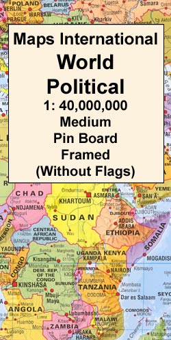
Smaller version of the framed and mounted on pin board, medium size political map of the world from Maps International, with its size reduced to 103 x 62cm (3ft 4’’ x 2ft approx.) by removing the decorative panel of flags under the map. Countries are shown in bright vivid colours against light blue oceans. Country
Flag of Tajikistan

Flags are a great way to show some national pride, pay homage to a fondly remembered visit abroad, celebrate a special occasion, or simply decorate the wall of your room.Flags measure 5’x 3’ (152.4 x 91.44cm), are made from 100% polyester and come with two brass eyelets for fastening.
World Maps International Political Wall Map MEDIUM MAGNETIC-BOARD FRAMED without flags
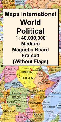
Smaller version of the framed and mounted on magnetic board, medium size political map of the world from Maps International, with its size reduced to 103 x 62cm (3ft 4’’ x 2ft approx.) by removing the decorative panel of flags under the map. Countries are shown in bright vivid colours against light blue oceans. Country
Flag of Singapore
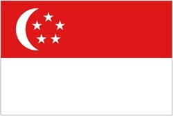
Flags are a great way to show some national pride, pay homage to a fondly remembered visit abroad, celebrate a special occasion, or simply decorate the wall of your room.Flags measure 5’x 3’ (152.4 x 91.44cm), are made from 100% polyester and come with two brass eyelets for fastening.
World Maps International Political Wall Map SMALL MAGNETIC-BOARD FRAMED without flags
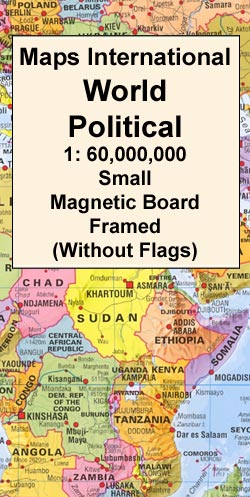
Smaller version of the framed and mounted on magnetic board, small political map of the world from Maps International, with its size reduced to 70 x 45cm (28″ x 17″ approx.) by removing the decorative panel of flags under the map. Countries are shown in bright vivid colours against light blue oceans. Country names are
Flag of Kyrgyzstan

Flags are a great way to show some national pride, pay homage to a fondly remembered visit abroad, celebrate a special occasion, or simply decorate the wall of your room.Flags measure 5’x 3’ (152.4 x 91.44cm), are made from 100% polyester and come with two brass eyelets for fastening.
St Lucia Wall Map
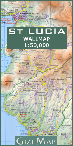
Wall map version of a lovely indexed road map of St. Lucia, with street plans of central Castries and the holiday complex at Anse Chastanet. Bright altitude colouring and vivid relief shading provide an excellent picture of the islands topography. Mangroves and coral reefs are marked. Road network includes minor local roads and tracks. The
Kangertittivaq – Scoresbysund Fjord 11
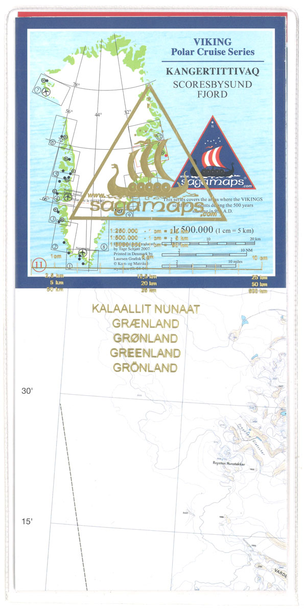
One of the titles in a series of contoured physical maps covering the coastal areas of Greenland. The maps have the same cartography as the 1:250,000 series by this publisher, reproduced here at half the original scale. The reduction means that some place names, symbols and fine detail are harder to read than on the
Kokoda Trail (3-sheet set)
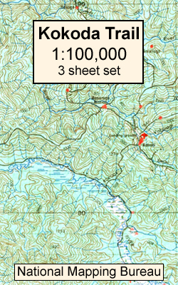
A set of three maps from the 1:100,000 topographic survey of Papua New Guinea, covering the whole of the famous Kakoda Trail, a 96km route from Owers Corner in (50km east of Port Moresby to Kokoda. The trail is famous as the location of a World War II battle between Japanese and Australian forces in
Nansen Land
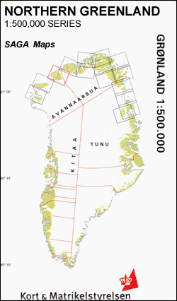
Nansen Land area in a series covering the northern coast of Greenland at 1:500,000, originally produced by the Danish survey organization Kort & Martikelstyrelsen in April 2000 and now printed by Saga Maps. The maps have contours at 100m intervals with spot heights and indicate areas covered by icecap. Local settlements, research stations, airstrips and
Quaanaaq/Thule
Quaanaaq/Thule area in a series covering the northern coast of Greenland at 1:500,000, originally produced by the Danish survey organization Kort & Martikelstyrelsen in April 2000 and now printed by Saga Maps. The maps have contours at 100m intervals with spot heights and indicate areas covered by icecap. Local settlements, research stations, airstrips and boundaries
Inglefield Land
Inglefield Land area in a series covering the northern coast of Greenland at 1:500,000, originally produced by the Danish survey organization Kort & Martikelstyrelsen in April 2000 and now printed by Saga Maps. The maps have contours at 100m intervals with spot heights and indicate areas covered by icecap. Local settlements, research stations, airstrips and
Washington Land
Washington Land area in a series covering the northern coast of Greenland at 1:500,000, originally produced by the Danish survey organization Kort & Martikelstyrelsen in April 2000 and now printed by Saga Maps. The maps have contours at 100m intervals with spot heights and indicate areas covered by icecap. Local settlements, research stations, airstrips and
Nyboe Land
Nyboe Land area in a series covering the northern coast of Greenland at 1:500,000, originally produced by the Danish survey organization Kort & Martikelstyrelsen in April 2000 and now printed by Saga Maps. The maps have contours at 100m intervals with spot heights and indicate areas covered by icecap. Local settlements, research stations, airstrips and