Category Archives: Maps
Colesberg

Map No. 3024, Colesberg, in South Africa’s official topographic survey at 1:250,000 from the country’s national survey organization, the Chief Directorate of Surveys and Mapping. The maps have altitude colouring and contours at 50m or 100m intervals, depending on the map edition, plus spot heights. Deserts, marshes, dry pans, perennial and seasonal water features, etc,
Beaufort West
Map No. 3222, Beaufort West, in South Africa’s official topographic survey at 1:250,000 from the country’s national survey organization, the Chief Directorate of Surveys and Mapping. The maps have altitude colouring and contours at 50m or 100m intervals, depending on the map edition, plus spot heights. Deserts, marshes, dry pans, perennial and seasonal water features,
Graaff-Reinet
Map No. 3224, Graaff-Reinet, in South Africa’s official topographic survey at 1:250,000 from the country’s national survey organization, the Chief Directorate of Surveys and Mapping. The maps have altitude colouring and contours at 50m or 100m intervals, depending on the map edition, plus spot heights. Deserts, marshes, dry pans, perennial and seasonal water features, etc,
Agua Prieta
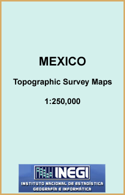
Topographic mapping from Mexico’s national survey agency, Instituto Nacional de Estadรญstica, Geografรญa e Informรกtica. The maps have contours at 20m intervals with relief shading and indicate various types of terrain and vegetation, e.g. dense vegetation, cultivated areas, swamps, sand dunes, salt pans, etc. UTM grid is at 10km intervals, with latitude and longitude shown by
Aguascalientes
Topographic mapping from Mexico’s national survey agency, Instituto Nacional de Estadรญstica, Geografรญa e Informรกtica. The maps have contours at 20m intervals with relief shading and indicate various types of terrain and vegetation, e.g. dense vegetation, cultivated areas, swamps, sand dunes, salt pans, etc. UTM grid is at 10km intervals, with latitude and longitude shown by
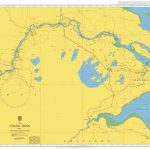
Bahia Ascension
Topographic mapping from Mexico’s national survey agency, Instituto Nacional de Estadรญstica, Geografรญa e Informรกtica. The maps have contours at 20m intervals with relief shading and indicate various types of terrain and vegetation, e.g. dense vegetation, cultivated areas, swamps, sand dunes, salt pans, etc. UTM grid is at 10km intervals, with latitude and longitude shown by
Buenaventura
Topographic mapping from Mexico’s national survey agency, Instituto Nacional de Estadรญstica, Geografรญa e Informรกtica. The maps have contours at 20m intervals with relief shading and indicate various types of terrain and vegetation, e.g. dense vegetation, cultivated areas, swamps, sand dunes, salt pans, etc. UTM grid is at 10km intervals, with latitude and longitude shown by
Caborca
Topographic mapping from Mexico’s national survey agency, Instituto Nacional de Estadรญstica, Geografรญa e Informรกtica. The maps have contours at 20m intervals with relief shading and indicate various types of terrain and vegetation, e.g. dense vegetation, cultivated areas, swamps, sand dunes, salt pans, etc. UTM grid is at 10km intervals, with latitude and longitude shown by
Calkini
Topographic mapping from Mexico’s national survey agency, Instituto Nacional de Estadรญstica, Geografรญa e Informรกtica. The maps have contours at 20m intervals with relief shading and indicate various types of terrain and vegetation, e.g. dense vegetation, cultivated areas, swamps, sand dunes, salt pans, etc. UTM grid is at 10km intervals, with latitude and longitude shown by
World K+F Political 30M Wall Map MEDIUM PIN-BOARD

Political map of the world from Kรผmmerly+Frey, size 140 x 99cm (55″ x 39″ approx) ‘“ on pin board, with countries in pleasant pastel colours against light blue seas, a presentation which will appeal to anyone who prefers gentler shades. Subtle relief shading with plenty of names of topographic features provides physical information.The map has
Campeche
Topographic mapping from Mexico’s national survey agency, Instituto Nacional de Estadรญstica, Geografรญa e Informรกtica. The maps have contours at 20m intervals with relief shading and indicate various types of terrain and vegetation, e.g. dense vegetation, cultivated areas, swamps, sand dunes, salt pans, etc. UTM grid is at 10km intervals, with latitude and longitude shown by
World K+F Physical 30M Wall Map MEDIUM MAGNETIC-BOARD
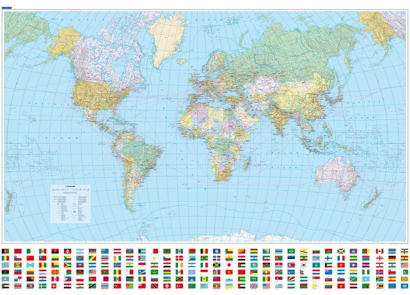
Political map of the world from Kรผmmerly+Frey, size 140 x 99cm (55″ x 39″ approx) ‘“ on magnetic board, with countries in pleasant pastel colours against light blue seas, a presentation which will appeal to anyone who prefers gentler shades. Subtle relief shading with plenty of names of topographic features provides physical information.The map has
Cananea
Topographic mapping from Mexico’s national survey agency, Instituto Nacional de Estadรญstica, Geografรญa e Informรกtica. The maps have contours at 20m intervals with relief shading and indicate various types of terrain and vegetation, e.g. dense vegetation, cultivated areas, swamps, sand dunes, salt pans, etc. UTM grid is at 10km intervals, with latitude and longitude shown by
Port Harcourt
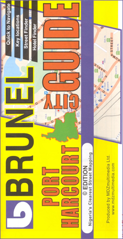
Indexed street plan of Port Harcourt with information for visitors including lists of various institutions and facilities, plus a map of the city’s environs, a road map of the Rivers State and an administrative map of Nigeria. The main plan at 1:15,000, extending north to include the city’s airport, is annotated with symbols indicating locations
Cuba Wall Map
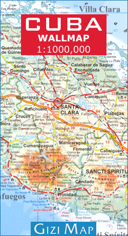
Wall map of Cuba from Gizi with excellent topographic information, a street plan of Old Havana, enlargements for the Varadero Peninsula, Valle de Viรฑales and the environs of the capital, plus a distance table and an extensive index.Vivid altitude colouring with graphics for mangrove and swamps, plus plenty of names of geographical features: peaks, mountain
Flag of Bahrain

Flags are a great way to show some national pride, pay homage to a fondly remembered visit abroad, celebrate a special occasion, or simply decorate the wall of your room.Flags measure 5’x 3’ (152.4 x 91.44cm), are made from 100% polyester and come with two brass eyelets for fastening.
Flag of Yemen

Flags are a great way to show some national pride, pay homage to a fondly remembered visit abroad, celebrate a special occasion, or simply decorate the wall of your room.Flags measure 5’x 3’ (152.4 x 91.44cm), are made from 100% polyester and come with two brass eyelets for fastening.
Flag of Brunei
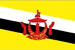
Flags are a great way to show some national pride, pay homage to a fondly remembered visit abroad, celebrate a special occasion, or simply decorate the wall of your room.Flags measure 5’x 3’ (152.4 x 91.44cm), are made from 100% polyester and come with two brass eyelets for fastening.
Flag of Myanmar (Burma)
Flags are a great way to show some national pride, pay homage to a fondly remembered visit abroad, celebrate a special occasion, or simply decorate the wall of your room.Flags measure 5’x 3’ (152.4 x 91.44cm), are made from 100% polyester and come with two brass eyelets for fastening.
Flag of Taiwan (Republic of China)
Flags are a great way to show some national pride, pay homage to a fondly remembered visit abroad, celebrate a special occasion, or simply decorate the wall of your room.Flags measure 5’x 3’ (152.4 x 91.44cm), are made from 100% polyester and come with two brass eyelets for fastening.