Category Archives: Maps
Netherlands Falkplan Cycling Atlas
Cycling atlas of the Netherlands at 1:75,000 from Falk BV, presenting in one A5 spiral-bound volume the country’s extensive network of signposted cycling routes and junctions, including the long-distance LF trails and smaller local cycle paths. The network consists of numbered junctions joined by sign-posted connecting routes in either direction. At each junction there is
South-Holland South – Goeree-Overflakkee Falkplan Cycling Map 15

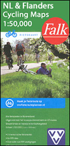
The southern part of the South Holland Province of the Netherlands at 1:50,000 in a series from Falk B.V. showing the network of signposted cycling routes on large, double-sided indexed maps with prominent highlighting of long-distance LF routes, symbols indicating accommodation and other tourist services, plus in each title two or more panels with recommended
Flevoland – Kop van Overijssel Falkplan Cycling Map 06

North-western part of the Overijssel Province in the Netherlands at 1:50,000 in a series from Falk B.V. showing the network of signposted cycling routes on large, double-sided indexed maps with prominent highlighting of long-distance LF routes, symbols indicating accommodation and other tourist services, plus in each title two or more panels with recommended local circuits
South-Holland North – Green Heart West and Bollenstreek Falkplan Cycling Map 14

The northern part of the South Holland Province of the Netherlands at 1:50,000 in a series from Falk B.V. showing the network of signposted cycling routes on large, double-sided indexed maps with prominent highlighting of long-distance LF routes, symbols indicating accommodation and other tourist services, plus in each title two or more panels with recommended
Haarlem Falkplan Street Plan

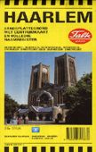
Surland Falk, leading publishers of street plans of Dutch towns, produce clear and detailed maps that make strong use of colour. The plans extend into the outlying suburbs and include an enlarged inset of the central area. One-way streets and public transport routes are clearly shown. Useful addresses for tourists and a full street index
Netherlands

Netherlands on a large, indexed road map at 1:250,000 from Falk BV, with five city centre street plans, a route planning map, plus a distance table. Road network clearly shows motorway junction numbers and names. Driving distances are marked on main and selected local routes. Railway lines are shown with main stations and ferry connections,
Sallandse Heuvelrug

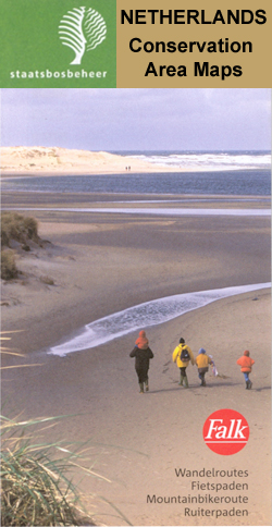
Sallandse Heuvelrug area of the Netherlands in a series of walking and cycling maps at 1:25,000 ‘“ 1:35,000, published by Falk BV in cooperation with Staatsbosbeheer ‘“ Dutch government’s organization for forestry and the management of nature reserves.Colouring indicates different types of vegetation or terrain: woodland, pastures, heath or sand dunes. Given the topography of
Drents-Friese Wold

Drents-Friese Wold area of the Netherlands in a series of walking and cycling maps at 1:25,000 ‘“ 1:35,000, published by Falk BV in cooperation with Staatsbosbeheer ‘“ Dutch government’s organization for forestry and the management of nature reserves.Colouring indicates different types of vegetation or terrain: woodland, pastures, heath or sand dunes. Given the topography of
Vechtdal and Salland Falkplan Cycling Map 07

Vechtdal and Salland regions of the Netherlands at 1:50,000 in a series from Falk B.V. showing the network of signposted cycling routes on large, double-sided indexed maps with prominent highlighting of long-distance LF routes, symbols indicating accommodation and other tourist services, plus in each title two or more panels with recommended local circuits and additional
Drentsche A

Drentsche A area of the Netherlands in a series of walking and cycling maps at 1:25,000 ‘“ 1:35,000, published by Falk BV in cooperation with Staatsbosbeheer ‘“ Dutch government’s organization for forestry and the management of nature reserves.Colouring indicates different types of vegetation or terrain: woodland, pastures, heath or sand dunes. Given the topography of
Veluwe Central Falkplan 24

The central part of the Veluwe area of the Netherlands in a series of walking and cycling maps at 1:25,000 ‘“ 1:35,000, published by Falk BV in cooperation with Staatsbosbeheer ‘“ Dutch government’s organization for forestry and the management of nature reserves.Colouring indicates different types of vegetation or terrain: woodland, pastures, heath or sand dunes.
Drenthe South-East

South-Eastern Drenthe area of the Netherlands in a series of walking and cycling maps at 1:25,000 ‘“ 1:35,000, published by Falk BV in cooperation with Staatsbosbeheer ‘“ Dutch government’s organization for forestry and the management of nature reserves.Colouring indicates different types of vegetation or terrain: woodland, pastures, heath or sand dunes. Given the topography of
Kempenland – de Meijerij Falkplan Cycling Map 18

Kempenland region of the Netherlands at 1:50,000 in a series from Falk B.V. showing the network of signposted cycling routes on large, double-sided indexed maps with prominent highlighting of long-distance LF routes, symbols indicating accommodation and other tourist services, plus in each title two or more panels with recommended local circuits and additional tourist information.
Dwingelderveld – Ruinen

Dwingelderveld – Ruinen area of the Netherlands in a series of walking and cycling maps at 1:25,000 ‘“ 1:35,000, published by Falk BV in cooperation with Staatsbosbeheer ‘“ Dutch government’s organization for forestry and the management of nature reserves.Colouring indicates different types of vegetation or terrain: woodland, pastures, heath or sand dunes. Given the topography
Drenthe Central 10

Central Drenthe area of the Netherlands in a series of walking and cycling maps at 1:25,000 ‘“ 1:35,000, published by Falk BV in cooperation with Staatsbosbeheer ‘“ Dutch government’s organization for forestry and the management of nature reserves.Colouring indicates different types of vegetation or terrain: woodland, pastures, heath or sand dunes. Given the topography of
Limburg Central and South Falkplan Cycling Map 20

The central and southern part of the Dutch province of Limburg at 1:50,000 in a series from Falk B.V. showing the network of signposted cycling routes on large, double-sided indexed maps with prominent highlighting of long-distance LF routes, symbols indicating accommodation and other tourist services, plus in each title two or more panels with recommended


