Category Archives: Maps
Ramsele
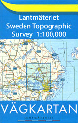
Topographic survey of Sweden at 1:100,000, the Vรคgkartan, from the Lantmรคteriet, covering most of the country in 79 double-sided maps. Please note: the mountainous regions of central and northern Sweden are not covered by this series but presented in a separate ‘Fjรคllkartan – Mountain Map” series also listed on our website.Each 1:100,000 topographic survey map
Dorotea

Topographic survey of Sweden at 1:100,000, the Vรคgkartan, from the Lantmรคteriet, covering most of the country in 79 double-sided maps. Please note: the mountainous regions of central and northern Sweden are not covered by this series but presented in a separate ‘Fjรคllkartan – Mountain Map” series also listed on our website.Each 1:100,000 topographic survey map
Trosa

Topographic survey of Sweden at 1:100,000, the Vรคgkartan, from the Lantmรคteriet, covering most of the country in 79 double-sided maps. Please note: the mountainous regions of central and northern Sweden are not covered by this series but presented in a separate ‘Fjรคllkartan – Mountain Map” series also listed on our website.Each 1:100,000 topographic survey map
Stockholm Lantmateriet 129

Topographic survey of Sweden at 1:100,000, the Vรคgkartan, from the Lantmรคteriet, covering most of the country in 79 double-sided maps. Please note: the mountainous regions of central and northern Sweden are not covered by this series but presented in a separate ‘Fjรคllkartan – Mountain Map” series also listed on our website.Each 1:100,000 topographic survey map
Hagfors

Topographic survey of Sweden at 1:100,000, the Vรคgkartan, from the Lantmรคteriet, covering most of the country in 79 double-sided maps. Please note: the mountainous regions of central and northern Sweden are not covered by this series but presented in a separate ‘Fjรคllkartan – Mountain Map” series also listed on our website.Each 1:100,000 topographic survey map
Kopparberg

Topographic survey of Sweden at 1:100,000, the Vรคgkartan, from the Lantmรคteriet, covering most of the country in 79 double-sided maps. Please note: the mountainous regions of central and northern Sweden are not covered by this series but presented in a separate ‘Fjรคllkartan – Mountain Map” series also listed on our website.Each 1:100,000 topographic survey map
Norrtรคlje

Topographic survey of Sweden at 1:100,000, the Vรคgkartan, from the Lantmรคteriet, covering most of the country in 79 double-sided maps. Please note: the mountainous regions of central and northern Sweden are not covered by this series but presented in a separate ‘Fjรคllkartan – Mountain Map” series also listed on our website.Each 1:100,000 topographic survey map
Sysslebรคck

Topographic survey of Sweden at 1:100,000, the Vรคgkartan, from the Lantmรคteriet, covering most of the country in 79 double-sided maps. Please note: the mountainous regions of central and northern Sweden are not covered by this series but presented in a separate ‘Fjรคllkartan – Mountain Map” series also listed on our website.Each 1:100,000 topographic survey map
Vansbro

Topographic survey of Sweden at 1:100,000, the Vรคgkartan, from the Lantmรคteriet, covering most of the country in 79 double-sided maps. Please note: the mountainous regions of central and northern Sweden are not covered by this series but presented in a separate ‘Fjรคllkartan – Mountain Map” series also listed on our website.Each 1:100,000 topographic survey map
Bengtsfors

Topographic survey of Sweden at 1:100,000, the Vรคgkartan, from the Lantmรคteriet, covering most of the country in 79 double-sided maps. Please note: the mountainous regions of central and northern Sweden are not covered by this series but presented in a separate ‘Fjรคllkartan – Mountain Map” series also listed on our website.Each 1:100,000 topographic survey map
ร–sthammar

Topographic survey of Sweden at 1:100,000, the Vรคgkartan, from the Lantmรคteriet, covering most of the country in 79 double-sided maps. Please note: the mountainous regions of central and northern Sweden are not covered by this series but presented in a separate ‘Fjรคllkartan – Mountain Map” series also listed on our website.Each 1:100,000 topographic survey map
Vรคrnamo

Topographic survey of Sweden at 1:100,000, the Vรคgkartan, from the Lantmรคteriet, covering most of the country in 79 double-sided maps. Please note: the mountainous regions of central and northern Sweden are not covered by this series but presented in a separate ‘Fjรคllkartan – Mountain Map” series also listed on our website.Each 1:100,000 topographic survey map
Vรคxjรถ

Topographic survey of Sweden at 1:100,000, the Vรคgkartan, from the Lantmรคteriet, covering most of the country in 79 double-sided maps. Please note: the mountainous regions of central and northern Sweden are not covered by this series but presented in a separate ‘Fjรคllkartan – Mountain Map” series also listed on our website.Each 1:100,000 topographic survey map
Oskarshamn

Topographic survey of Sweden at 1:100,000, the Vรคgkartan, from the Lantmรคteriet, covering most of the country in 79 double-sided maps. Please note: the mountainous regions of central and northern Sweden are not covered by this series but presented in a separate ‘Fjรคllkartan – Mountain Map” series also listed on our website.Each 1:100,000 topographic survey map
South Gotland

Topographic survey of Sweden at 1:100,000, the Vรคgkartan, from the Lantmรคteriet, covering most of the country in 79 double-sided maps. Please note: the mountainous regions of central and northern Sweden are not covered by this series but presented in a separate ‘Fjรคllkartan – Mountain Map” series also listed on our website.Each 1:100,000 topographic survey map
Gothenburg

Topographic survey of Sweden at 1:100,000, the Vรคgkartan, from the Lantmรคteriet, covering most of the country in 79 double-sided maps. Please note: the mountainous regions of central and northern Sweden are not covered by this series but presented in a separate ‘Fjรคllkartan – Mountain Map” series also listed on our website.Each 1:100,000 topographic survey map
Borรฅs

Topographic survey of Sweden at 1:100,000, the Vรคgkartan, from the Lantmรคteriet, covering most of the country in 79 double-sided maps. Please note: the mountainous regions of central and northern Sweden are not covered by this series but presented in a separate ‘Fjรคllkartan – Mountain Map” series also listed on our website.Each 1:100,000 topographic survey map
Nรคssjรถ

Topographic survey of Sweden at 1:100,000, the Vรคgkartan, from the Lantmรคteriet, covering most of the country in 79 double-sided maps. Please note: the mountainous regions of central and northern Sweden are not covered by this series but presented in a separate ‘Fjรคllkartan – Mountain Map” series also listed on our website.Each 1:100,000 topographic survey map
Gothenburg Pocket Atlas
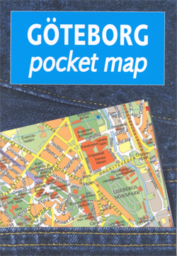
Gothenburg/Gรถteborg in a handy size, indexed pocket atlas from Liber Kartor with diagrams of the public transport networks, a road map of the city’s environs, and ferry connections between the nearby islands.The plan shows the city with its network of tram routes (line numbers are not given) and ferry connections. Main public buildings are highlighted
North Gotland

Topographic survey of Sweden at 1:100,000, the Vรคgkartan, from the Lantmรคteriet, covering most of the country in 79 double-sided maps. Please note: the mountainous regions of central and northern Sweden are not covered by this series but presented in a separate ‘Fjรคllkartan – Mountain Map” series also listed on our website.Each 1:100,000 topographic survey map


