Category Archives: Maps
Sรถlvesborg Lantmateriet 510
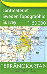
Topographic survey of Sweden at 1:50,000, the Terrรคngkartan, from the Lantmรคteriet, covering most of the country in 244 double-sided maps. Please note: the mountainous regions of central and northern Sweden are not covered by this series but presented in a separate ‘Fjรคllkartan – Mountain Map” series also listed on our website.Each 1:50,000 topographic survey map
Ronneby Lantmateriet 511

Topographic survey of Sweden at 1:50,000, the Terrรคngkartan, from the Lantmรคteriet, covering most of the country in 244 double-sided maps. Please note: the mountainous regions of central and northern Sweden are not covered by this series but presented in a separate ‘Fjรคllkartan – Mountain Map” series also listed on our website.Each 1:50,000 topographic survey map
Karlskrona Lantmateriet 512

Topographic survey of Sweden at 1:50,000, the Terrรคngkartan, from the Lantmรคteriet, covering most of the country in 244 double-sided maps. Please note: the mountainous regions of central and northern Sweden are not covered by this series but presented in a separate ‘Fjรคllkartan – Mountain Map” series also listed on our website.Each 1:50,000 topographic survey map
Bรฅstad Lantmateriet 513

Topographic survey of Sweden at 1:50,000, the Terrรคngkartan, from the Lantmรคteriet, covering most of the country in 244 double-sided maps. Please note: the mountainous regions of central and northern Sweden are not covered by this series but presented in a separate ‘Fjรคllkartan – Mountain Map” series also listed on our website.Each 1:50,000 topographic survey map
Markaryd Lantmateriet 514

Topographic survey of Sweden at 1:50,000, the Terrรคngkartan, from the Lantmรคteriet, covering most of the country in 244 double-sided maps. Please note: the mountainous regions of central and northern Sweden are not covered by this series but presented in a separate ‘Fjรคllkartan – Mountain Map” series also listed on our website.Each 1:50,000 topographic survey map
รlmhult Lantmateriet 515

Topographic survey of Sweden at 1:50,000, the Terrรคngkartan, from the Lantmรคteriet, covering most of the country in 244 double-sided maps. Please note: the mountainous regions of central and northern Sweden are not covered by this series but presented in a separate ‘Fjรคllkartan – Mountain Map” series also listed on our website.Each 1:50,000 topographic survey map
Ryd Lantmateriet 516

Topographic survey of Sweden at 1:50,000, the Terrรคngkartan, from the Lantmรคteriet, covering most of the country in 244 double-sided maps. Please note: the mountainous regions of central and northern Sweden are not covered by this series but presented in a separate ‘Fjรคllkartan – Mountain Map” series also listed on our website.Each 1:50,000 topographic survey map
Emmaboda Lantmateriet 517

Topographic survey of Sweden at 1:50,000, the Terrรคngkartan, from the Lantmรคteriet, covering most of the country in 244 double-sided maps. Please note: the mountainous regions of central and northern Sweden are not covered by this series but presented in a separate ‘Fjรคllkartan – Mountain Map” series also listed on our website.Each 1:50,000 topographic survey map
Torsรฅs Lantmateriet 518

Topographic survey of Sweden at 1:50,000, the Terrรคngkartan, from the Lantmรคteriet, covering most of the country in 244 double-sided maps. Please note: the mountainous regions of central and northern Sweden are not covered by this series but presented in a separate ‘Fjรคllkartan – Mountain Map” series also listed on our website.Each 1:50,000 topographic survey map
Kalmar Lantmateriet 520

Topographic survey of Sweden at 1:50,000, the Terrรคngkartan, from the Lantmรคteriet, covering most of the country in 244 double-sided maps. Please note: the mountainous regions of central and northern Sweden are not covered by this series but presented in a separate ‘Fjรคllkartan – Mountain Map” series also listed on our website.Each 1:50,000 topographic survey map
Falkenberg Lantmateriet 521

Topographic survey of Sweden at 1:50,000, the Terrรคngkartan, from the Lantmรคteriet, covering most of the country in 244 double-sided maps. Please note: the mountainous regions of central and northern Sweden are not covered by this series but presented in a separate ‘Fjรคllkartan – Mountain Map” series also listed on our website.Each 1:50,000 topographic survey map
Halmstad Lantmateriet 522

Topographic survey of Sweden at 1:50,000, the Terrรคngkartan, from the Lantmรคteriet, covering most of the country in 244 double-sided maps. Please note: the mountainous regions of central and northern Sweden are not covered by this series but presented in a separate ‘Fjรคllkartan – Mountain Map” series also listed on our website.Each 1:50,000 topographic survey map
ร…hus Lantmateriet 506

Topographic survey of Sweden at 1:50,000, the Terrรคngkartan, from the Lantmรคteriet, covering most of the country in 244 double-sided maps. Please note: the mountainous regions of central and northern Sweden are not covered by this series but presented in a separate ‘Fjรคllkartan – Mountain Map” series also listed on our website.Each 1:50,000 topographic survey map
Bolmen Lantmateriet 523

Topographic survey of Sweden at 1:50,000, the Terrรคngkartan, from the Lantmรคteriet, covering most of the country in 244 double-sided maps. Please note: the mountainous regions of central and northern Sweden are not covered by this series but presented in a separate ‘Fjรคllkartan – Mountain Map” series also listed on our website.Each 1:50,000 topographic survey map
Helsingborg Lantmateriet 507

Topographic survey of Sweden at 1:50,000, the Terrรคngkartan, from the Lantmรคteriet, covering most of the country in 244 double-sided maps. Please note: the mountainous regions of central and northern Sweden are not covered by this series but presented in a separate ‘Fjรคllkartan – Mountain Map” series also listed on our website.Each 1:50,000 topographic survey map
Ljungby Lantmateriet 524

Topographic survey of Sweden at 1:50,000, the Terrรคngkartan, from the Lantmรคteriet, covering most of the country in 244 double-sided maps. Please note: the mountainous regions of central and northern Sweden are not covered by this series but presented in a separate ‘Fjรคllkartan – Mountain Map” series also listed on our website.Each 1:50,000 topographic survey map
Perstorp Lantmateriet 508

Topographic survey of Sweden at 1:50,000, the Terrรคngkartan, from the Lantmรคteriet, covering most of the country in 244 double-sided maps. Please note: the mountainous regions of central and northern Sweden are not covered by this series but presented in a separate ‘Fjรคllkartan – Mountain Map” series also listed on our website.Each 1:50,000 topographic survey map
Vรคxjรถ Lantmateriet 525

Topographic survey of Sweden at 1:50,000, the Terrรคngkartan, from the Lantmรคteriet, covering most of the country in 244 double-sided maps. Please note: the mountainous regions of central and northern Sweden are not covered by this series but presented in a separate ‘Fjรคllkartan – Mountain Map” series also listed on our website.Each 1:50,000 topographic survey map
Hรคssleholm Lantmateriet 509

Topographic survey of Sweden at 1:50,000, the Terrรคngkartan, from the Lantmรคteriet, covering most of the country in 244 double-sided maps. Please note: the mountainous regions of central and northern Sweden are not covered by this series but presented in a separate ‘Fjรคllkartan – Mountain Map” series also listed on our website.Each 1:50,000 topographic survey map
Lessebo Lantmateriet 526

Topographic survey of Sweden at 1:50,000, the Terrรคngkartan, from the Lantmรคteriet, covering most of the country in 244 double-sided maps. Please note: the mountainous regions of central and northern Sweden are not covered by this series but presented in a separate ‘Fjรคllkartan – Mountain Map” series also listed on our website.Each 1:50,000 topographic survey map


