Category Archives: Maps
Gislaved Lantmateriet 531

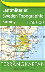
Topographic survey of Sweden at 1:50,000, the Terrรคngkartan, from the Lantmรคteriet, covering most of the country in 244 double-sided maps. Please note: the mountainous regions of central and northern Sweden are not covered by this series but presented in a separate ‘Fjรคllkartan – Mountain Map” series also listed on our website.Each 1:50,000 topographic survey map
Vรคrnamo Lantmateriet 532

Topographic survey of Sweden at 1:50,000, the Terrรคngkartan, from the Lantmรคteriet, covering most of the country in 244 double-sided maps. Please note: the mountainous regions of central and northern Sweden are not covered by this series but presented in a separate ‘Fjรคllkartan – Mountain Map” series also listed on our website.Each 1:50,000 topographic survey map
Lammhult Lantmateriet 533

Topographic survey of Sweden at 1:50,000, the Terrรคngkartan, from the Lantmรคteriet, covering most of the country in 244 double-sided maps. Please note: the mountainous regions of central and northern Sweden are not covered by this series but presented in a separate ‘Fjรคllkartan – Mountain Map” series also listed on our website.Each 1:50,000 topographic survey map
ร…seda Lantmateriet 534

Topographic survey of Sweden at 1:50,000, the Terrรคngkartan, from the Lantmรคteriet, covering most of the country in 244 double-sided maps. Please note: the mountainous regions of central and northern Sweden are not covered by this series but presented in a separate ‘Fjรคllkartan – Mountain Map” series also listed on our website.Each 1:50,000 topographic survey map
Hรถgsby Lantmateriet 535

Topographic survey of Sweden at 1:50,000, the Terrรคngkartan, from the Lantmรคteriet, covering most of the country in 244 double-sided maps. Please note: the mountainous regions of central and northern Sweden are not covered by this series but presented in a separate ‘Fjรคllkartan – Mountain Map” series also listed on our website.Each 1:50,000 topographic survey map
Oskarshamm Lantmateriet 536

Topographic survey of Sweden at 1:50,000, the Terrรคngkartan, from the Lantmรคteriet, covering most of the country in 244 double-sided maps. Please note: the mountainous regions of central and northern Sweden are not covered by this series but presented in a separate ‘Fjรคllkartan – Mountain Map” series also listed on our website.Each 1:50,000 topographic survey map
Hoburgen Lantmateriet 538

Topographic survey of Sweden at 1:50,000, the Terrรคngkartan, from the Lantmรคteriet, covering most of the country in 244 double-sided maps. Please note: the mountainous regions of central and northern Sweden are not covered by this series but presented in a separate ‘Fjรคllkartan – Mountain Map” series also listed on our website.Each 1:50,000 topographic survey map
Hemse Lantmateriet 539

Topographic survey of Sweden at 1:50,000, the Terrรคngkartan, from the Lantmรคteriet, covering most of the country in 244 double-sided maps. Please note: the mountainous regions of central and northern Sweden are not covered by this series but presented in a separate ‘Fjรคllkartan – Mountain Map” series also listed on our website.Each 1:50,000 topographic survey map
Ljugarn Lantmateriet 540

Topographic survey of Sweden at 1:50,000, the Terrรคngkartan, from the Lantmรคteriet, covering most of the country in 244 double-sided maps. Please note: the mountainous regions of central and northern Sweden are not covered by this series but presented in a separate ‘Fjรคllkartan – Mountain Map” series also listed on our website.Each 1:50,000 topographic survey map
South Gothenburg Lantmateriet 541

Topographic survey of Sweden at 1:50,000, the Terrรคngkartan, from the Lantmรคteriet, covering most of the country in 244 double-sided maps. Please note: the mountainous regions of central and northern Sweden are not covered by this series but presented in a separate ‘Fjรคllkartan – Mountain Map” series also listed on our website.Each 1:50,000 topographic survey map
Bollebygd Lantmateriet 542

Topographic survey of Sweden at 1:50,000, the Terrรคngkartan, from the Lantmรคteriet, covering most of the country in 244 double-sided maps. Please note: the mountainous regions of central and northern Sweden are not covered by this series but presented in a separate ‘Fjรคllkartan – Mountain Map” series also listed on our website.Each 1:50,000 topographic survey map
Borรฅs Lantmateriet 543

Topographic survey of Sweden at 1:50,000, the Terrรคngkartan, from the Lantmรคteriet, covering most of the country in 244 double-sided maps. Please note: the mountainous regions of central and northern Sweden are not covered by this series but presented in a separate ‘Fjรคllkartan – Mountain Map” series also listed on our website.Each 1:50,000 topographic survey map
Nybro Lantmateriet 527

Topographic survey of Sweden at 1:50,000, the Terrรคngkartan, from the Lantmรคteriet, covering most of the country in 244 double-sided maps. Please note: the mountainous regions of central and northern Sweden are not covered by this series but presented in a separate ‘Fjรคllkartan – Mountain Map” series also listed on our website.Each 1:50,000 topographic survey map
Tranemo Lantmateriet 544

Topographic survey of Sweden at 1:50,000, the Terrรคngkartan, from the Lantmรคteriet, covering most of the country in 244 double-sided maps. Please note: the mountainous regions of central and northern Sweden are not covered by this series but presented in a separate ‘Fjรคllkartan – Mountain Map” series also listed on our website.Each 1:50,000 topographic survey map
Borgholm Lantmateriet 528

Topographic survey of Sweden at 1:50,000, the Terrรคngkartan, from the Lantmรคteriet, covering most of the country in 244 double-sided maps. Please note: the mountainous regions of central and northern Sweden are not covered by this series but presented in a separate ‘Fjรคllkartan – Mountain Map” series also listed on our website.Each 1:50,000 topographic survey map
Vaggeryd Lantmateriet 545

Topographic survey of Sweden at 1:50,000, the Terrรคngkartan, from the Lantmรคteriet, covering most of the country in 244 double-sided maps. Please note: the mountainous regions of central and northern Sweden are not covered by this series but presented in a separate ‘Fjรคllkartan – Mountain Map” series also listed on our website.Each 1:50,000 topographic survey map
Varberg Lantmateriet 529

Topographic survey of Sweden at 1:50,000, the Terrรคngkartan, from the Lantmรคteriet, covering most of the country in 244 double-sided maps. Please note: the mountainous regions of central and northern Sweden are not covered by this series but presented in a separate ‘Fjรคllkartan – Mountain Map” series also listed on our website.Each 1:50,000 topographic survey map
Nรคssjรถ Lantmateriet 546

Topographic survey of Sweden at 1:50,000, the Terrรคngkartan, from the Lantmรคteriet, covering most of the country in 244 double-sided maps. Please note: the mountainous regions of central and northern Sweden are not covered by this series but presented in a separate ‘Fjรคllkartan – Mountain Map” series also listed on our website.Each 1:50,000 topographic survey map
Ullared Lantmateriet 530

Topographic survey of Sweden at 1:50,000, the Terrรคngkartan, from the Lantmรคteriet, covering most of the country in 244 double-sided maps. Please note: the mountainous regions of central and northern Sweden are not covered by this series but presented in a separate ‘Fjรคllkartan – Mountain Map” series also listed on our website.Each 1:50,000 topographic survey map
Mariannelund Lantmateriet 547

Topographic survey of Sweden at 1:50,000, the Terrรคngkartan, from the Lantmรคteriet, covering most of the country in 244 double-sided maps. Please note: the mountainous regions of central and northern Sweden are not covered by this series but presented in a separate ‘Fjรคllkartan – Mountain Map” series also listed on our website.Each 1:50,000 topographic survey map


