Category Archives: Caribbean
NGA Chart 26260 – Passages Between Acklins Islands, Haiti
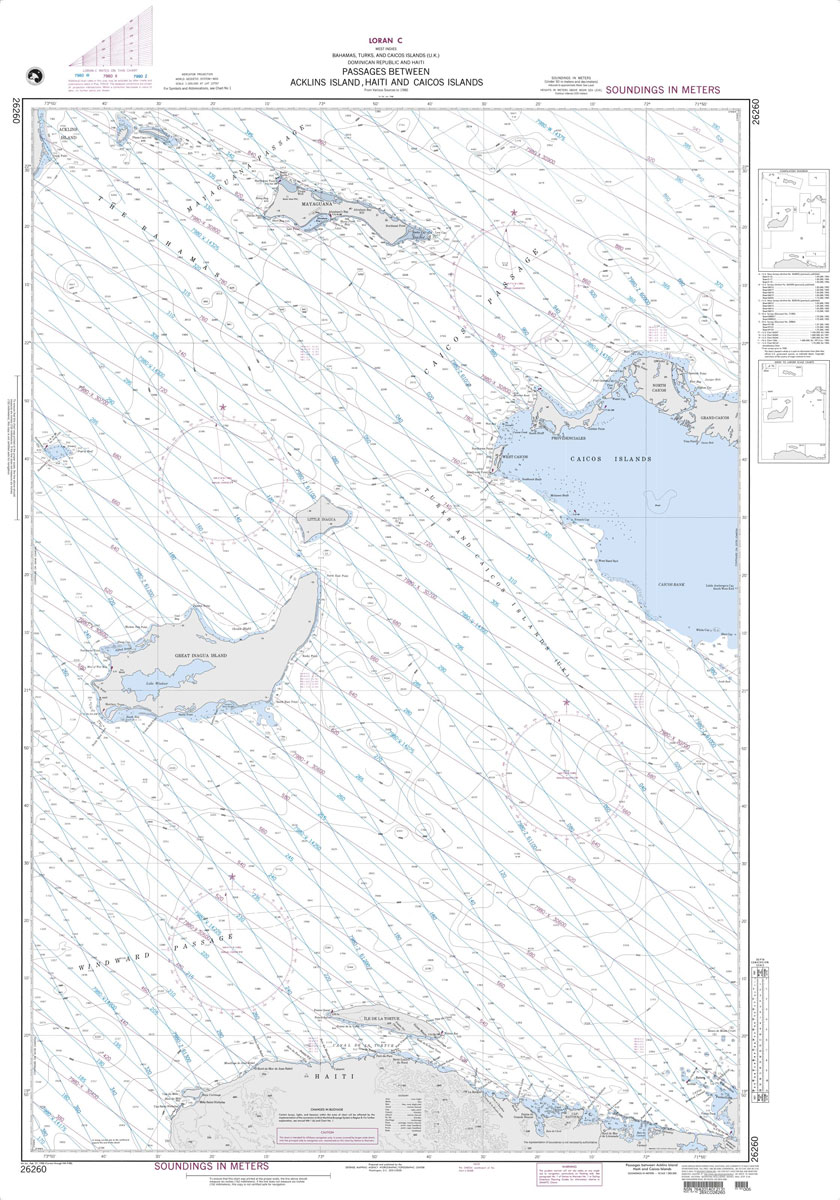
Produced by the US Government, National Geospatial-Intelligence Agency (NGA) charts provide information for the International Waters. They are printed on demand at our London shop and are supplied as flat charts.PLEASE NOTE: NGA charts are not updated often, therefore some may no longer be suitable for safe navigation and should be used for reference only.
NGA Chart 26281 – Cockburn Town San Salvador

Produced by the US Government, National Geospatial-Intelligence Agency (NGA) charts provide information for the International Waters. They are printed on demand at our London shop and are supplied as flat charts.PLEASE NOTE: NGA charts are not updated often, therefore some may no longer be suitable for safe navigation and should be used for reference only.
NGA Chart 26288 – The Bahamas – Bird Rock to Mira Vos Passage

Produced by the US Government, National Geospatial-Intelligence Agency (NGA) charts provide information for the International Waters. They are printed on demand at our London shop and are supplied as flat charts.PLEASE NOTE: NGA charts are not updated often, therefore some may no longer be suitable for safe navigation and should be used for reference only.
NGA Chart 26320 – N. PRT Strait of FLA. and NW Providence

Produced by the US Government, National Geospatial-Intelligence Agency (NGA) charts provide information for the International Waters. They are printed on demand at our London shop and are supplied as flat charts.PLEASE NOTE: NGA charts are not updated often, therefore some may no longer be suitable for safe navigation and should be used for reference only.
NGA Chart 26328 – West Indies – The Bahamas – Berry Islands

Produced by the US Government, National Geospatial-Intelligence Agency (NGA) charts provide information for the International Waters. They are printed on demand at our London shop and are supplied as flat charts.PLEASE NOTE: NGA charts are not updated often, therefore some may no longer be suitable for safe navigation and should be used for reference only.
NGA Chart 27130 – Cabo San Antonio to Cayo del Rosario

Produced by the US Government, National Geospatial-Intelligence Agency (NGA) charts provide information for the International Waters. They are printed on demand at our London shop and are supplied as flat charts.PLEASE NOTE: NGA charts are not updated often, therefore some may no longer be suitable for safe navigation and should be used for reference only.
NGA Chart 21601 – Morro de Puercos to Panama

Produced by the US Government, National Geospatial-Intelligence Agency (NGA) charts provide information for the International Waters. They are printed on demand at our London shop and are supplied as flat charts.PLEASE NOTE: NGA charts are not updated often, therefore some may no longer be suitable for safe navigation and should be used for reference only.
National Geographic United States National Parks 1067 x 762 mm
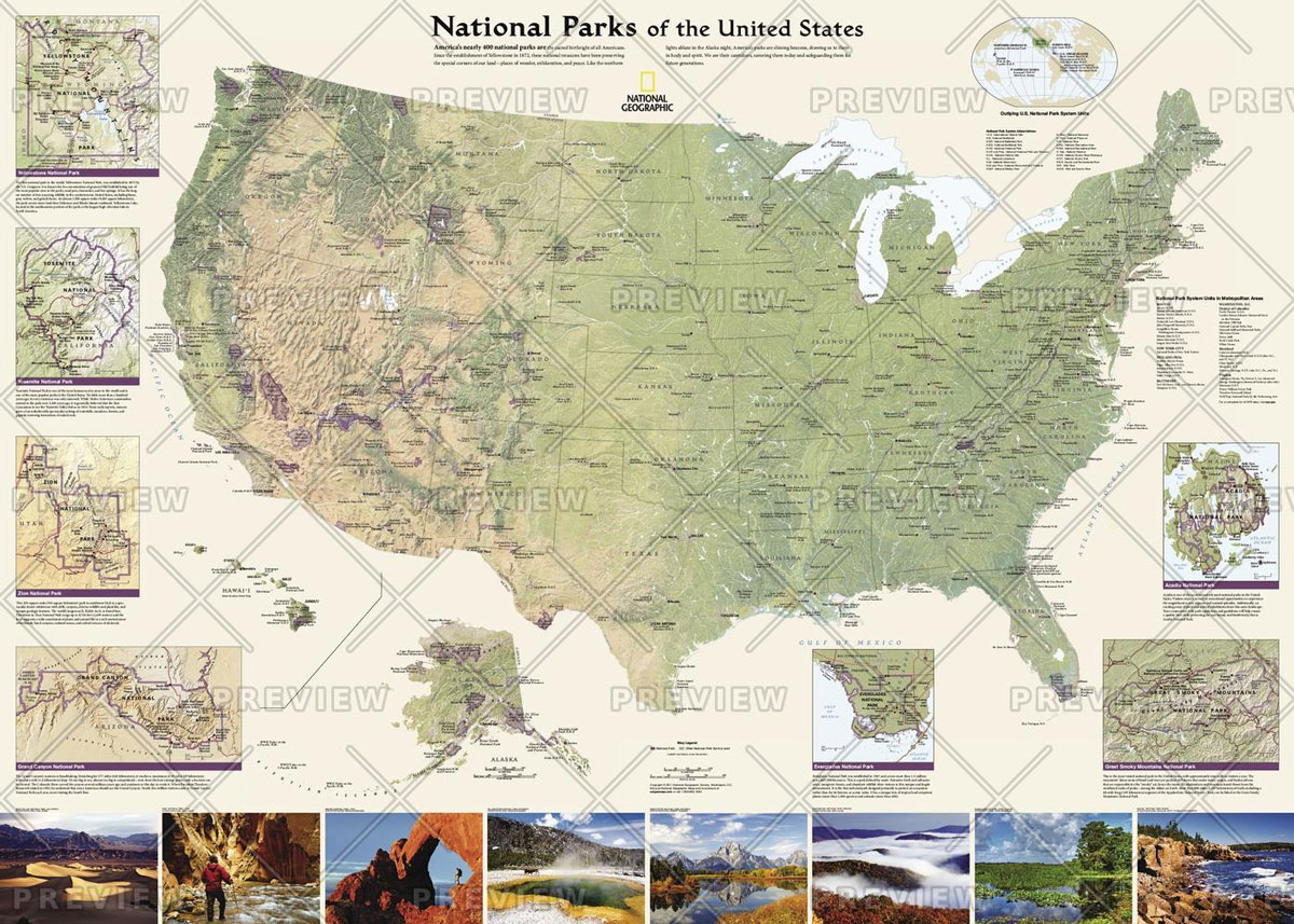
National Geographic`s wall map of National Parks of the United States highlights the nearly 400 magnificent parks across America. The country is represented in subtle earth-tones with shaded mountain relief and intricately drawn river systems. Photos capture some of the diverse landscapes preserved and protected by the national park system.Separate inset maps provide detail and
National Geographic Lands of the Bible 1967 Map – Published 2012 983 x 689 mm

This unique map was created in 1967 for the National Geographic Magazine and has been reprinted in its original format. Filled with reference information, the map includes insets of: The Holy Land, Walled city of Jerusalem, Traditional route of the Exodus, St. Paul`s four great journeys, and The Crusades.

National Geographic West Indies – Published 1954 949 x 735 mm
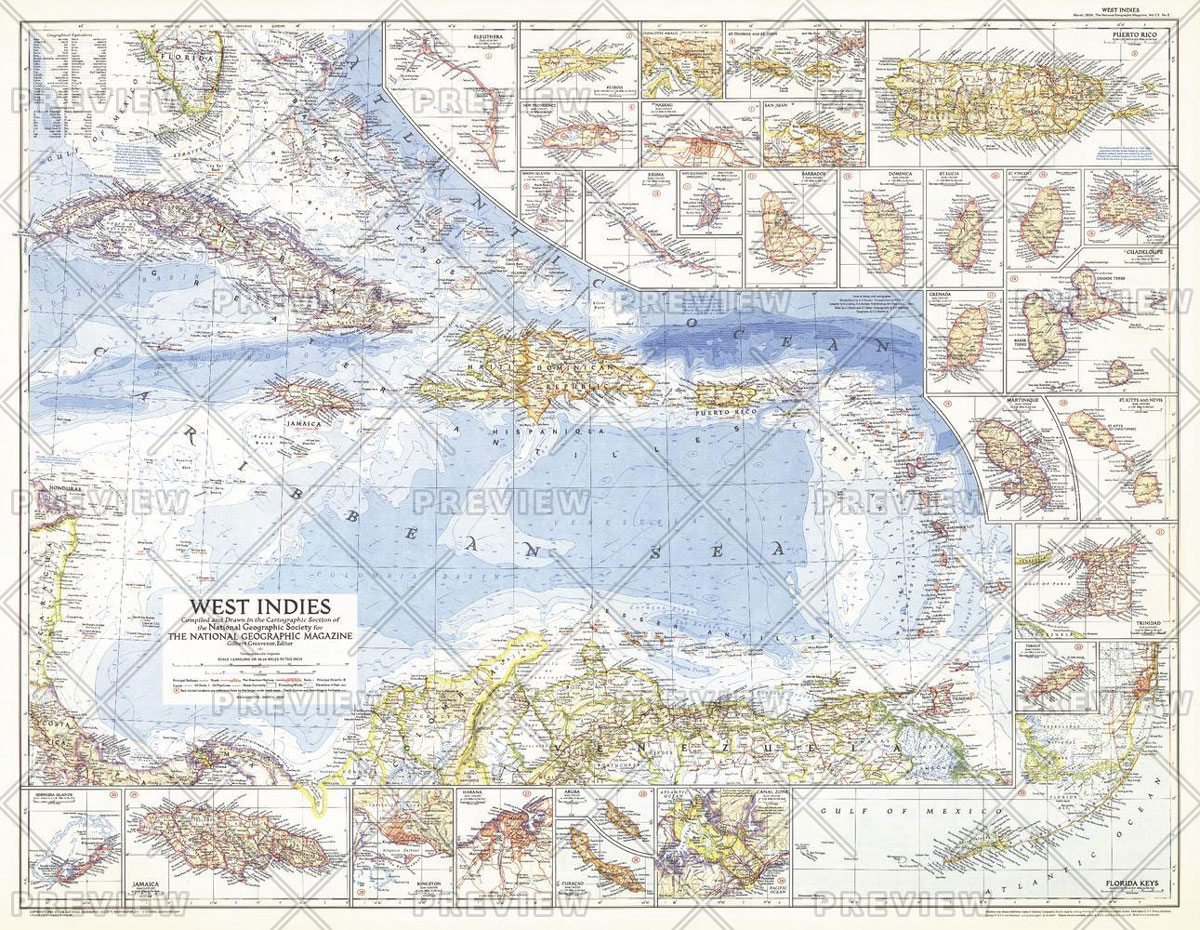
This colourful map of the West Indies contains thirty inset maps providing spectacular detail of the many islands in the Caribbean. Published in March 1954 with two articles, โ€Jamaica – Hub of the Caribbeanโ€ and โ€Night Life in the Gulf Stream.โ€
Admiralty Chart 4402 – Caribbean Sea

NEW EDITION OUT ON 24/09/2020Admiralty standard nautical charts comply with Safety of Life at Sea (SOLAS) regulations and are ideal for professional, commercial and recreational use. Charts within the series consist of a range of scales, useful for passage planning, ocean crossings, coastal navigation and entering port.Standard Admiralty charts are folded to fit in a
NOAA Chart 18680 – Point Sur to San Francisco

NOAA maintains the nautical charts and publications for U.S. coasts and the Great Lakes. Over a thousand charts cover 95,000 miles of shoreline and 3.4 million square nautical miles of waters.Printed on demand using the most up to date NOAA data and latest Notice to Mariners (NTMs) applied at time of print. Meets United States
Guatemala Hand Flag

100% polyester, screen printed flag on a 30cm wooden pole with a white plastic ball cap.
Costa Rica hand flag

100% polyester, screen printed Costa Rica flag on a 30cm wooden pole with a white plastic ball cap
Panama hand flag

100% polyester, screen printed Panama flag on a 30cm wooden pole with a white plastic ball cap