Category Archives: Accessories
Portugal: 100K Topographic Survey Maps
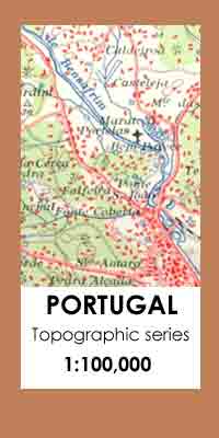
Topographic survey of Portugal at 1:100,000 from the Instituto Geogrรกfico Portuguรชs, the countryโ€s civilian survey organisation. The maps have contours at 50m intervals and in addition to the standard features shown on topographic mapping at this scale also indicate various types of vegetation (vineyards, olive groves, etc). Each sheet covers an area of 64 x
Portugal: 50K Civilian Topographic Survey Maps
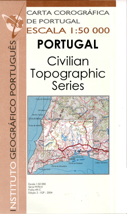
Topographic survey of Portugal at 1:50,000 from the Instituto Geogrรกfico Portuguรชs, the countryโ€s civilian survey organisation. The maps have contours at 25m intervals and in addition to the standard features shown on topographic mapping at this scale also indicate various types of vegetation (vineyards, olive groves, etc). Each sheet covers an area of 32 x
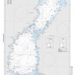
Portugal: 50K Military Topographic Survey Maps

Topographic survey of Portugal at 1:50,000 from the Instituto Geogrรกfico do Exรฉrcito, the countryโ€s military survey organisation. The maps have contours at 20m intervals and in addition to the standard features shown on topographic mapping at this scale also indicate various types of terrain or vegetation (sand, terraces, rocks, woodlands, vineyards, etc). Each sheet covers
Switzerland: Michelin 200K Road Maps
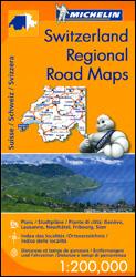
Switzerland on three indexed touring maps at 1:200,000 from Michelin, each with street plans of major cities showing access routes and main streets, plus a distance table. The maps also indicate places with entries in Michelinโ€s annual Red Guides to hotels and restaurants.Topography is presented by relief shading and colouring for woodlands, plus names of
France: Rando Editions/IGN 50K Walking Maps of the Pyrenees
French Pyrenees in a series of recreational maps at 1:50,000 from Rando Editions with GPS compatible topographic base provided by the IGN, plus extensive overprint highlighting local and long-distance hiking trails, campsites, mountain refuges, gรฎtes dโ€etape, areas for various recreational pursuits, tourist information offices, historical heritage, etc.Topography is vividly presented by contours at 20m intervals
USA: Michelin Regional Road Maps
United States divided into three regional maps 1:2,400,000 (1โ€ to 38 miles) from Michelin, with additionally more detailed coverage of the north-eastern seaboard on maps of New England and the Mid-Atlantic states at 1:500,000 (1โ€ to 8 miles).Road network indicates toll roads and clearly shows road numbers of interstate and state highways plus on selected
Germany: Rhineland-Palatinate 50K Topographic Survey Recreational Maps
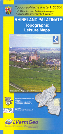
GPS compatible, topographic recreational maps at 1:50,000 of the German state of Rhineland-Palatinate with cartography identical to the standard topographic survey of Germany but with additional extensive overprint highlighting local and long-distance hiking trails, cycle routes, various facilities including accommodation, places of interest, etc.Each title is designed to cover a popular recreational area and several
Africa: Michelin Sectional Maps
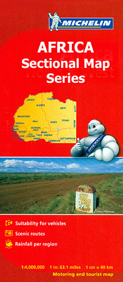
Africa covered by three popular road maps at 1:4,000,000 from Michelin, excellent for long-distance overland traveling or route planning, with detailed road classification and plenty of geographical features. Each title has a very comprehensive climate chart listing several locations.Road detail distinguishes various classes of road surface, e.g. improved, partially-improved, earth roads and tracks, with the
Greenland: Sagamaps 250K Topographic Maps
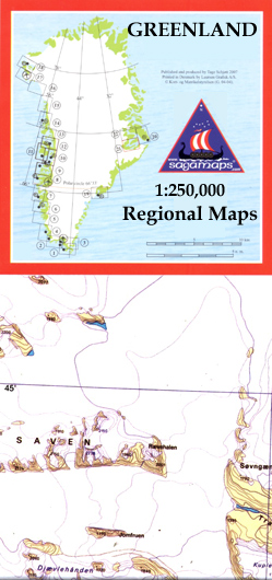
Topographic survey of Greenland at 1:250,000 from Sagamaps in a series which along the western coast extends past Thule to the latitude of 78ยฐ, plus covers selected areas of the east coast including the Stauning Alps. Relief is shown by contours at 50m intervals, augmented by frequent spot heights. Main peaks are named, along with
Iceland: Mรกl og Menning 300K Road Maps
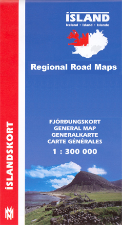
Iceland at 1:300,000 on five maps from Mรกl og menning showing the road network on a base with contours, coloring and graphics to provide a very clear picture of the countryโ€s topography, plus on the reverse photos and descriptions of main sights.The maps have contours at 100m intervals, enhanced by very effective relief shading and
Nepal: Schneider Trekking Maps
Nepalโ€s most popular trekking regions at 1:50,000 or 1:100,000 in a series of detailed topographic maps originally prepared by the Austrian climber and cartographer Erwin Schneider which for nearly five decades provided the best and often the only coverage of these areas. Now sponsored by the German Scientific Association of Comparative High-Mountain Research (Arbeitsgemeinschaft fรผr
Sweden: Norstedts Regional Road Maps
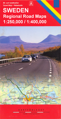
Touring maps of Sweden produced in cooperation with the countryโ€s national survey organization. Central and southern Sweden is covered at 1:250,000, with the north at 1:400,000. Spot heights and relief colouring in mountainous areas present the terrain. The maps also distinguish between forested and open areas, and show marshes and glaciers. Detailed road classification includes
Finland: Karttakeskus 250/400K GT Road Maps

Finland on four double-sided road maps from Karttakeskus, the countryโ€s national survey organization, with both topographic and extensive tourist information, including hotels, campsites, youth hostels, etc. The southern part of the country is covered at 1:250,000, with the north at 1:400,000.Road classification ranges from dual carriageways to unsurfaced tracks and privately maintained roads, indicating the
Italy: LAC Provincial Road Maps

Italy on handy size road maps from Litografia Artistica Cartografica (LAC), each covering an administrative province, with more minor local roads and tracks than can be found on most regional maps. The series is gradually being changed to a new style of digitally derived cartography, so presentation of adjoining titles may vary.*All the maps* have
Iceland: Topographic Hiking and Tourist Maps
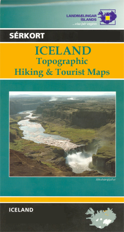
Icelandโ€s most visited areas on special detailed, GPS compatible recreational and touring maps with cartography from the countryโ€s topographic survey, highlighting hiking paths, bridleways, tourist accommodation, etc.The maps are contoured, (usually at 20m intervals) and carry all the information expected of topographic maps at such scales, including, where appropriate types of vegetation and terrain, details
Germany: Lower Saxony 50/40K Topographic Survey Leisure Maps
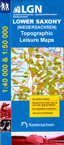
Detailed maps of selected areas of Lower Saxony, with cartography of the German topographic survey. Overprint highlights numerous hiking paths, including those suitable for wheelchairs, and cycling routes, indicating their waymarking. Road network is also annotated with symbols showing various sightseeing routes.An extensive range of symbols mark different types of accommodation, sport and leisure facilities,
Mexico: 250K Topographic Survey Maps
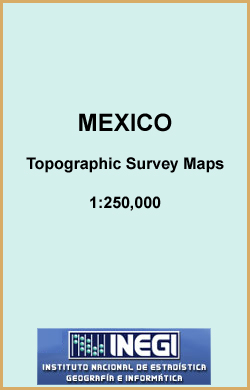
Topographic mapping from Mexicoโ€s national survey agency, Instituto Nacional de Estadรญstica, Geografรญa e Informรกtica. The maps have contours at 20m intervals with relief shading and indicate various types of terrain and vegetation, e.g. dense vegetation, cultivated areas, swamps, sand dunes, salt pans, etc. UTM grid is at 10km intervals, with latitude and longitude shown by
Mexico: Guja Roji State Road Maps
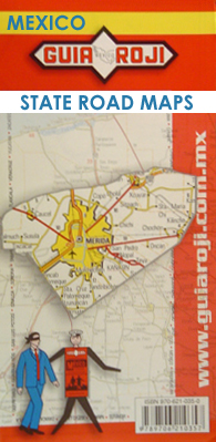
Road maps of the administrative states of Mexico from Guia Roji, highlighting places of interest. The maps show four different grades of roads, with intermediate driving distances on main routes, railways, local airports, ferry connections and administrative boundaries. Topographic information is limited to names of main mountain ranges, spot heights for main peaks, rivers and
Ireland: 250K Holiday Maps
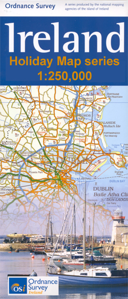
Four road maps at 1:250,000 covering both the Republic of Ireland and Northern Ireland, with detailed road classification, altitude colouring and tourist information, published by OSI, the Ordnance Survey of Ireland, with the northern sheet produced in cooperation with the Ordnance Survey of Northern Ireland.Topography of the island is shown by altitude colouring, with additional