Category Archives: Accessories
Germany: Freytag & Berndt “Top 10 Tips” Road Maps
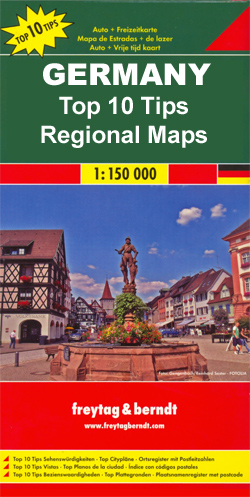
Germanyโ€s popular holiday areas on detailed road maps at 1:150,000 from Freytag & Berndt, each with a booklet with street plans, an index and descriptions of 10 selected places of interest, all prominently highlighted on the maps.Relief is portrayed by hill-shading without distracting from other detail. Although these maps are using the same cartography as
The Unofficial Guides

The Unofficial Guides series comprises a range of guides dedicated to American cities or thematic destinations such as adventure travel, Disney World, beach resorts or ideas for travelling with children. The moniker โ€unofficialโ€ refers to the publisherโ€s series title, rather than an indication of the accuracy of the information that is provided in individual guides.
Greece: Anavasi Hiking Maps of the Mainland and Peloponnese
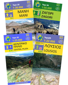
The mountains of Greece in a series of waterproof and tear-resistant hiking maps from Anavasi at scales varying from 1:50,000 to 1:10,000, with a UTM grid for GPS users. Contour interval varies depending on the scale, on most maps it is 20m. Relief shading, spot heights, springs, seasonal streams and, in most titles, landscape/land-use variations,
Moon `Living Abroad` Guides
The Living Abroad series from Moon, one of Americaโ€s leading travel publishers, covers a range of countries worldwide and offers practical guidance on residing away from home. Stylistically, Moonโ€s editorial style is strongly American in focus, often offering cultural insights and observations with an American audience in mind. However, each of the titles in the
Greece: Anavasi Touring Maps of the Mainland and Peloponnese
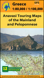
Selected popular areas of mainland Greece and the Peloponnese in a series of waterproof and tear-resistant, GPS compatible, indexed topographic road maps from Anavasi at scales between 1:80,000 and 1:110,000. The maps have contours at 100m intervals (or 50m where indicated in the individual descriptions) and relief shading to provide an excellent presentation of the
Germany: Baden-Wรผrttemberg 50K Topographic Survey Leisure Maps

Black Forest and the rest of the state of Baden-Wรผrttemberg in a series of double-sided, GPS compatible topographic maps at 1:50,000 with hiking and cycling routes, sport and recreational facilities, cultural, historical and other tourist sites, etc.The maps, produced by the stateโ€s official survey organization Landesamt fรผr Geoinformation und Landentwicklung Baden-Wรผrttemberg, have cartography identical to
Italy: Ed. Multigraphic Walking Maps of Central Italy
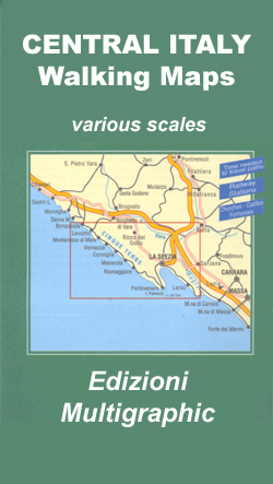
Hiking maps at 1:25,000 or 1:50,000 from the Florence-based Edizioni Multigraphic covering parts of Tuscany, Umbria and the adjoining regions of central Italy. The cartography is rather old fashioned and sometimes not as clear as in other map series but for some areas these are the only hiking maps currently obtainable. Most maps have contours
Iceland: 250K Topographic Survey Road Maps
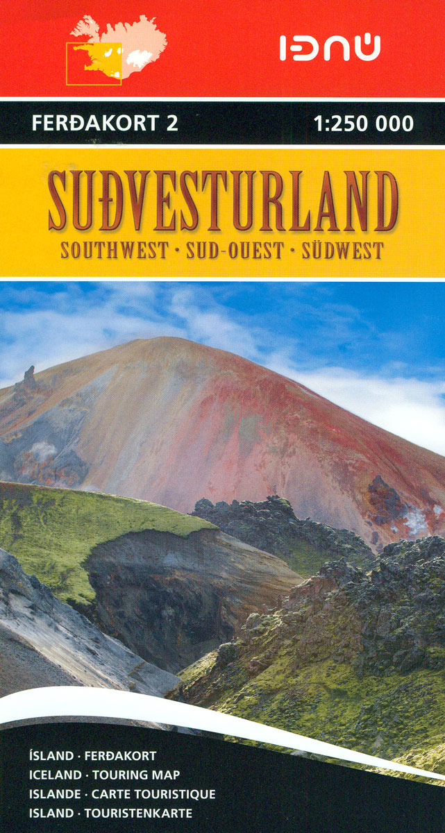
Iceland at 1:250,000 on four detailed, contoured road maps, plus a special title providing coverage of the Highlands – the most visited part of the country, published by Icelandโ€s national survey organization.The maps have cartography based on the countryโ€s topographic survey, supplemented by additional tourist information. Contours are at 50m intervals, enhanced by relief shading
Argentina: de Dios Tourist Maps of Popular Regions

Argentinaโ€s most visited regions and routes in a series of handy format, light, laminated and waterproof concertina maps from De Dios, presenting a selection of tourist road maps, street plans and trekking suggestions. The road maps in these titles do not aim to provide a detailed picture of the regionโ€s road network, but are designed
Guadeloupe/French Antilles: 25K Topographic Survey Maps
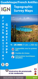
Guadeloupe administrative department, including St. Martin and St. Barthรฉlemy, in a series of GPS compatible topographic survey maps at 1:25,000 from the Institut Gรฉographique National, with hiking paths and other tourist information.Contour interval varies according to the terrain (5m or 10m), with bold relief shading and plenty of information on the type of vegetation: woods
Romania: Dimap Hiking Maps
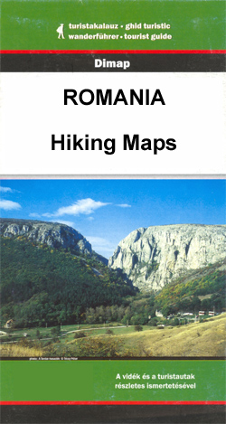
Popular hiking areas of Transylvania on detailed contoured maps from Dimap, one of Hungaryโ€s leading publishers specializing in mapping of that region. The maps show local hiking routes and provide tourist information such as campsites, places of interest, etc. Many titles include street plans and/or English language descriptions of recommended hiking trails.Cartography including GPS coordinates,
N/A 506

AA publish a range of thematic, pictorial and outdoor titles that explore Britain and Europe, covering walking, cycling, food and drink and language in addition to celebrating the diversity of regions and cities through a range of pictorial titles. A selection of paperback and larger format guides is dedicated to exploring the walking possibilities and
Iceland: 100K Topographic Survey Maps
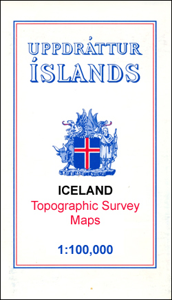
Topographic survey of Iceland at 1:100,000 covering the whole of country in a series last revised in the early eighties. Contour interval is 20 meters. In addition to the usual features shown on survey mapping, the maps also include a large amount of information indicating the type of the terrain and land use (block or
Collins World Atlases
Collins World Atlases feature the same award winning cartography as Times World Atlases. Cartography type is specified for physical maps, i.e. whether maps are displayed in accordance with variations on mercator, conic or azimuthal systems. Atlases contain a wide range of topical reference maps and country based geographical facts, figures and information. Atlases include time
Martinique: IGN 25K Topographic Survey Maps
Topographic maps from the Institut Gรฉographique National in Paris covering Martinique on three sheets. Cartography is similar to that used for IGNโ€s coverage of France at this scale, with contours at 10m intervals, relief shading, and plenty of information on the type of vegetation: woods and forests, brushwood, plantations and orchards, banana and sugar cane
New Zealand: Kiwimaps 500K Touring Maps
Double-sided, indexed touring maps with plenty of tourist information and street plans of town centres. The maps highlight main highways and regional roads, but also show small local roads and selected 4WD tracks. Railways and popular hiking tracks are also shown. National parks and forests are highlighted, and a wide range of symbols indicate numerous
Reunion: IGN 25K Topographic Survey Maps
Reunion on a topographic survey at 1:25,000, published by the Institut Gรฉographique National in Paris, on six contoured, GPS compatible maps with hiking routes, campsites and mountain refuges, etc.The maps have contours at 10m intervals with bold relief shading enhancing the presentation of the terrain. In addition to the usual information shown on topographic surveys
Australia: Hema Great Desert Tracks Road Maps
Hemaโ€s Great Desert Tracks series for trips across Australiaโ€s Outback presented on four GPS compatible maps printed on light, waterproof and tear-resistant synthetic paper. The series was specially prepared by Hema using base maps from Geoscience Australia, the countryโ€s national survey organization. The mapping shows roads and 4WD tracks, as well as very rough tracks
Norway: 100K Topographic Survey of Svalbard/Spitsbergen
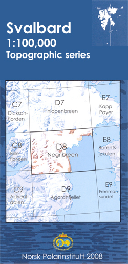
Topographic mapping of the Svalbard (Spitsbergen) group at 1:100,000 is published by the Norsk Polarinstitutt in two versions. The western coast, central and southern part of Spitsbergen, plus two small islands of Svenskรธya and Kongsรธya, are covered by colour maps with contours at 25-metre intervals, bold relief shading, spot heights. The maps show settlements, roads
Czech Republic: MairDumont Marco Polo 200K Road Maps
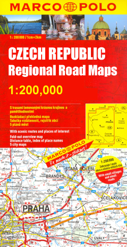
MairDumont`s Marco Polo regional series of the Czech Repoublic at 1:200,000, with special new features to aid route planning whilst retaining the publisherโ€s excellent cartography. The index is now in a separate booklet, which also includes street plans of main cities.The new presentation of this series, introduced in March 2009, includes a fold-out extension of