Category Archives: Accessories
ADMIRALTY Routeing Charts
Essential for use in passage planning for ocean voyages, Routeing Charts include routes and distances between major ports, ocean currents, ice limits, load lines and wind roses. They also contain expected meteorological and oceanographic conditions for each month of the year.Individual chart scales of 1:5,000,000, 1:10,000,000 and 1:20,000,000 assist bridge crews in high-level route planning.Information
Greece: Terrain Editions 100K Touring Maps of Crete
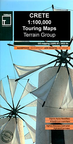
Crete at 1:100,000 on three contoured maps from Terrain Editions printed on light, waterproof and tear-resistant plastic paper. Each title is indexed and includes large street plan(s) of main town(s).The maps have contours at 100m intervals, enhanced by relief shading with spot heights and plenty of names of topographic features such as peaks, mountain ranges,
Rick Steves` Snapshot Guides
Rick Steves` Snapshot Guides consist of the best of Rick Steves` European country guidebooks. Published in the UK by Avalon, comprise a range of titles focussing on destinations in Great Britain and Europe. As one of the leading American guide book publishers to European destinations, Rick Stevesโ€ guides are predominantly targeted at an American market
Nepal: Nepa Maps (Himalayan MapHouse) Rafting & Kayaking Maps

Nepal on three maps at 1:500,000 from the Nepa Maps (Himalayan MapHouse) designed to present the countryโ€s river network classified according to the suitability for white water rafting and kayaking, with water volume profiles, etc.Each title shows the river network graded into five classes. Additional panels list rivers with rafting and kayaking summaries, providing stretch-by
Great Britain: Godfrey Editions of Historical Ordnance Survey “A Yard to the Mile” City Plans
Exceptionally detailed reproductions of old Ordnance Survey street plans for areas of larger cities which have undergone substantial redevelopment in the late 19th or the early 20th century, published in the Alan Godfrey Editions.The plans, printed in back and white, have been taken from the original Ordnance Survey mapping at 1:1,056 and reproduced at 1:1,760
Great Britain: Godfrey Editions of Historical Ordnance Survey Inch to a Mile Maps of England & Wales
Reproductions in the Alan Godfrey Editions of Ordnance Surveyโ€s famous โ€Inch to the Mileโ€ maps covering England and Wales. The maps provide an invaluable overview of a wider area, typically 18 x 12 miles (29 x 19 kms approx.), and offer historical mapping for small towns and villages not covered by the more detailed series
Compass Maps PopOut Maps
Compass Mapsโ€ Pop-Out Maps are designed to provide street plans in a handy format to fit neatly all but the smallest pockets, with, as appropriate, transport network diagrams, additional useful maps, etc. Each titleโ€s two cover flaps open up to reveal one or more street plans: usually the city centre in greater detail, plus a
South America: NGS Classic Style Wall Maps
South America wall maps published by National Geographic Society in their classic style of presentation: light beige background with relief shading to show the topography and country borders outlined in contrasting colours. The maps are published in two sizes, (61 x 76cm or 92 x 117cm) each available either on paper or encapsulated.The maps have
Canada: Go Trekkers Maps of National Parks

Canadaโ€s national parks in a series of GPS compatible recreational maps at various scales from Go Trekkers highlighting recreational possibilities including trekking and/or snowshoe trails, canoeing and kayaking routes, campgrounds, warden stations, etc.Cartography varies according to the terrain of the national park, but the maps are contoured and have spot heights plus, as appropriate, graphics
Norway: New 50K Topographic Survey Maps
New topographic survey of Norway at 1:50,000 covering the country on 195 double-sided sheets and first published by Nordeca in 2011 – 2012; fully GPS compatible, indicating waymarked footpaths, campsites, tourist huts, illuminated ski runs, etc.The maps, now published by Nordeca, the successors to Statens Kartverk and its subsequent owners the Ugland Group, are printed
France: IGN Maps of Environs of Main Cities
Environs of French cities in a series of detailed road maps at 1:80,000 from the IGN, designed to highlight places of interest and recreational possibilities, with a city centre street plan and an enlargement of a selected hiking area.Cartography is an enlargement of IGNโ€s bestselling TOP100 series of road maps, enlarged here from 1:100,000 to
Spain: 25K Mainland Spain Civilian Topographic Survey

Topographic coverage of mainland Spain at 1:25,000 published by the Centro Nacional de Informaciรณn Geograficรก, the countryโ€s civilian survey organization. The maps have contours at 10m intervals and colouring and/or graphics to show different types of vegetation or land use. Boundaries of national parks and other protected areas are marked. In addition to all the
Europe: NGS Executive Style Political Wall Maps
Political wall maps of Europe from the National Geographic Society in their executive style, offering current information in elegant antique presentation. Available either as 77 x 60cm or 117 x 92cm, both sizes on paper or encapsulated.The maps present Europe with relief shading to indicate mountainous regions. Additional graphics show topographic features such as main
Spain: 25K Canary Islands Civilian Topographic Survey

Topographic coverage of the Canary Islands at 1:25,000 published by the Instituto Geogrรกfico Nacional โ€“ Centro Nacional de Informaciรณn Geografica, the countryโ€s civilian survey organization. The maps have contours at 10m intervals and colouring and/or graphics to show different types of vegetation or land use. Boundaries of national parks and other protected areas are marked.
Formac Colorguides
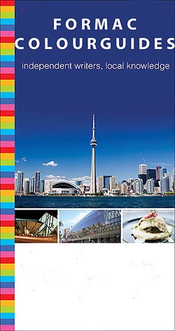
Formac Colorguides are a series of guide books to parts of Canada that have been both written by locals and printed in Canada. Itโ€s this first hand knowledge that give these little guides the edge for Canadian destinations.Colourguides offer detailed information on museums, galleries, and heritage sites as well as shopping, dining nightlife and more;
Luxe City Guides
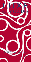
Luxe city guides are slim and small enough to fit easily in a pocket or handbag. Information is distilled from elite suggestions by city residents, specially selected for their style, knowledge and expertise.Luxe guides aim at the upper end of the market and subjectively edit to choose the very best recommendations for shopping, restaurants, leisure
Nepal: Newgrove Consultants Great Himalaya Trail High Route Series
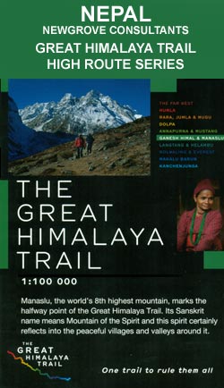
The Great Himalaya Trail (GHT) series of maps at 1:100,000 from Newgrove Consultants covering the course of GHTโ€s High Route on nine contoured maps printed on light, waterproof and tear-resistant plastic paper. The base map, derived from satellite imagery, has contours at 200m intervals enhanced by relief shading and colouring to show glaciers, the snow
Tanzania: Veronica Roodt Maps of National Parks and Conservation Areas
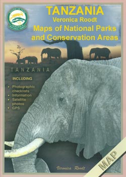
Tanzaniaโ€s national parks and other protected areas in a series of maps from Veronica Roodt Publications with each title consisting of main map plus several panels providing, as appropriate, extensive additional tourist information about various aspects of the region, particularly its fauna and flora. The maps do not use conventional cartography but are based on
Explorer `Resident`s`, `How to…` and `Working in…` Guides
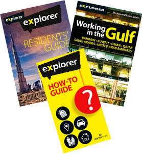
The โ€Residentsโ€, โ€How to… โ€ and โ€Working inโ€ฆโ€ guides are aimed at those living and working or thinking of relocating in a particular country. They offer various specific information from dealing with all major topics of moving and living abroad featured in the โ€Residentsโ€ guides, to more bureaucracy specific information found in the โ€How to…โ€
Explorer Top Ten and Visitors` Guides
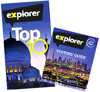
Explorer Publishingโ€s Visitors and Top 10 guides designed to maximise your holiday and help you navigate your way like a local. The Visitors guides, usually written by residents and ex-pats, are packed with essential information; they cover sights, culture, history, activities, the best places for eating and drinking, and much more. Illustrated with full-colour photographs,