Category Archives: Accessories

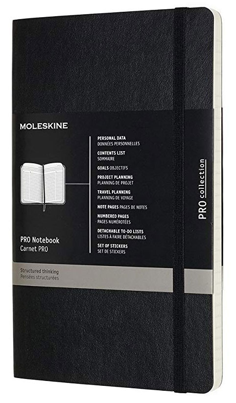
Pro Notebook Large Hardcover Black
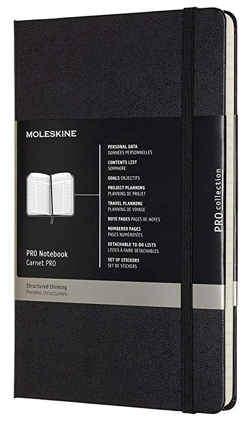
– Features rounded corners, elastic closure, ribbon bookmark, and double inner pocket in cardboard and cloth.- Includes 240 pages, ivory-coloured 70 g/m2 acid-free paper, and 8 detachable pages.
Pro Notebook Large Hardcover Pearl Grey
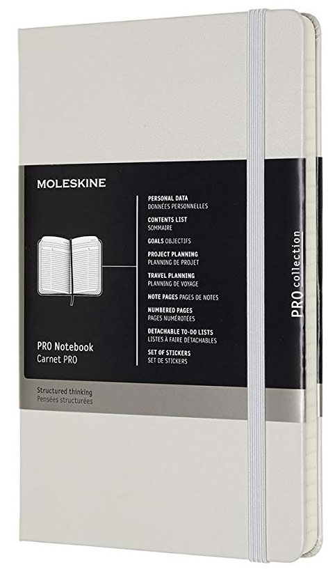
– Features rounded corners, elastic closure, ribbon bookmark, and double inner pocket in cardboard and cloth.- Includes 240 pages, ivory-coloured 70 g/m2 acid-free paper, and 8 detachable pages.
Pro Notebook Large Softcover Black
– Features rounded corners, elastic closure, ribbon bookmark, and double inner pocket in cardboard and cloth.- Includes 192 pages, ivory-coloured 70 g/m2 acid-free paper, and 8 detachable pages.


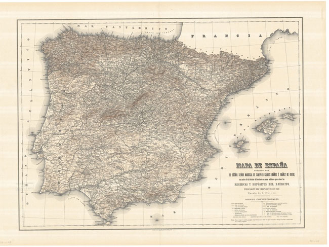
Villamayor CNIG Topographic Map 478-I

Topographic coverage of mainland Spain at 1:25,000 published by the Centro Nacional de Informaciรณn Geograficรก, the country’s civilian survey organization. The maps have contours at 10m intervals and colouring and/or graphics to show different types of vegetation or land use. Boundaries of national parks and other protected areas are marked. In addition to all the
Salamanca CNIG Topographic Map 478-II
Topographic coverage of mainland Spain at 1:25,000 published by the Centro Nacional de Informaciรณn Geograficรก, the country’s civilian survey organization. The maps have contours at 10m intervals and colouring and/or graphics to show different types of vegetation or land use. Boundaries of national parks and other protected areas are marked. In addition to all the
Cilleros el Hondo CNIG Topographic Map 478-III
Topographic coverage of mainland Spain at 1:25,000 published by the Centro Nacional de Informaciรณn Geograficรก, the country’s civilian survey organization. The maps have contours at 10m intervals and colouring and/or graphics to show different types of vegetation or land use. Boundaries of national parks and other protected areas are marked. In addition to all the
Calvarrasa de Arriba CNIG Topographic Map 478-IV
Topographic coverage of mainland Spain at 1:25,000 published by the Centro Nacional de Informaciรณn Geograficรก, the country’s civilian survey organization. The maps have contours at 10m intervals and colouring and/or graphics to show different types of vegetation or land use. Boundaries of national parks and other protected areas are marked. In addition to all the