Category Archives: Accessories
Great Britain: Philip`s Road Atlases
Road Atlases of Great Britain from Philipโ€s in 12 different versions presenting the country in variety of formats and scales. The atlases can be grouped into three types, according to their scale and the presentation of the road network โ€“ additional features of each title are listed in its individual description. – NAVIGATOR TITLES: Nos.
Albania: Huber Verlag 50K Hiking and Cycling Maps
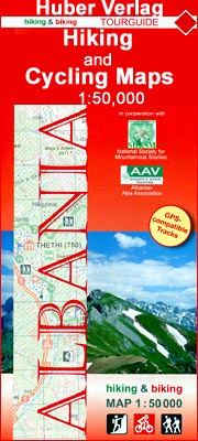
Albaniaโ€s popular recreational areas on GPS compatible contoured maps at 1:50,000 from Huber Verlag showing hiking and cycling routes, climbing sites, tourist accommodation, with detailed descriptions of recommended tours.The maps, prepared in cooperation with the Albanian Alps Associations and the National Society for Mountainous Studies, have contours at 50m intervals, with spot heights, graphic relief
Royal Geographic Society Individual Prints

Exclusive to Stanfords, the Royal Geographical Society (with IBG) has selected a range of vintage photographs of travel and exploration. The images are from the Societyโ€s prestigious archive collection.
Great Britain: AA/Ordnance Survey 25K Walker`s Maps
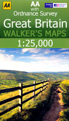
Great Britainโ€s best hiking regions at 1:25,000 in a series of Walkerโ€s Maps published by the AA with the cartography from the Ordnance Surveyโ€s Explorer series. Each title is designed to cover a popular area, with many maps double-sided to provide wider coverage.The maps provide plenty of recreational and tourist information, indicating in England and
Spain: Editorial Alpina Maps of Long-distance Hiking Trails
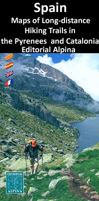
Detailed, contoured and GPS compatible maps from Editorial Alpina showing long-distance hiking routes, mostly in the Spanish Pyrenees but the series also includes trails which span both sides of the border or are on the French side, and it is now expanding to cover other parts of Spain. An overprint highlights the route itself and
Great Britain: Footprint Maps of Long-distance Hiking Routes
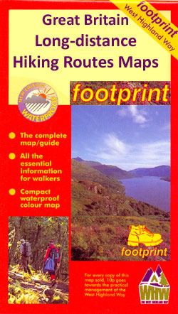
Britainโ€s long-distance footpaths in a series of compact, waterproof and tear-resistant maps from Footprint Walks presenting each route in separate stages with mapping designed to provide user-friendly yet comprehensive information about the challenges of the route, services along the way, places of interest, etc.Each route is divided into overlapping panels designed to cover one daily
Old House Books: Nostalgia and Heritage Maps
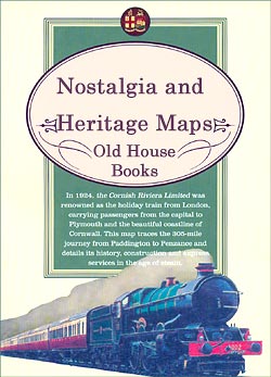
Maps that explore and explain the past, published by the Old House Books from a variety of sources and on a wide range of subjects, from a Victorian map of the Thames to the aerodromes of Europe and tea plantations Ceylon and Java.Most titles are reproductions of maps and posters originally published in the late
Great Britain: A-Z/Ordnance Survey 25K Adventure Atlases
Selected hiking areas of Britain on handy size Adventure Atlases at 1:25,000 from Geographers` A-Z Map Company with cartography from the Ordnance Surveyโ€s Explorer series. Each title has an index which includes geographical features, nature reserves, youth hostels and car parks, etc, and provides QR codes for other useful information.The atlases have cartography of the
Great Britain: Footprint Maps with Day Walks
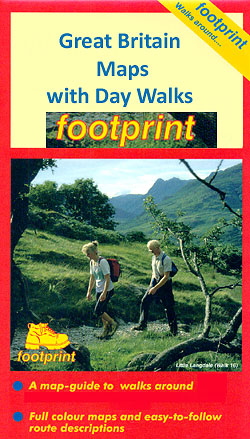
Recommended day walks in popular hiking areas of Britain on maps from Footprint, with each title presenting several routes within easy reach of one base. The walks include easy strolls and keep to well-used tracks and public footpaths. Each walk is presented on its own panel which can be viewed with the whole map refolded
Cavallini & Co. Wrapping Paper
Cavallini & Co. offers a wonderful selection of unique wrapping paper featuring vintage designs and prints of travel tags, posters, maps and much more. Each sheet measure 51x71cm (20โ€x28โ€) and is made of thick, paper stock. The beautiful prints and quality of the paper make these posters ideal for wrapping special presents as well as
Great Britain: Reproductions of Old City Maps from the Old House Books
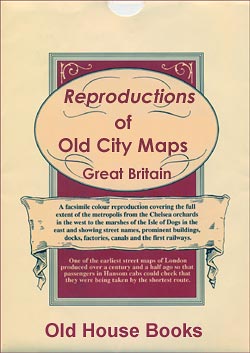
Reproductions from the Old House Books of old city maps, with particularly interesting coverage of London, from the earliest surviving plan of the whole city to the famous Boothโ€s Poverty Maps and various posters from the inter-war period. Each title comes with explanatory notes. All the titles are published as a folded map, with selected
Switzerland: Hallwag Winter Maps
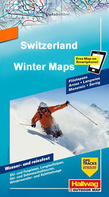
Popular winter sports areas of Switzerland in a new series of waterproof and tear resistant Winter Maps from Hallwag with extensive information for ski and snowshoe tours, cross-country tracks, sledge tracks, winter hiking routes, tourist facilities, etc, printed on waterproof and tear-resistant synthetic paper.Detailed, contoured topographic base has additional colouring to indicate slope gradients between
Great Britain: Footprint Maps of Long-distance Cycling Routes
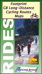
Long-distance cycling routes in northern England and southern Scotland on waterproof and tear-resistant maps from Footprint Walks, with the course of each route presented on mapping with altitude colouring and annotated with gradient markings, etc. Locations along the route have symbols showing what facilities can be found there.For more information please see individual descriptions โ€“
South America: NGS Classic Style Wall Maps
South America wall maps published by National Geographic Society in their classic style of presentation: light beige background with relief shading to show the topography and country borders outlined in contrasting colours. The maps are published in two sizes, (61 x 76cm or 92 x 117cm) each available either on paper or encapsulated.The maps have
Canada: Go Trekkers Maps of National Parks

Canadaโ€s national parks in a series of GPS compatible recreational maps at various scales from Go Trekkers highlighting recreational possibilities including trekking and/or snowshoe trails, canoeing and kayaking routes, campgrounds, warden stations, etc.Cartography varies according to the terrain of the national park, but the maps are contoured and have spot heights plus, as appropriate, graphics
Norway: New 50K Topographic Survey Maps
New topographic survey of Norway at 1:50,000 covering the country on 195 double-sided sheets and first published by Nordeca in 2011 – 2012; fully GPS compatible, indicating waymarked footpaths, campsites, tourist huts, illuminated ski runs, etc.The maps, now published by Nordeca, the successors to Statens Kartverk and its subsequent owners the Ugland Group, are printed
France: IGN Maps of Environs of Main Cities
Environs of French cities in a series of detailed road maps at 1:80,000 from the IGN, designed to highlight places of interest and recreational possibilities, with a city centre street plan and an enlargement of a selected hiking area.Cartography is an enlargement of IGNโ€s bestselling TOP100 series of road maps, enlarged here from 1:100,000 to
Spain: 25K Mainland Spain Civilian Topographic Survey

Topographic coverage of mainland Spain at 1:25,000 published by the Centro Nacional de Informaciรณn Geograficรก, the countryโ€s civilian survey organization. The maps have contours at 10m intervals and colouring and/or graphics to show different types of vegetation or land use. Boundaries of national parks and other protected areas are marked. In addition to all the
Europe: NGS Executive Style Political Wall Maps
Political wall maps of Europe from the National Geographic Society in their executive style, offering current information in elegant antique presentation. Available either as 77 x 60cm or 117 x 92cm, both sizes on paper or encapsulated.The maps present Europe with relief shading to indicate mountainous regions. Additional graphics show topographic features such as main