Category Archives: Accessories
Great Britain: Sustrans/CycleCity Cycling Maps of Great Britain & Northern Ireland

Great Britain and Northern Ireland in a series of cycle maps at 1:110,000 approx from Sustrans highlighting routes of the National and the Regional Cycle Networks, plus publishersโ€ own recommendations for best day rides and street plans with cross-city cycle routes – to see the list of day rides and street plans please see the
London: A-Z Street Atlases and Maps
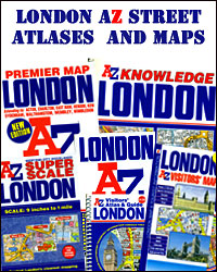
A-Z street atlases and street maps of London from the Geographers` A-Z Map Company produced in a variety of formats and sizes, from large atlases to small pocket maps. The titles use the same basic cartography, enlarged or reduced according to the requirements of each version, so the print size of street names and other
World: Global Mapping Political Wall Maps
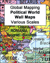
Political maps of the world from Global Mapping with bright colouring of the individual countries pleasantly contrasted by the light blue oceans, relief shading for mountain ranges on land and the structure of the ocean floor, a panel of country flags, etc.FORMAT & SIZES: the maps are available on paper or encapsulated and in four
Herb Lester Associates City Map/Guides
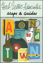
City Map/Guides from Herb Lester Associates are an eclectic selection of quirky titles designed to illuminate particular aspects of a city or a district. Each title lists publishersโ€ recommendations, ranging from the already famous attractions to little gems known only to the well informed locals, all with brief descriptions and, where appropriate, contact details.Accompanying maps
Italy: Touring Club Italiano Regional Smart Maps
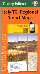
Maps of popular sightseeing regions of Italy presented by the Touring Club Italiano on Smart Maps printed on light, waterproof and tear-resistant synthetic paper. The maps use the cartography of TCIโ€s bestselling regional series at 1:200,000, but enlarged on most titles to 1:175,000 and accompanied by publishersโ€ recommendations for how to get the best of
Black Sheep Guides Travel for Food
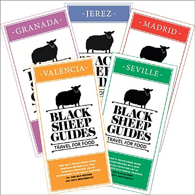
The Black Sheep Guides – Travel for Food โ€“ offer a pocket sized itinerary to the best places, restaurants, cafรฉโ€s and bars for you to try in the city, as knowledgeably picked as by the locals.The guides unfold like an accordion, opening with a โ€Local Knowledgeโ€ section highlighting the words you will probably use the
Old Folding Maps Reproductions of Historical Maps
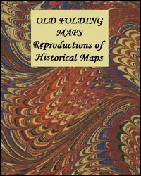
Old maps from late 18th and 19th century reproduced by the Old Folding Maps company and mounted on cloth. Each individual map is presented folded in a colourful case covered with a unique design marbled paper โ€“ no two cases are identical.Many of the reproductions have been taken from what used to be called โ€cloth-dissectedโ€
Confraternity of Saint James Pilgrim Guides

Pocket guides to various pilgrim routes to Santiago de Compostela published by the London-based Confraternity of St James. Researched by the members of the Confraternity and updated to incorporate feedback from the users, the guides were originally published in the absence of other English language publications and still provide much useful information. Unless indicated to
France: IGN 350K Touring Maps (2016 editions)
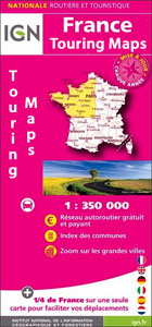
Touring maps of France at 1:350,000, 2016 editions, designed by the IGN to make route planning easier by presenting several regions together on one double-sided, indexed map which also includes enlargements showing environs of main cities.The Touring Series of four maps conveniently fills the gap between IGNโ€s general road maps presenting the whole country on
Kerber Little Global Cities Guides
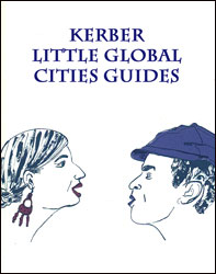
Little Global Cities series from the German publishers Kerber Verlag is designed to provide informative and interesting guidebooks to smaller cities of Eastern Europe and the Balkans, aimed at tourist who like to venture off the beaten track and explore old and new city quarters, meet the locals, etc. All the text is presented in
Lonely Planet Pocket Guides
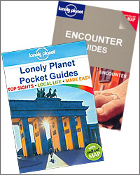
Titles in the Pocket Guide series from Lonely Planet explore a range of cities worldwide in a handy, pocket-sized format designed to introduce visitors to their destination. Frank and informal in style, the guides are renowned for their appeal to independent travellers and are written and researched by local authors. They offer advice on top
Indonesia: Periplus Regional Maps
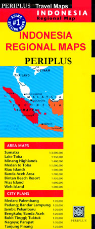
Coverage of the Indonesian islands by the Singapore-based Periplus Editions is designed to present the most visited parts of the main islands in greater detail and to provide street plans of principal towns and/or holiday resorts. The main island itself is shown at a smaller scale than on maps from other publishers. Each title consists
Canada: NGS Trails Illustrated Maps of Banff and Jasper
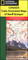
Canadian Rockies on four double-sided, contoured, GPS compatible recreational maps at 1:100,000 from the National Geographic printed on light, waterproof and tear-resistant synthetic paper. The maps show numerous hiking, horse riding and biking trails, accommodation facilities, etc.Each map is double-sided to cover a wider area. Topography is very vividly presented by contours at 30m intervals
Great Britain: Footprint Maps of Long-distance Cycling Routes
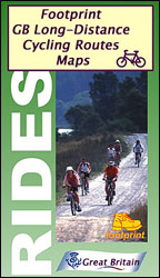
Long-distance cycling routes in northern England and southern Scotland on waterproof and tear-resistant maps from Footprint Walks, with the course of each route presented on mapping with altitude colouring and annotated with gradient markings, etc. Locations along the route have symbols showing what facilities can be found there.For more information please see individual descriptions โ€“
Italy: Kรผmmerly + Frey Outdoor Maps of Northern Italy
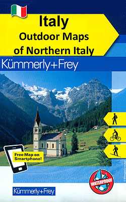
The mountains of northern Italy in a series of waterproof and tear-resistant, GPS compatible and contoured recreational maps from Kรผmmerly + Frey with both local and long-distance hiking and cycling trails, ski routes, sites for other outdoor pursuits, accommodation, bus stops, etc. Maps in this series are printed on sturdy waterproof and tear-resistant plastic. Most
Lifesystems – Mosquito Nets
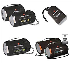
When travelling to countries where insect-borne diseases such as malaria, yellow fever and dengue fever are common, a mosquito net is an important accessory to carry with you. To guard against serious health threats, ensure that you do not get bitten in the first place. Sleeping underneath a mosquito net provides important protection. Lifesystems offers
Lifesystems – Insect Killers, Repellents and Bite Relief
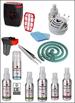
Travelling to certain regions where biting insects like mosquitoes are common and there is a risk of contracting diseases such as malaria or leishmaniasis, it is important to protect yourself from being bitten. Lifesystems provides a range of products, from insect killers to insect repellents and bite relief providing highly effective cover against biting insects
Marco Polo Travel Guides
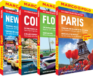
Most travellers want to have fun and feel relaxed from the moment they arrive at their holiday destination – thatโ€s what Marco Polo Guides are all about. This new series will appeal to all types of travellers, including those who havenโ€t bought a travel guide in the past! Marco Poloโ€s unique insider tips are peppered
Sweden: Norstedts 90K Cycling Maps
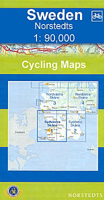
The southern part of Sweden in a series of 30 double-sided cycling maps from Norstedts printed on light, waterproof and tear-resistant synthetic paper. Mainland is covered at 1:90,000 with Gotland at 1:100,000.The maps, prepared in association with Cykelfrรคmjandet – Swedenโ€s largest national cycling organization, highlight all the national and other major cycle routes, plus a