Category Archives: Accessories
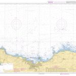
Planning Charts for Atlantic Coast of Canada
Canadian Hydrographic Service charts covering large areas of the Atlantic coast of Canada, ideal for planning routes.
Faroe Islands Official Charts
Official charts for the Faroe Islands produced by the Danish Hydrographic Office.The charts are ordered upon customer demand, therefore please contact us if you require the charts urgently.For any further information, you can contact maritime@stanfords.co.uk.
Mercator Plotting Sheets
A series charts each covering three degrees of latitude with a compass rose and latitude scale, longitude being defined by the user.This facilitates dead reckoning plots to be visualised, and the plotting and resolution of position lines of celestial observations.
Official Charts of Greenland
Official charts for the coast of Greenland produced by the Danish Hydrographic Office. The charts are ordered upon customer demand, therefore please contact us if you require the charts urgently.For any further information, you can contact maritime@stanfords.co.uk.
Alta Via Cycling Maps
Alta Via`s topographical cycling maps emphasize car-free cycling routes or the so-called Voies Vertes(Green Routes), a cycling network that runs through Belgium, Luxembourg and the North of France. – All LF and Ravel cycle routes are included, supplemented with old railways and towpaths that have been transformed into bike paths. – The map also lists
Official Charts of Denmark
Official charts for the coast of Denmark produced by the Danish Hydrographic Office. The charts are ordered upon customer demand, therefore please contact us if you require the charts urgently.For any further information, you can contact maritime@stanfords.co.uk.


