Category Archives: Accessories
Greece: Geopsis Hiking Maps of North-Eastern Greece
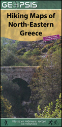
Popular hiking and recreational areas of north-eastern Greece on waterproof and tear-resistant, contoured and GPS compatible maps from Geopsis highlighting local hiking trails. On the reverse the maps have more tourist information, such as descriptions of the local area or the trails, notes on wildlife, panels with a road map of a wider area for
World: Global Mapping Antique Style Political Wall Maps
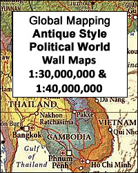
Award winning political wall maps of the world from Global Mapping in an antique style of presentation with the countries in pleasant subdued colours and the oceans with graphics to show the ridges, etc. A useful enlargement presents Europe in greater clarity. The maps are available in two sizes, with the larger version showing more
Australia: Carto Graphics Regional Maps of South Australia
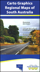
South Australiaโ€s most visited regions on maps from the locally based publishers Carto Graphics, with each title designed to present the most interesting aspects of its area through additional features such as enlargements with more detailed coverage, lists of wineries, highlighting of hiking trails, etc. Catrography and specifications vary, so please see individual descriptions for
Lonely Planet Activity Books for Children
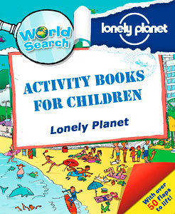
A range of Activity Books by Lonely Planet that will delight children. With the use of colourful illustrations, games and humour these books will lead children curiosity and learning, while providing entertainment and fun. Children will learn about geography, amazing places and cities, the animal world and much more. Colourful, educational and funny, these books
Australia: UBD Gregory`s Road Atlases
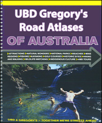
Road atlases of Australia from UBD Gregoryโ€s presenting the country in a variety of sizes and formats and with different additional features providing extra information. The maps are arranged by state; scales vary according to the size of the state. Road network is shown on a base with no relief shading but with spot heights
1Wall Door Murals
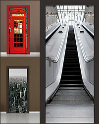
The Door Murals by 1Wall in a range of high quality wallpaper designs for decorating doors and adding an artistic tone to any space. The murals render a stunning sense of depth and a truly impressive visual effect making any room feel bigger and enhancing its look.Each design is divided in three high quality durable
1Wall Wallpaper Murals
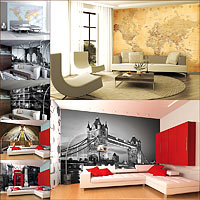
The Wallpaper Murals by 1Wall in a range of high quality wallpaper designs for decorating and adding an artistic tone to any space. The murals render a stunning sense of depth and a truly impressive visual effect making any room feel bigger and enhancing its look.Each design is divided in four high quality durable wallpaper
Albania: Vektor 200K Touring Maps
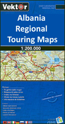
Albania on three indexed, GPS compatible touring maps at 1:200,000 from the Tirana-based cartographic publishers Vektor with a vivid presentation of the countryโ€s topography through contours and bold altitude colouring, plus locations of campsites, beaches and other places of interest.Road network is graded into six types, from motorways to minor dirt roads, and indicates border
Albania: Vektor Administrative Prefecture Maps

Albaniaโ€s administrative prefectures on handy size, waterproof and tear-resistant road maps from the Tirana-based publishers Vektor at scales between 1:50,000 and 1:150,000; contoured, GPS compatible, with campsites, beaches and places of interest, etc.Landscape is presented by altitude colouring and contours lines at 100m intervals, with spot heights and a few more names of topographic features
Switzerland: Swisstopo “Once and Today” Historical Maps
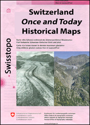
Diverse titles from Swisstopo, Switzerlandโ€s national survey organization, in their โ€Once and Todayโ€ series which covers various locations on a combination of old and present day topographic survey mapping and/or aerial photography to show various aspects of their development.Presentation and content vary – for more details please see descriptions of the individual titles.