Category Archives: Accessories
USA: Regional Coverage by ITMB Maps
Regional coverage of United States from the Vancouver-based ITMB in a map series providing a wide range of titles, from coverage of the country on two sheets to more detailed maps offering on one side a city street plan with on the reverse a road map presenting the surrounding region with altitude colouring to indicate
Spain: Editorial Everest Street Plans
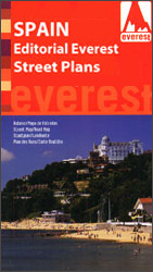
Indexed street plans of Spanish cities from Editorial Everest, covering each location with its outer suburbs and, where useful, providing a more detailed enlargement for the townโ€s historic centre. Street plans from Editorial Everest come in two formats. For most towns, on the reverse is an indexed road map of the surrounding province, as indicated
Metropolitan Travel Accessories
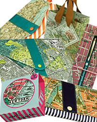
Travel the world in well-equipped style! Metropolitan travel accessories take their lead from vintage maps of favourite cities; London, Paris, Venice and New York. Wild & Wolf presents a wide selection of cool travel bags, purses, document holders, pens and lip balms each with a contemporary neon flash.

Greece: Geopsis Hiking Maps of North-Eastern Greece
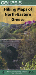
Popular hiking and recreational areas of north-eastern Greece on waterproof and tear-resistant, contoured and GPS compatible maps from Geopsis highlighting local hiking trails. On the reverse the maps have more tourist information, such as descriptions of the local area or the trails, notes on wildlife, panels with a road map of a wider area for
World: Global Mapping Antique Style Political Wall Maps
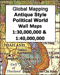
Award winning political wall maps of the world from Global Mapping in an antique style of presentation with the countries in pleasant subdued colours and the oceans with graphics to show the ridges, etc. A useful enlargement presents Europe in greater clarity. The maps are available in two sizes, with the larger version showing more