Category Archives: Accessories
Insight Explore Guides

The Explore Guides by Insights is a new series comprising of ideal pocket companions when discovering a destination. These full-colour guides contain a number of easy-to-follow routes which will lead your exploration of an area, from well know sites to the lesser-known corners. In line with Insight`s trademark the cultural coverage perfectly sets the routes
London: A-Z Wall Maps of London in 1964
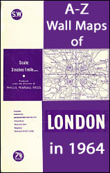
Reproductions of A-Zโ€s wall maps covering London on four sheets, originally published in 1964 ahead of major road infrastructure development to meet the demands of increasing car ownership. Each map offers a fascinating snapshot of the capital at a time when the new Greater London Council boroughs were being established. The maps are at a
Frommer`s Easy Guides
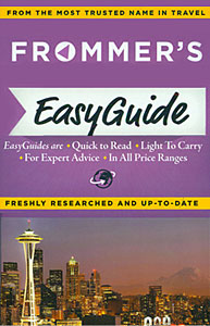
The Guides in the EasyGuide Series by Frommerโ€s capture the unique spirit of the place offering expert advice in all price ranges for a variety of establishments and attractions. Arranged in a clear layout, put together in a light and compact format (256 pages ), these guides are easy to read and light to carry.
Sweden: Lantmรคteriet 100K Topographic Survey
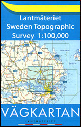
Topographic survey of Sweden at 1:100,000, the Vรคgkartan, from the Lantmรคteriet, covering most of the country in 79 double-sided maps. Please note: the mountainous regions of central and northern Sweden are not covered by this series but presented in a separate โ€Fjรคllkartan – Mountain Mapโ€ series also listed on our website.Each 1:100,000 topographic survey map
Sweden: Lantmรคteriet 250K Topographic Survey
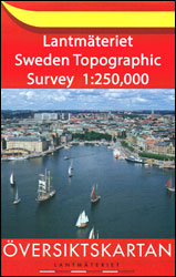
Topographic survey of Sweden at 1:250,000, the ร–versiktkartan, from the Lantmรคteriet on 21 double-sided maps each covering an area of 187.5 x 100km. Contour interval is 25m below 600 metres and 50m above 600m. Colouring and/or graphics indicate built up areas with under or over 200 inhabitants, forests, open land, alvar and marshes. Boundaries of
Sweden: Lantmรคteriet 50K Topographic Survey
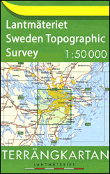
Topographic survey of Sweden at 1:50,000, the Terrรคngkartan, from the Lantmรคteriet, covering most of the country in 244 double-sided maps. Please note: the mountainous regions of central and northern Sweden are not covered by this series but presented in a separate โ€Fjรคllkartan – Mountain Mapโ€ series also listed on our website.Each 1:50,000 topographic survey map