Category Archives: Accessories

USA: National Geographic Destination Maps of Popular Scenic Regions
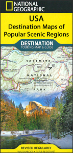
Popular scenic regions across the USA on waterproof and tear-resistant maps from the National Geographic with excellent presentation of local topography, highlighting for national or state parks and other protected areas, various points of interest, etc. Extensive notes and map enlargements provide additional useful tourist information.For more details please see individual descriptions of the titles.
Victoria Eggs` London Kitchenware Collection
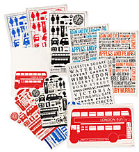
Victoria Eggs` London Kitchenware Collection featuring London inspired designs for a range of accessories, tea towels, oven gloves, tote bags and more.From the humorous Cockney Slang tea towel to the stylish oven glove and the tote bag Victoriaโ€s creations are born from her love for all things British. The technique and themes used produce contemporary
London: Louis` Thematic London Walks
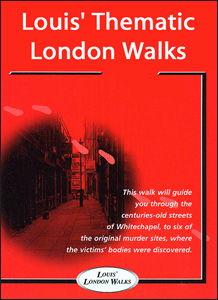
Handy pocket size guides to thematic walks within London, illustrating diverse aspects of the capitalโ€s history: locations associated with Shakespeare, Sherlock Holmes, Dickens, Jack the Ripper, etc. Directions for following the routes are accompanied by clear, easy to follow street maps cross-referenced to the descriptions of the sites, and, where appropriate, the guides provide information
Great Britain: Ordnance Survey Off-Road Cycle Trails
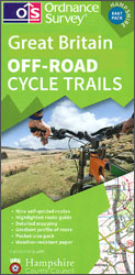
A new series of off-road cycling sets from the Ordnance Survey, begun in summer 2014 with coverage of their home county of Hampshire. Each set consists of a number of handy-size, 30x21cm map extracts from the OS Landranger series overprinted with a recommended route and presented at either the original 1:50,000 or enlarged to 1:33,333.Various
Italy: Fraternali Editore Hiking Maps of Southern Italian Alps
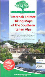
The southern part of the Italian Alps and the foothills around Turin and Lanzo on large, contoured and GPS compatible walking maps at 1:25,000 from Fraternali Editore, printed on light, waterproof and tear-resistant synthetic paper. Topography is presented by contour lines at 5m intervals with relief shading, spot heights, and colouring and/or graphics for woodlands,