Category Archives: Accessories
Great Britain: Harvey Summit Maps
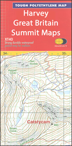
Handy size, light, waterproof and tear-resistant maps from Harvey Map Services, ideal for mountaineering in poor weather conditions, covering at 1:12,500 in exceptional detail the summit areas of Britainโ€s highest peaks. Each map, only 41x30cm when opened and 10x20cm when folded, provides an excellent picture of the terrain through contours at 15m intervals with additional
Lonely Planet Kids Adventures In…Activity Books
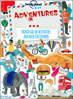
The Lonely Planetโ€s Adventures Inโ€ฆ activity book series for young explorer help children discover the real world with colourful stickers, illustrations and games that show incredible sights and diverse environments of planet earth. The books mix amazing facts about the worldโ€s wonderful places with great illustrations all accompanied with a good dose of humour to
Netherlands: Falk/VVV Hiking Maps
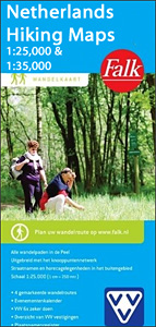
This is a series of eleven walking maps in 1:25,000 or 1:35,000 from Falk, which cover the most beautiful hiking areas in four regions: North Brabant in the south, the tip of North Holland, Friesland and Groningen in the north of the country.The maps features a very detailed topography (landscape information is provided by colouring
Netherlands/Belgium: Falk Citymap & More Pocket Street Plans
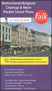
Handy size, detailed and indexed city centre street plans of main towns in the Netherlands and Flanders including Brussels from Falk, highlighting recommended walks and places of interest, with six best sights prominently marked and cross-referenced to brief descriptions. The plans also indicate publishersโ€ recommendations for shopping and/or bars and restaurants.The network of streets and
Freytag & Berndt City Pocket Street Plans
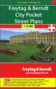
Handy size, only 9x15cm when folded, waterproof and tear-resistant street plans of major cities highlighting the publishersโ€ recommendations of five best choices in five categories: shopping, restaurants and cafes, culture, nightlife and sights. The series also includes similarly presented maps of other popular holiday destinations.On one side is an indexed street plan annotated with colour-coded
Cavallini & Co. Notebooks – Small
The Cavallini & Co. practical and beautiful range of notebooks with robust covers featuring exquisite images from the Cavalliniโ€s archive, around 260 lined pages, inside pockets and handy elastic bands to keep them tidy. Ideal travel companions to treasure your notes, thoughts and plans.
Cavallini & Co. Notebooks – Large
The Cavallini & Co. practical and beautiful range of large notebooks with robust covers featuring exquisite images from the Cavalliniโ€s archive, around 144 lined pages, inside pockets and handy elastic bands to keep them tidy. Ideal travel companions to treasure your notes, thoughts and plans.
Great Britain: Harvey Cycling and Other Recreational Maps
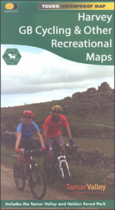
A selection of cycling, hiking and other recreational maps from Harvey Map Services, grouped together to present those of the publishersโ€ titles which are not part of their four main series: the Superwalker, the Mountain Map, the Summit Map, and the Long-Distance Hiking Trails.Map scales, GPS compatibility, and the overprint for hikers and/or cyclists vary,
Great Britain & Ireland: Rucksack Readers` Guides to Long-distance Footpaths
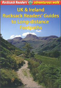
Long-distance hiking trails in Great Britain and Ireland presented by Rucksack Readers in handy A5 size, spiral-bound, waterproof guides, with stage-by-stage descriptions of the route, useful tourist advice and background information, and numerous colour photos.Background information covers various interesting aspects of each route: wildlife, geology, the history of the region or the route itself, etc.