Category Archives: Accessories
NGA Charts – Region 8

Produced by the US Government, National Geospatial-Intelligence Agency (NGA) charts provide information for the International Waters. They are printed on demand at our London shop and are supplied as flat charts.PLEASE NOTE: NGA charts are not updated often, therefore some may no longer be suitable for safe navigation and should be used for reference only.
NGA Charts – Region 9

Produced by the US Government, National Geospatial-Intelligence Agency (NGA) charts provide information for the International Waters. They are printed on demand at our London shop and are supplied as flat charts.PLEASE NOTE: NGA charts are not updated often, therefore some may no longer be suitable for safe navigation and should be used for reference only.
IMO Maritime Safety

IMO โ€“ the International Maritime Organization โ€“ is the United Nations specialized agency with responsibility for the safety and security of shipping and the prevention of marine and atmospheric pollution by ships. IMO Publications are an important source of information regarding safety, legal and best practice standards used by the shipping industry around the world.For
ADMIRALTY Magnetic Variation Charts
Charts which show the current magnetic variation and the annual rates of change.Whilst local information is shown on all charts, this series provides more detailed coverage at a worldwide level.

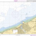
NGA Charts – Region 1

Produced by the US Government, National Geospatial-Intelligence Agency (NGA) charts provide information for the International Waters. They are printed on demand at our London shop and are supplied as flat charts.PLEASE NOTE: NGA charts are not updated often, therefore some may no longer be suitable for safe navigation and should be used for reference only.
NGA Charts – Region 2
Produced by the US Government, National Geospatial-Intelligence Agency (NGA) charts provide information for the International Waters. They are printed on demand at our London shop and are supplied as flat charts.PLEASE NOTE: NGA charts are not updated often, therefore some may no longer be suitable for safe navigation and should be used for reference only.
NGA Charts – Region 3

Produced by the US Government, National Geospatial-Intelligence Agency (NGA) charts provide information for the International Waters. They are printed on demand at our London shop and are supplied as flat charts.PLEASE NOTE: NGA charts are not updated often, therefore some may no longer be suitable for safe navigation and should be used for reference only.

NGA Charts – Region 4
Produced by the US Government, National Geospatial-Intelligence Agency (NGA) charts provide information for the International Waters. They are printed on demand at our London shop and are supplied as flat charts.PLEASE NOTE: NGA charts are not updated often, therefore some may no longer be suitable for safe navigation and should be used for reference only.
NGA Charts – Region 5
Produced by the US Government, National Geospatial-Intelligence Agency (NGA) charts provide information for the International Waters. They are printed on demand at our London shop and are supplied as flat charts.PLEASE NOTE: NGA charts are not updated often, therefore some may no longer be suitable for safe navigation and should be used for reference only.