Category Archives: Accessories
USA: NGS Appalachian Trail Topographic Hiking Atlases
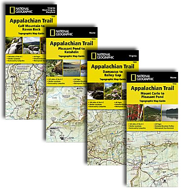
Appalachian Trail, from Springer Mountain in Georgia to Mount Katahdin in Maine, presented in 13 handy size, waterproof and tear-resistant atlases at 1:63,360 from the National Geographic with contoured and GPS compatible topographic mapping overprinted with extensive tourist information, plus a list of camping options, etc.Each 11x24cm atlas covers a section of the trail between
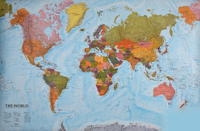
World: Freytag & Berndt Political Wall Maps
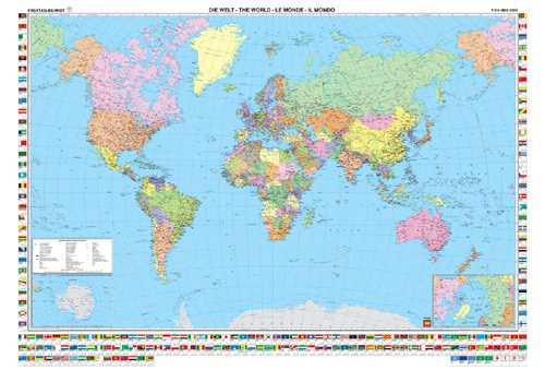
Political wall maps of the world from Freytag & Berndt in an international edition with all place names in their English versions, presenting countries in pleasant pastel colours against light blues seas. The maps are published in two sizes, 122x86cm and 176×122.5cm; both have the same number of place names and vary only in the
World: Freytag & Berndt Political/Physical World Wall Maps
Wall maps of the world from Freytag & Berndt printed on sturdy, waterproof and tear-resistant synthetic paper which can be annotated with suitable write-on/wipe-off marker pens. Countries are in warm, earthy colours enhanced by physical shading to show mountain ranges, with oceans indicating the relief of the sea floor through different shades of light blue.Published
India: International Publications State Road Map/Guides
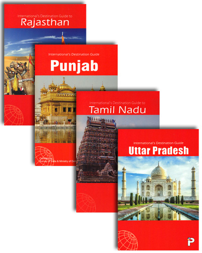
India`s states on road maps from the Delhi-based International Publications, with most titles also including an informative, illustrated booklet describing main sights. The maps show more, or sometimes different small towns or villages than included in other similar publications.Unless indicated to the contrary in the individual description, the maps present the state with its constituent
Future Mapping Company Geological Wall Maps of the World
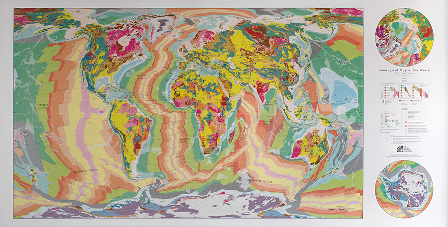
Beautifully presented geological wall maps of the world from the Future Mapping Company, designed to appeal to anyone who wants to enhance their room with a bold splash of colour. Available in two sizes, 100x70cm or 196x100cm, the maps are produced using the lithographic printing process in 10 metallic ink colours on high quality FSC
Latvia: Jana Seta 75K Maps of Environs of Main Towns
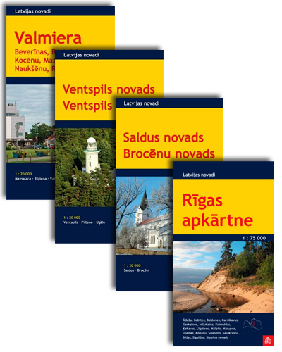
Environs of Latviaโ€s main towns on contoured and GPS compatible maps at 1:75,000 from the locally-based Jana Seta publishers, with detailed presentation the road or rail networks, places of interest and tourist facilities, etc. The maps are double-sided with a good overlap between the sides.Topography and landscape are shown by contours at 10m intervals, numerous
Italy: Odos Cycling maps
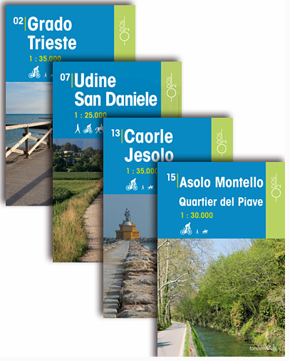
This series of Odos cycling maps are at a scale of 1:25,000 and 1:35,000 and have prominently marked out cycling routes that are differentiated into different types of cycle situation and terrain. Ideal for planning suitable routes and knowing which routes to avoid whether you are on a mountain bike or road bike. These maps
London Winter Christmas Cards by Coconut Tin

London Winter is the Christmas range from The Coconut Tin Card Company, creation of London based illustrator Finn Dean, award winning illustrator of evocative cityscapes and landscapes.