Category Archives: Accessories
Spain: Mairdumont 300K Regional Road Maps

Spain on regional maps at 1:300,000 from MairDumont, each with street plans of main cities. A special feature of the โ€Marco Poloโ€ range of maps and atlases is a set of seven peel-on/peel-off stickers which can be placed on the maps to help with navigating and removed without damaging the surface. Topography is shown by
Greece: Terrain Editions Maps of the Greek Islands
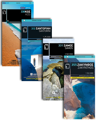
Greek islands on contoured and GPS-compatible maps from Terrain Editions, presented at scales varying according to the size of each island. All place names are in both Greek and Latin alphabet. Most titles printed on light, waterproof and tear resistant synthetic paper – smaller islands are covered by pocket size paper maps as indicated in

Italy: Odos Cycling maps
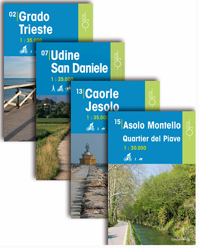
This series of Odos cycling maps are at a scale of 1:25,000 and 1:35,000 and have prominently marked out cycling routes that are differentiated into different types of cycle situation and terrain. Ideal for planning suitable routes and knowing which routes to avoid whether you are on a mountain bike or road bike. These maps
Belgium: Ardennes Recreational Maps
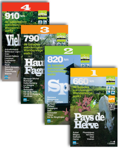
Ardennes Recreational Maps at a scale of 1:25,000 enable you to discover the Ardennes from junction to junction, each associated with a locality, through a network of hiking, cycling or riding paths.The network of mini walks consists of suggested routes with kilometre distance marked showing field boundaries and urbanised built up areas. Contour markings are