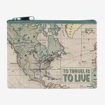
Category Archives: Accessories


IMO Model Courses

Following the adoption of the International Convention on Standards of Training, Certification and Watchkeeping for Seafarers (STCW), 1978, IMO, assisted by contributions from various IMO Member Governments, developed a series ofModel Courses to help implement the Convention and facilitate access to the knowledge and skills demanded by increasingly sophisticated maritime technology.The model courses each include
Charts for Juan de Fuca, Johnstone and Georgia Straits

The official Canadian charts provide an excellent range of scales for the whole length of Canada`s coastline as well as the Grat Lakes and comply with Safety of Life at Sea (SOLAS) regulations.PLEASE NOTE: Canadian Hydrographic Service charts are ordered on demand, please allow 1-2 weeks for the order to arrive at Stanfords.
West Coast of Vancouver Island and Queen Charlotte Sound Charts
The official Canadian charts provide an excellent range of scales for the whole length of Canada`s coastline as well as the Grat Lakes and comply with Safety of Life at Sea (SOLAS) regulations. PLEASE NOTE: Canadian Hydrographic Service charts are ordered on demand, please allow 1-2 weeks for the order to arrive at Stanfords.

Charts for Haida Gwaii
The official Canadian charts provide an excellent range of scales for the whole length of Canada`s coastline as well as the Grat Lakes and comply with Safety of Life at Sea (SOLAS) regulations. PLEASE NOTE: Canadian Hydrographic Service charts are ordered on demand, please allow 1-2 weeks for the order to arrive at Stanfords.
Mackenzie River, Great Slave Lake and Surrounding Areas
The official Canadian charts provide an excellent range of scales for the whole length of Canada`s coastline as well as the Great Lakes and comply with Safety of Life at Sea (SOLAS) regulations. PLEASE NOTE: Canadian Hydrographic Service charts are ordered on demand, please allow 1-2 weeks for the order to arrive at Stanfords.
Labrador Coast Charts
The official Canadian charts provide an excellent range of scales for the whole length of Canada`s coastline as well as the Grat Lakes and comply with Safety of Life at Sea (SOLAS) regulations. PLEASE NOTE: Canadian Hydrographic Service charts are ordered on demand, please allow 1-2 weeks for the order to arrive at Stanfords.

Newfoundland Coast including St Pierre and Miquelon
The official Canadian charts provide an excellent range of scales for the whole length of Canada`s coastline as well as the Grat Lakes and comply with Safety of Life at Sea (SOLAS) regulations. PLEASE NOTE: Canadian Hydrographic Service charts are ordered on demand, please allow 1-2 weeks for the order to arrive at Stanfords.