Category Archives: Accessories
Lonely Planet City Maps
Lonely Planet presents these durable and waterproof city maps with a handy slipcase and an easy-fold format. Lonely Get more from your map and your trip with images and information about top city attractions, walking tour routes, transport maps, itinerary suggestions, extensive street and site index, and practical travel tips and directory.
Michelin “Write & Wipe” Tourist Street Plans
Michelinโ€s โ€Write & Wipeโ€ range of handy size, laminated so waterproof and tear-resistant, tourist street maps, with the main plan of the central districts accompanied by enlargements of most visited areas and/or access maps of the suburbs. Places of interest are clearly marked and best sights are cross-referenced to descriptions based on the publishersโ€ Green
Estonia: Regio 275K Regional Road Maps
Estonia on five regional maps at 1:275,000 from the Tallinn-based Regio, with prominent highlighting of protected areas and places of interest including 15 recommended top sights, plus on the reverse city maps of the regionโ€s main towns.Road network is presented on a clear base which highlights protected areas. Locations of petrol stations are shown but
Italy: Zanetti 30K Maps of the Italian Alps
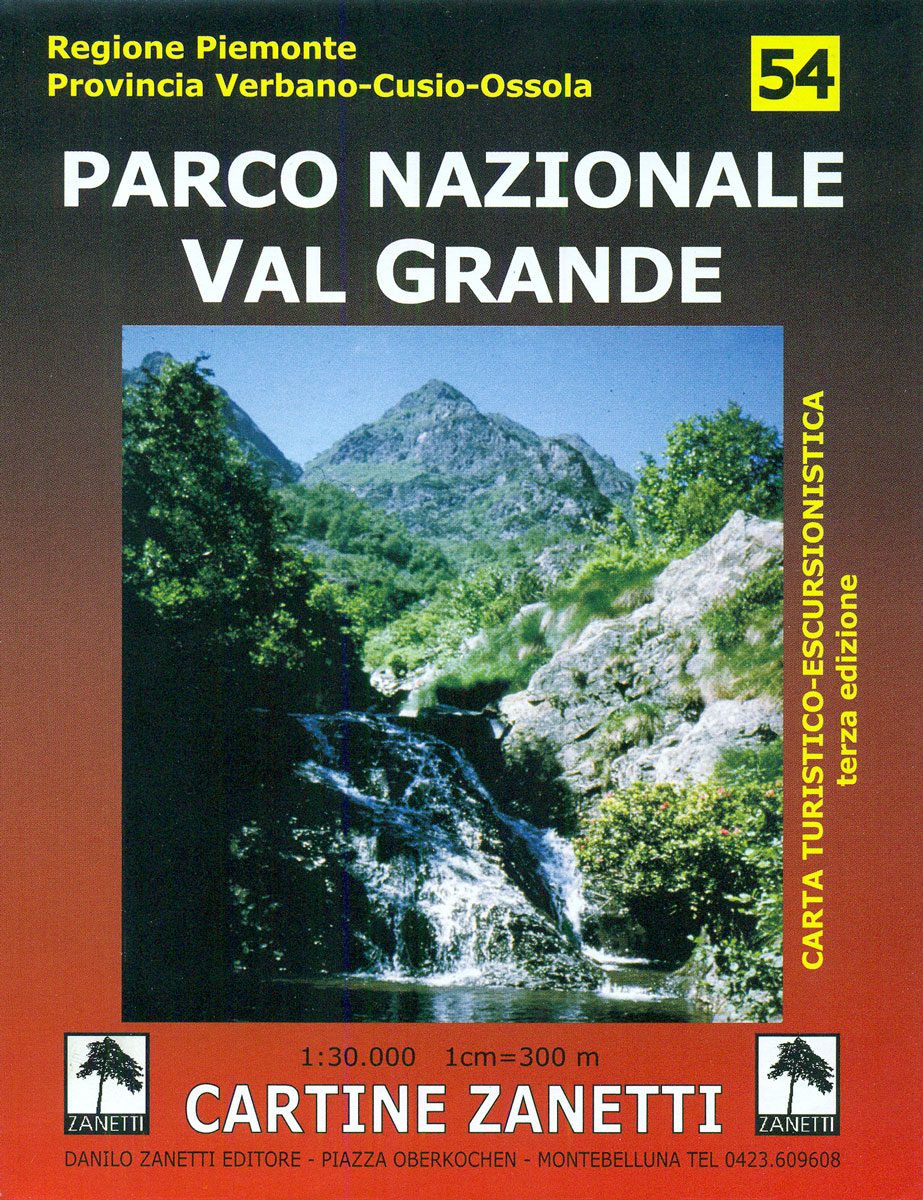
The northernmost tip of the Piedmontese Alps, around Domodossola and including the western shore of Lago Maggiore, at 1:30,000 on maps from Zanetti Editore highlighting hiking trails and refuges. Some titles also show a wider range of local accommodation options, various places of interest, etc.Contours at 25m with spot heights, shading and colouring for woodlands
Great Britain: Ordnance Survey 250K Regional Maps
Great Britain in a series of eight maps at 1:250,000 from the Ordnance Survey with excellent presentation of the landscape by altitude colouring with contours and hill shading, plus prominent highlighting of National and Forest Parks, ideal for planning interesting picturesque routes.Making a much appreciated return to the Ordnance Survey catalogue in autumn 2016, maps