Categories
-
Best Sellers
-
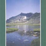
Spain: Tienda Verde Hiking Maps of Central Spain
Spainโ€s Sistema Central, including the eastern part of Sierra de Gredos and Sierra de Guadarrama on detailed hiking maps with cartography of the Spanish military survey Read More » -

Bangkok – A Cultural & Literary History
Bangkok in the Cities of the Imagination guide series; providing an in-depth cultural and historical exploration of some of the great city landscapes of the world. Read More » -

Belgium – Luxembourg 2021 Michelin
Updated annually, MICHELIN National Map Belgium & Luxembourg will give you an overall picture of your journey thanks to its clear and accurate mapping scale 1/350,000. Read More » -

Blue Guide Liguria
This easy-to-carry guide includes Genoa, San Remo, Savona, Portofino, the Cinque Terre, La Spezia and Lerici. Art historian, landscape architect and long-time Italy resident Paul Blanchard Read More » -

Battersea & Clapham 1913 – 101.3
Battersea and Clapham in 1913 in a fascinating series of reproductions of old Ordnance Survey plans in the Alan Godfrey Editions, ideal for anyone interested in Read More » -

British Bird Sounds: The Definitive Audio Guide to Birds in Britain
This is a guide to all British birds whose sounds are likely to be encountered by the average birdwatcher. A total of 175 species are heard. Read More » -

The Buildings of Green Park: A Tour of Certain Buildings, Monuments and Other Structures in Mayfair and St. James`s
“This is at one level a book about a part of London and its buildings. At another, it`s a book about learning to savour our lives” Read More » -

NL2 Waddenzee
Passage ChartsC1 Borkum ยท Den Helder 1:375.000 Coastal ChartsC2 Texel ยท Schulpengat 1:50.000 C3 Den Helder ยท Den Oever 1:50.000 C4 Texelstroom ยท Eierlandsche Gat 1:50.000 Read More » -
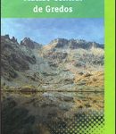
Macizo Central de Gredos CNIG
The central section of the Sierra de Gredos on a contoured and GPS compatible map at 1:250,000 from IGN/CNIG using cartography of their civilian topographic survey Read More » -

NGA Chart 29742 – Vahsel Bay and Vicinity including Belgrano Station II
Produced by the US Government, National Geospatial-Intelligence Agency (NGA) charts provide information for the International Waters. They are printed on demand at our London shop and Read More »
-


