Category Archives: Accessories

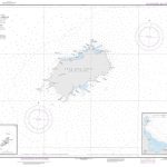
General and Regional Mexican SEMAR charts
Official Mexican Hydrographic Office charts (SEMAR – Secretarรญa de Marina Armada de Mรฉxico) for the coast waters of Mexico offer a great range of scales. General and Regional charts cover large areas of the coastline and are great for planning. Available to order from Stanfords. Also available:- Charts for ports along the Pacific coast of
Pacific Coast Mexican SEMAR charts
Official Mexican Hydrographic Office charts (SEMAR – Secretarรญa de Marina Armada de Mรฉxico) offer a great range of scales for ports along the Mexico`s Pacific coast. Available to order from Stanfords. Also available:- General and Regional charts of Mexico- Charts for ports along the Gulf of Mexico and the Caribbean coastFor more information, please email
Gulf of Mexico and the Caribbean coast Mexican SEMAR charts
Official Mexican Hydrographic Office charts (SEMAR – Secretarรญa de Marina Armada de Mรฉxico) offer a great range of scales for ports along the Mexico Gulf and Mexico`s Caribbean coast. Available to order from Stanfords. Also available: – General and Regional charts of Mexico – Charts for ports along the Pacific coast of Mexico For more