Disclosure : This site contains affiliate links to products. We may receive a commission for purchases made through these links.
Catalonia ICGC Road Map
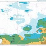
Large, indexed road map of Catalonia with enlargements for Costa Brava and environs of Barcelona, Girona, Lleida and Tarragona- Reus. The map, published by the Catalan survey organization, provides very detailed picture of the region’s road network, including small country roads. Railway lines are also shown. Towns, villages and other places of particular interest, including areas of outstanding natural beauty, are clearly highlighted.The map has subtle relief shading to indicate the topography, with spot heights and names of sierras. No geographical coordinates are provided. Map legend includes English. Costa Brava, from Cadaquรฉs southwards, and the environs of Barcelona, Girona, Lleida and Tarragona – Reuss are shown on enlargements at 1:130,000. Four maps of Barcelona show: a street plan of the central part of the city naming main streets and highlighting major places of interest, an enlargement of the Old Town area, a map of the metro and local rail connections, and a map of the city’s motorway ring with junction names and numbers. Also included is a small map showing Catalonia’s administrative division and distances between main towns.An extensive index on the reverse of the map includes names of geographical locations and various places of interest highlighted on the map.

Related Products:
 Catalonia ICC Road Atlas
 Pyrenees – Costa Brava – Basque Country – Navarra – Aragon – Andorra – Catalonia
 Catalonia: Recipes from Barcelona and Beyond
 Costa Brava – Andorra – Perpignan – Barcelona Marco Polo Map
 Catalonia Tourist Road – Regional Divisions Map
 Barcelona & Catalonia ITMB
 Costa Brava – Barcelona K+F Road Map
 Catalonia Editorial Alpina Road Map
 Aragon – Catalonia Michelin Regional 574
 Moon Barcelona & Beyond: With Catalonia & Valencia: Day Trips, Local Spots, Strategies to Avoid Crowds
DK Eyewitness Barcelona and Catalonia
Moon Barcelona & Beyond: With Catalonia & Valencia: Day Trips, Local Spots, Strategies to Avoid Crowds
DK Eyewitness Barcelona and Catalonia
 Pirineu Oriental – Girona – Costa Brava
 Catalonia Topographic Map
 Barcelona and Environs ICGC 13
Finland Karttakeskus Road Atlas
Barcelona and Environs ICGC 13
Finland Karttakeskus Road Atlas
 Costa Brava – Barcelona & Surrounding Area Michelin Zoom 147
 Latvia Jana Seta Road Atlas
 Fodor`s Barcelona: With Highlights of Catalonia
New Zealand Kiwimaps Travellers Road Atlas
Fodor`s Barcelona: With Highlights of Catalonia
New Zealand Kiwimaps Travellers Road Atlas
 Spain: Mairdumont 300K Regional Road Maps
Poland ExpressMap Road Atlas 2020/2021
Spain: Mairdumont 300K Regional Road Maps
Poland ExpressMap Road Atlas 2020/2021
 Catalonia Auotomous Community CNIG Physical Road Map
 Italy: Kรผmmerly + Frey 200K Regional Road Maps
 Pyrenees 350K Editorial Alpina Road Map
 Hungary Pocket Road Atlas SPIRAL-BOUND
 Chile Compass Road Map
 Campania – Basilicata – Naples – Potenza – Bari K+F Regional Road Map 12
 Italy North K+F Road Map
 Emilia-Romagna – Parma – Bologna – Ravenna K+F Regional Road Map 7
 Abruzzo – Molise – l`Aquila – Pescara – Campobasso K+F Regional Road Map 11
 Italy K+F Double-Sided Road Map
 Karelia Karttakeskus Road Map
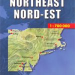 USA North-East
 Finland Road Atlas GLOVEBOX, SPIRAL-BOUND
 Barcelona “Maps to Go” Street Plan
 Bulgaria Road Atlas
 Latvia Jana Seta Compact Road Atlas
Norway: Cappelen Regional Road Maps
Italy TCI Road Atlas
Latvia Jana Seta Compact Road Atlas
Norway: Cappelen Regional Road Maps
Italy TCI Road Atlas