Disclosure : This site contains affiliate links to products. We may receive a commission for purchases made through these links.
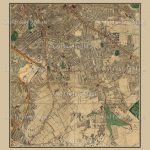
Cased Dissected Map Stanfords Victorian London Section 3
Cased Dissected Map of Stanfords Victorian London, Section 3, laid on cloth in a marbled slip case by Old Folding Maps.Chief cartographer John Bolton helped Stanford to produce a series of library maps – including this one of London – described as “the most perfect map of London that has ever been produced” by the Royal Geographical Society. A large scale highly decorative and highly detailed map of London, green spaces and railways are also clearly illustrated. First published in 1862, and frequently updated as London rapidly expanded, this edition is from 1878. This section covers areas up to and including New River Reservoirs, Upper Clapton, Stoke Newington, Highbury, Islington, Kingsland, Dalston, and Hackney.These maps are hand made and delivery can take up to 3 weeks.THIS IS A REPUBLISHED MAP LAID ONTO CLOTH.

Related Products:
 Cased Dissected Map Stanfords Victorian London Section 12
Cased Dissected Map Stanfords Victorian London Section 13
Cased Dissected Map Stanfords Victorian London Section 10
Cased Dissected Map Stanfords Victorian London Section 15
Cased Dissected Map Stanfords Victorian London Section 7
Cased Dissected Map Stanfords Victorian London Section 12
Cased Dissected Map Stanfords Victorian London Section 13
Cased Dissected Map Stanfords Victorian London Section 10
Cased Dissected Map Stanfords Victorian London Section 15
Cased Dissected Map Stanfords Victorian London Section 7
 Cased Dissected Map Stanfords Victorian London Section 11
Cased Dissected Map Stanfords Victorian London Section 4
Cased Dissected Map Stanfords Victorian London Section 9
Cased Dissected Map Stanfords Victorian London Section 2
Cased Dissected Map Stanfords Victorian London Section 8
Cased Dissected Map Stanfords Victorian London Section 11
Cased Dissected Map Stanfords Victorian London Section 4
Cased Dissected Map Stanfords Victorian London Section 9
Cased Dissected Map Stanfords Victorian London Section 2
Cased Dissected Map Stanfords Victorian London Section 8
 Cased Dissected Map Stanfords Victorian London Section 5
Cased Dissected Map Stanfords Victorian London Section 16
Cased Dissected Map Stanfords Victorian London Section 5
Cased Dissected Map Stanfords Victorian London Section 16
 Cased Dissected Map Stanfords Victorian London Section 14
 Cased Dissected Map Stanfords Victorian London Section 6
Cased Dissected Map Stanfords Victorian London Section 1
Cased Dissected Map Stanfords Victorian London Section 6
Cased Dissected Map Stanfords Victorian London Section 1
 Cased Dissected Map Stanfords Victorian London
 Stanfords Travel Bag – London 1862
 Stanfords Luxury Tote Bag – London 1862
 Stanfords Cushion Cover – London 1862
 Stanfords Premium Tea-towel – London 1862
 London: Rocque London c. 1741-5 SMALL
London: Rocque London c. 1741-5 MEDIUM
London: Rocque London c. 1741-5 SMALL
London: Rocque London c. 1741-5 MEDIUM
 London: A New Map of London by Robert Laurie & James Whittle c.1800 MEDIUM
 London: City of London Borough Map – Stanfords Print on Demand
 Dicken`s Victorian London
 London: Daniel Paterson`s 24 Miles Round London with Seats of Gentry and Nobility c.1791 MEDIUM
London: Daniel Paterson`s 24 Miles Round London with Seats of Gentry and Nobility c.1791 SMALL
London: Daniel Paterson`s 24 Miles Round London with Seats of Gentry and Nobility c.1791 MEDIUM
London: Daniel Paterson`s 24 Miles Round London with Seats of Gentry and Nobility c.1791 SMALL
 London: Lewis` Topographical Dictionary Plan 1840 MEDIUM
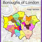
London Boroughs Poster Map – Stanfords Print on Demand
London: Lewis` Topographical Dictionary Plan 1840 MEDIUM
London Boroughs Poster Map – Stanfords Print on Demand
 London: Urbium Londini et West Monasterii c.1736 MEDIUM
 London: Urbium Londini et West Monasterii c.1736 SMALL
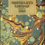 Cruchley`s London 1832
 Stanfords Library Map of London (1862) 40×50 Canvas Print
 A New Map Of London c.1800
London: Froggets 30 miles round London MEDIUM
London: Vicinity of London c.1847 MEDIUM
A New Map Of London c.1800
London: Froggets 30 miles round London MEDIUM
London: Vicinity of London c.1847 MEDIUM
 London: Vicinity of London c.1847 SMALL
 Public Houses Map of Victorian London 1886
 London: Cruchley`s 12 Miles Round London c.1826 SMALL
London: Cruchley`s 12 Miles Round London c.1826 MEDIUM
London: Cruchley`s 12 Miles Round London c.1826 SMALL
London: Cruchley`s 12 Miles Round London c.1826 MEDIUM