Disclosure : This site contains affiliate links to products. We may receive a commission for purchases made through these links.
Carpathian Mountains (AT/CZ/SK/PL/UA/HU/RO) Huber Map
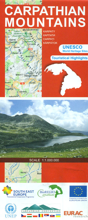
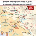
The arch of the Carpathian Mountains across central Europe on an indexed road map from Huber Verlag with on the reverse extensive tourist and historical information including a list of UNESCO World Heritage sites, etc. All the text is in English.With Budapest, Vienna, Krakรณw and Lviv on the north-western and northern edges of the map, coverage extends south to Belgrade, the Danube Iron Gate National Park and Bucharest. Topography is indicated by relief shading, with graphics for swamps/marshlands and colouring for the forested areas. The map shows the network of main, secondary and selected other roads, with driving distances on main routes. Also shown are petrol stations, rest areas with overnight facilities, and border crossings. Railway lines are included and local airports are marked. Symbols highlight cultural heritage including UNESCO World Heritage sites, the region’s characteristic wooden churches, recreational areas, etc. Place names in the Ukraine and Serbia are in the Latin alphabet. The map has latitude and longitude lines at 1ยฐ intervals and an extensive index. The reverse side is taken with text, maps and photos illustrating various aspects of the region: a list and map showing UNESCO World Heritage sites, information about the region’s characteristic wooden churches, Dacian fortresses, Transylvanian place names, fauna, etc. (One small complaint from the Polish heart of the writer of this description: why has Poland’s highest peak, Rysy, been included from the list of mountains over 1500 meters?!). Map legend and all the text are in English.

Related Products:
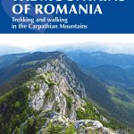 The Mountains of Romania: Trekking in the Carpathian Mountains
 Carpathian Mountains Road Atlas
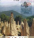 Radan and Sokolovica Mountains
 Czech Republic Road Atlas
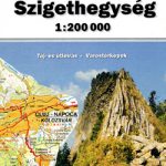 Apuseni Mountains
 Rwenzori Mountains
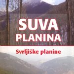 Suva Mountains
 Samokov – Borovets with the Rila Mountains
 Nicaragua – Honduras – El Salvador Reise Know-How
 Costa Rica Reise Know-How
 Tarcau Mountains and Ghimes Dimap Hiking Map
 Costa Rica – Panama Reise Know-How
Gurghiu Mountains Northern and Central Dimap Hiking Map
Costa Rica – Panama Reise Know-How
Gurghiu Mountains Northern and Central Dimap Hiking Map
 Karavanke Mountains – Kep to Kosuta Kartografija WATERPROOF Hiking Map
 With Their Backs to the Mountains: A History of Carpathian Rus` and Carpatho-Rusyns
 Strandzha Mountains: Burgas to the Turkish Border Domino Map
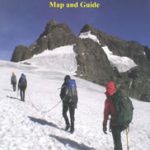
 Oman Map & Guide
 Algeria: Ahaggar (Hoggar) Mountains Reise-Know-How Map
 Istria Reise Know-How
 Baltic States Reise Know-How
 Bucegi Mountains
 Wicklow Mountains East
 Great Smoky Mountains National Park, NC/TN
 Lithuania Reise Know-How
Vosges Mountains – Alsace – Black Forest
Lithuania Reise Know-How
Vosges Mountains – Alsace – Black Forest
 Dublin and North Wicklow Mountains (30K)
 Guatemala – Belize Reise Know-How
 Dolomites Tabacco UNESCO Tourist Map
 Blue Mountains Suburban Streets UBD Gregory`s 290
 Peru Reise Know-How
 Senegal – Gambia Reise Know-How
 Iran Reise Know-How
 France – Ways of St James IGN Map 922
 France – Ways of St James IGN Map
Caliman Mountains Dimap Hiking Map
France – Ways of St James IGN Map
Caliman Mountains Dimap Hiking Map
 Albania Reise Know-How
 Pakistan Reise Know-How
 Turkey`s Highest Peaks – Mount Ararat – Kackar Mountains – Mount Suphan terraQuest Trekking Map
 Ecuador – Galapagos Islands Reise Know-How
 France: Kummerly + Frey Recreational Maps of the Vosges Mountains and Alsace