Disclosure : This site contains affiliate links to products. We may receive a commission for purchases made through these links.
Cariboo Chilcotin ITMB
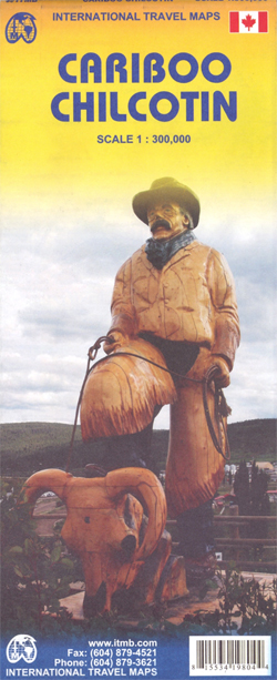
Double-sided road map at 1:300,000 from ITMB covering the Chilcotin Cariboo region of British Columbia, one of the most popular recreational areas of the province. Altitude colouring, spot heights and names of various mountain and hill ranges show the topography, with swamps and marshes, and the region’s extensive network of rivers and lakes. National parks and protected areas are prominently marked.Road network includes 4WD tracks and indicates locations of petrol stations. Local railways are also shown. An extensive range of symbols mark locations of campsites and trailer parks, wilderness camping and other accommodation facilities, plus numerous recreational areas: hiking, cross-country skiing, mountain biking, horse riding, canoeing, hand gliding, fishing, snowmobiling, etc. The map has latitude and longitude grid at intervals of 30’ and an index of localities.To see other titles in this series please click on the series link.


