Disclosure : This site contains affiliate links to products. We may receive a commission for purchases made through these links.
Caribbean Sea
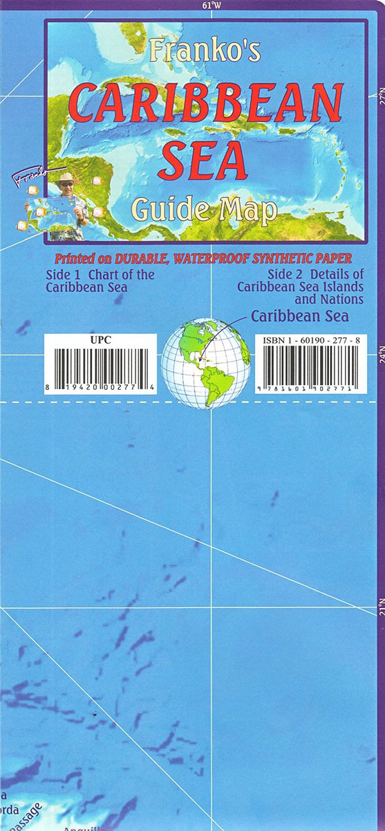
The Caribbean at 1:5,000,000 on a double-sided, waterproof and tear-resistant map from Franko’s Maps, useful for planning cruises in the region or as a reference during a voyage. On one side is a map of the Caribbean with the coast of Central America southwards from the Yucatan Peninsula and northern South America. Countries with their main cities and individual islands are named and the surrounding seas vividly present the ridges and banks of the sea floor.On the reverse is the same map, but with each country annotated with a panel providing a brief description of its history. This side of the map is also decorated with lovely drawings of various local fish.

Related Products:
 Caribbean – Central America – Virgin Islands – Bahamas
 Caribbean Marco Polo Map
 Caribbean Cruises F&B
 Caribbean – Lesser Antilles Nelles
 Central America – Caribbean Islands – Mexico
 Caribbean Collins Wall Map
 Caribbean Islands Explorer
 The Caribbean Destination Map
 Central America & the Caribbean – Stormrider Guide
 Caribbean Cruise Ports Marco Polo Pocket Guide – with pull out maps
 Caribbean NGS Classic Wall Map PAPER
 Insight Guides Pocket Caribbean Ports of Call
 Caribbean NGS Classic Wall Map ENCAPSULATED
 Caribbean – Central & South America
 Caribbean: The Northern Islands
 Caribbean Islands East & South ITMB Travel Atlas
 NV Charts – Caribbean Sea
 Caribbean Islands Western Half ITMB Travel Atlas
 Off the Beach in the Caribbean: Travels in the Little Leeward Islands
 Empire`s Crossroads: The Caribbean from Columbus to the Present Day
 The Caribbean Traveler Guide
 Where to Watch Birds Central America & the Caribbean
 A Cruising Guide to the Northwest Caribbean
 2021 Caribbean – Superyacht Services Guide
 Wildlife of the Caribbean
 Caribbean Certificate Atlas
 Caribbean Pilots Guide 2018
 Island People: The Caribbean and the World
 ADMIRALTY Total Tide Area 9 – North America (East Coast) & Caribbean – 12 Months
 A Brief History of the Caribbean: Indispensable for Travellers
 Berlitz Pocket Guide Caribbean Ports of Call
 So Many Islands: Stories from the Caribbean, Mediterranean, Indian and Pacific Oceans
 NP286 (7) Pilot Services (Central and S America, the Caribbean) 2021
 Lonely Planet Caribbean Islands
 Traveller`s Tree – Journey through the Caribbean Islands
 DK Eyewitness Travel Guide Caribbean
 Guyana and the Caribbean 1656
 Pirates of the Caribbean
 Tales from the Caribbean