Disclosure : This site contains affiliate links to products. We may receive a commission for purchases made through these links.
Caribbean – Lesser Antilles Nelles
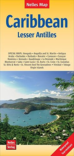
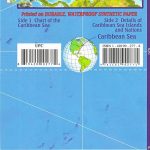
The southern part of the Caribbean at 1:2,500,000 from Nelles Verlag, combining separate maps of the individual islands with an overview of the whole region from Jamaica and the Dominican Republic to the coastline of South America.On one side is an overview map of the southern part of the Caribbean, with Jamaica, Hispaniola (Haiti and the Dominican Republic), Puerto Rico, Virgin Islands, Leeward Islands and Windward Islands, and the northern coast of South America. Next to the map and on the reverse are insets at various scales presenting enlargements of the individual islands or groups: Jamaica, Puerto Rico, Trinidad, Tobago, Virgin Islands, Anguilla with St Martin/Sint Maarten, St Berthรฉlemy, Saba, St Eustatius, St Kitts and Nevis, Montserrat, Barbuda, Antigua, Guadeloupe, Aruba, Curaรงao, Bonaire, Barbados, St Vincent and the Grenadines, Grenada, Saint Lucia, Martinique and Dominica.Topography of the islands is presented by relief shading with, where appropriate, names and heights of main peaks. The maps show each island’s network of main roads and tracks and locations of airports. Numerous places of interest and beaches are highlighted. On the overview map latitude and longitude are indicated by margin ticks at 2ยฐ intervals. Maps of the individual islands have no geographical coordinates. The map has no index of localities. Map legend includes English.

Related Products:
 Caribbean Cruises F&B
 Central America & the Caribbean – Stormrider Guide
 Insight Guides Caribbean: The Lesser Antilles (Travel Guide with Free eBook)
 DK Eyewitness Travel Guide Caribbean
 The Caribbean Destination Map
 Caribbean Islands Western Half ITMB Travel Atlas
 Caribbean – Central America – Virgin Islands – Bahamas
 Puerto Rico & US Virgin Islands ITMB
 Reg 12.1 Virgin Islands
 A Cruising Guide to Puerto Rico
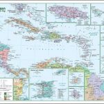
 Caribbean Sea
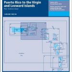 A2 Puerto Rico to the Virgin and Leeward Islands
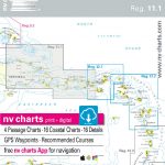 Reg 11.1 Puerto Rico
 Lonely Planet Caribbean Islands
 North America: Kรผmmerly + Frey Political Wall Map
 The Caribbean Traveler Guide
 Central America – Caribbean Islands – Mexico
 Caribbean Islands Explorer
 NOAA Charts for Puerto Rico and Virgin Islands
 Caribbean Islands East & South ITMB Travel Atlas
 Caribbean: The Northern Islands
 Cruise Ports Caribbean
 Insight Guides Pocket Caribbean Ports of Call
 Puerto Rico, the Spanish, US and British Virgin Islands
 Lesser Antilles: Guadeloupe and Martinique
 Caribbean Marco Polo Map
 Caribbean Collins Wall Map
 South Pacific Islands Nelles
 A Traveller`s History of the Caribbean
 The Rough Guide to the Dominican Republic
 Fodor`s Puerto Rico
 Caribbean Cruise Ports Marco Polo Pocket Guide – with pull out maps
 Caribbean National Forest – Puerto Rico NGS Trails Illustrated Map 790
 Birdwatchers` Guide to Cuba, Jamaica, Hispaniola, Puerto Rico & the Caymans
 A Brief History of the Caribbean: Indispensable for Travellers
 Moon Puerto Rico (Fifth Edition)
 Caribbean – Central & South America
Original Flava: Caribbean Recipes from Home
Caribbean – Central & South America
Original Flava: Caribbean Recipes from Home
 Birds of the Eastern Caribbean