Disclosure : This site contains affiliate links to products. We may receive a commission for purchases made through these links.
Caribbean Cruises F&B
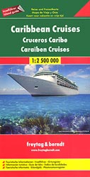
Caribbean Cruises Map from Freytag & Berndt showing on one side the whole region and on the reverse individual countries or islands on separate maps accompanied by descriptions and general information.On one side is a general map of the whole of the Caribbean, from Florida to the coast of South America, at 1:2,500,000, plus the index and information panels for Florida, Jamaica, Puerto Rico Haiti and the Dominican Republic.On the reverse are individual maps at various scales and information panels with descriptions of main places on interest for: Anguilla, Antigua and Barbuda, Aruba, Bahamas, Barbados, Bonaire, Cayman Islands, Curaรงao, Dominica, Grenada, Guadeloupe, Martinique, Montserrat, St Kitts and Nevis, St. Lucia, St. Martin/Maarten with St Barthรฉlemy, St. Vincent and the Grenadines, Trinidad and Tobago, Turks and Caicos Islands, British and US Virgin Islands, plus San Andrรฉs in Colombia and Isla de Margarita in Venezuela.Multilingual map legend includes English. The text in the information panels is in English and German.

Related Products:
 Caribbean – Lesser Antilles Nelles
 Caribbean Collins Wall Map
 Caribbean: The Northern Islands
 Insight Guides Caribbean: The Lesser Antilles (Travel Guide with Free eBook)
 Caribbean Islands East & South ITMB Travel Atlas
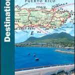 The Caribbean Destination Map
 DK Eyewitness Travel Guide Caribbean
 Insight Guides Pocket Caribbean Ports of Call
 Caribbean Sea
 Caribbean Islands Explorer
 Lonely Planet Caribbean Islands
 Caribbean Cruises
 Insight Guides Caribbean Cruises
 Central America & the Caribbean – Stormrider Guide
 Caribbean – Central America – Virgin Islands – Bahamas
 So Many Islands: Stories from the Caribbean, Mediterranean, Indian and Pacific Oceans
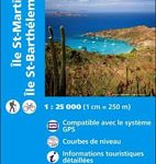 Saint-Martin / Sint Maarten – St.Barthรฉlemy IGN 4606GT
 Fodor`s Caribbean Cruise Ports of Call
 2021 Caribbean – Superyacht Services Guide
 Florida Keys Adventure & Dive Map-Guide
 Martinique & Guadeloupe ITMB
 Caribbean Cruise Ports Marco Polo Pocket Guide – with pull out maps
 Caribbean NGS Classic Wall Map ENCAPSULATED
 Wildlife of the Caribbean
 The South Sandwich Islands Volcanic Arc BAS Bathymetry and Geological Map 6
 Guadeloupe – St. Martin / Sint Maarten – St. Barthelemy IGN 84971
 The Caribbean Traveler Guide
 Cruise Ports Caribbean
 St. Vincent and the Grenadines
 Caribbean Pilots Guide 2018
 Caribbean Islands Western Half ITMB Travel Atlas
 Lesser Antilles: Guadeloupe and Martinique
 Caribbean Marco Polo Map
 Caribbean Certificate Atlas
 Caribbean NGS Classic Wall Map PAPER
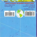
 NV Charts – Caribbean Sea
Florida Keys ITMB
NV Charts – Caribbean Sea
Florida Keys ITMB
 A Cruising Guide to the Northwest Caribbean
 Philip`s Certificate Atlas for the Caribbean
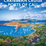
 Caribbean Cruise Ports Of Call