Disclosure : This site contains affiliate links to products. We may receive a commission for purchases made through these links.
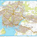
Cardiff A-Z Street Plan Wall Map
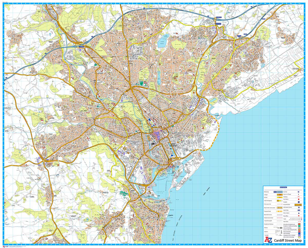
This Street Map of Cardiff is extracted from A-Z digital data to ensure that the latest A-Z revision is available as a printed sheet map.The map area covers:CardiffCardiff Bay & DocksDinas PowysEly (Trelรกi)LLandaffLlanishen (Llanisien)Marshfield (Maerun)Michaelston-super-ElyMorganstown (Treforgan)PenarthPentyrchRadyr (Radur)Rumney (Rhymni)St Fagans (Sain Ffagan)St MellonsThornhillWenvoe (Gwenfรด)Whitchurch (Yr Eglwys Newydd)A-Z Street Mapping includes:Distinctive road classification coloursUnder construction and proposed roadsOne-way streetsRailway and other transport networksCategorised buildingsPlaces of Interest

Related Products:
 Portsmouth A-Z Street Plan Wall Map
 Southampton A-Z Street Plan Wall Map
 Birmingham A-Z Street Plan Wall Map
 Coventry A-Z Street Plan Wall Map
 Cardiff A-Z Street Atlas
 Liverpool A-Z Street Plan Wall Map
 Leeds A-Z Street Plan Wall Map
 Plymouth A-Z Street Plan Wall Map
 Cardiff A-Z Pocket Street Map
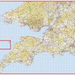 South West England & South Wales A-Z Wall Map PAPER
 Leicester A-Z Street Plan Wall Map
 Sheffield A-Z Street Plan Wall Map
 Iasi Cartographia Street Plan
 Buenos Aires Street de Dios Street Plan
 Bastia – Ajaccio – Calvi – Porto Vecchio Blay-Foldex Street Plan
Bremen Falk EXTRA Street Plan
Hanover Falk EXTRA Street Plan
Bastia – Ajaccio – Calvi – Porto Vecchio Blay-Foldex Street Plan
Bremen Falk EXTRA Street Plan
Hanover Falk EXTRA Street Plan
 Padua TCI Street Plan
 Pau Blay-Foldex Street Plan
 Vienna F&B Tourist Street Plan
Nuremberg Falk EXTRA Street Plan
Frankfurt am Main Falk EXTRA Street Plan
Trier Falk EXTRA Street Plan
Palermo TCI Street Plan
Vienna F&B Tourist Street Plan
Nuremberg Falk EXTRA Street Plan
Frankfurt am Main Falk EXTRA Street Plan
Trier Falk EXTRA Street Plan
Palermo TCI Street Plan
 Hyรจres Blay-Foldex Street Plan
 Mรขcon Blay-Foldex Street Plan
 Strasbourg Blay-Foldex Street Plan
 Nice Blay-Foldex Street Plan
 Tours Blay-Foldex Street Plan
 Grenoble Blay-Foldex Street Plan
 Rouen Blay-Foldex Street Plan
 Nancy Blay-Foldex Street Plan
 Le Mans Blay-Foldex Street Plan
 Poitiers Blay-Foldex Street Plan
 Brest Blay-Foldex Street Plan
 Montauban Blay-Foldex Street Plan
 Valence Blay-Foldex Street Plan
 Paris Blay-Foldex Street Plan
 Lorient Blay-Foldex Street Plan
 Auxerre Blay-Foldex Street Plan