Disclosure : This site contains affiliate links to products. We may receive a commission for purchases made through these links.
Caracas F&B
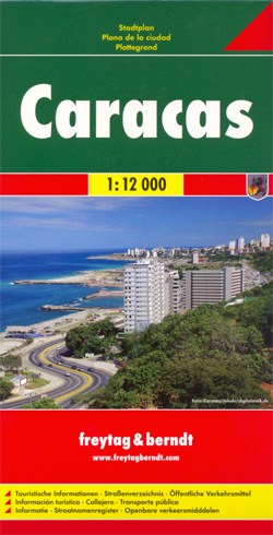
Caracas on a large indexed street plan at 1:12,000 from Freytag & Berndt covering the city with its outer districts and showing metro stations, various places of interest and facilities, etc. Coverage extends north to El Avila National Park and south to the La Rinconada race track, Baruta, Canta Rana and Alto Hatillo. West/east the plan extends from Perez Bonalde, Vista Alegre and La Vega districts to beyond the city’s Gen. Francisco de Miranda Airport to Le Marques California Norte, California Sur and Vista Linda districts.Principal traffic arteries are highlighted and exits onto the motorway are clearly drawn. The plan shows metro lines with stations and highlights various public buildings and facilities, including locations of several hotels. Street index is on the reverse. Multilingual map legend includes English.

Related Products:
 Prague F&B
 Singapore Borch
 Montreal
 Jakarta ITMB
 Los Angeles Borch
 Santiago de Chile Trekkingchile Street Plan
 Shanghai Periplus Travel Map
 Prague Borch
 Madrid Borch
 Rio de Janeiro de Dios CityMap
 Istanbul Marco Polo City Map
 Warsaw & Poland East ITMB
 Tokyo & Central Japan ITMB
 Wellington F&B
 Mumbai / Bombay – India West Coast ITMB
 Dublin Borch
 St. Petersburg Jana Seta Street Plan
 Amsterdam Borch
 Brussels Borch
 Bangkok Marco Polo City Map
 Buenos Aires & Argentina North East ITMB
 Kiev F&B City Pocket
 Sao Paulo & Brazil South Coast ITMB
 Moscow Jana Seta Street Plan
 Jurmala Jana Seta Street Plan
 Berlin Cityplan Pocket Map
 Manila ITMB
 East London and Gonubie
 Easter Island & Santiago ITMB
 Trujillo Metro Plan
 Barcelona Borch
Madrid Essential Telstar Map
Barcelona Borch
Madrid Essential Telstar Map
 Old City of Jerusalem Map
 Palma de Mallorca City Map / Mallorca Road Map
 Athens Anavasi Pocket Map
 Bangkok Borch
 Vilnius Jana Seta Pocket Street Plan
 Rome
Rome
 Barcelona: Gaudรญ Architecture Street Plan
 Santiago de Dios Map-Guide