Disclosure : This site contains affiliate links to products. We may receive a commission for purchases made through these links.
Cape Town – Western Cape Towns Map Studio Street Atlas

Cape Town and Western Cape Towns Street Atlas from Map Studio at 1:20,000, in an A4 spiral-bound format, with coverage extending well beyond the city’s outer suburbs to the towns of the Cape Winelands and South-Western Cape. The atlas includes an enlargement of central Cape Town and a route-planning map of main roads across the region with names and numbers of intersections.Motorways and main traffic arteries are highlighted, clearly showing access to/from junctions. One way streets, traffic lights and locations of petrol stations and car parks are marked. Railway lines are shown with stations. A very wide range of symbols indicate various facilities and places of interest, including hotels and other tourist accommodation, shopping centres, etc. In the Winelands area individual estates and wine sales points are also indicated. The atlas has two separate indexes: for street names and for the institutions such as schools, medical facilities, etc. Also provided are plans of the city’s international airport.Coverage includes Atlantis, Bredasdorp, Caledon, Ceres, Darling, Franschhoek, Grabouw, Hermanus, Gordon’s Bay, Kleinmond, Langebaan, Malmesbury, Montagu, Paarl, Pobertson, Saldanha, Somerset West, Stellenbosch, Strand, Swellendam, Tulbagh, Villiersdorp, Wellington and Worcester.

Related Products:
 Western Cape Map Studio Pocket Map
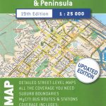
 Cape Town & the Peninsula Map Studio Visitors Guide
 Cape Town & Peninsula Map Studio
 Cape Town Map Studio Pocket Map
 Winelands of the Western Cape Map Studio
 Winelands of the Western Cape Map Studio SUPERCEDED
 Africa Overland – Cairo to Cape Town ITMB Travel Atlas
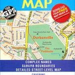
Western Cape Map Studio
Africa Overland – Cairo to Cape Town ITMB Travel Atlas
Western Cape Map Studio
 100km around Cape Town
 Cape Town – Northern Suburbs
 Cape Town Borch
 Cape Town & Surrounding Attractions Map Studio
 Cape Town Marco Polo City Map
 Ontario Western Street Atlas
 The ultimate guide to food, wine & adventure in Cape town and the Western Cape
 South Island New Zealand – 244 Provincial City & Towns Kiwimaps Travellers Street Directory
 Skopje Street Atlas
 Time Out Cape Town City Guide
 Maidstone & Medway Towns A-Z Street Atlas
 Cape Town, Winelands and The Garden Route Marco Polo Guide
 DK Eyewitness Top 10 Cape Town and the Winelands
 Cape Town – Cape Peninsula NP & Winelands
 South Africa Map Studio Glovebox Road Atlas
 Pune City Street Atlas
 Leicestershire and Rutland Philip`s Street Atlas
 Caribbean Islands Western Half ITMB Travel Atlas
 The Rough Guide to Cape Town, The Winelands and the Garden Route
 Canterbury, Margate, Ramsgate & North Kent Coastal Towns A-Z Street Atlas
 Berlitz Pocket Guide Cape Town
 Western & Northern Canada ITMB Travel Atlas
 Prague Street Atlas
 Wiltshire and Swindon Philip`s Street Atlas
 Surrey Philip`s Street Atlas
 Cape Town F&B
 Zurich Pocket Street Atlas
 Cornwall Philip`s Street Atlas
 Kolkata / Calcutta Street Atlas
 Cape Town & Peninsula NGS Adventure Map 3200
 Navi Mumbai Street Atlas
 Greater London Collins Street Atlas