Disclosure : This site contains affiliate links to products. We may receive a commission for purchases made through these links.
Cape Town & the Peninsula Map Studio Visitors Guide
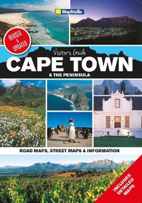
Cape Town and the Peninsula Visitor`s Guide and Atlas from Map Studio in a 24-page, A4 paperback format (5th edition, 2015), with highlighting of numerous places of interest and tourist facilities, descriptions of the area’s best sights, a winelands map, etc. Cape Town itself is shown on three maps: a street plan of its central districts indicating locations of 62 hotels and numerous other places of interest, a two-page street plan of the city showing its main transport arteries and access to the Table Mountain, plus a very attractive detailed plan of the V&A Waterfront with buildings drawn in 3-D. Cape Peninsula is shown on mapping at approx. 1:43,000, accompanied by enlargements and street plans presenting its most visited areas in greater detail. Included among them are a map showing hiking trails in the Table Mountain National Park, a plan of the Kirstenbosch Botanica Garden, maps of the Constantia Winelands, Robben Island, Hoerikwaggo Trail, etc. Topography of this interesting area is indicated by light relief shading and spot heights, with special colouring for protected areas.The atlas provides descriptions of top sights, suggestions for sightseeing routes, phone numbers for various organizations, etc.


