Disclosure : This site contains affiliate links to products. We may receive a commission for purchases made through these links.
Categories
-
Best Sellers
-

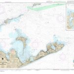
NOAA Chart 13209 – Block Island Sound and Gardiners Bay – Montauk Harbor
NOAA maintains the nautical charts and publications for U.S. coasts and the Great Lakes. Over a thousand charts cover 95,000 miles of shoreline and 3.4 million Read More » -
D6329 Mercator Plotting Sheet Lat. 24ยฐ to 27ยฐ N. and S.
A series charts each covering three degrees of latitude with a compass rose and latitude scale, longitude being defined by the user.This facilitates dead reckoning plots Read More » -

Don`t Tell Me You`re Afraid
Based on a remarkable true story, `Don`t Tell Me You`re Afraid` is a moving, inspiring novel of a life lived in hope. Samia Omar grows up Read More » -

Yanma
Yamna, sheet no. 2787-04, in the topographic survey of Nepal at 1:50,000 published by the Nepali Government in the late 1990s and early 2000s and produced Read More » -

MCA Garbage Record Book
-
Norwich (North) 1905 – 63.11
Norwich North in 1905 in a fascinating series of reproductions of old Ordnance Survey plans in the Alan Godfrey Editions, ideal for anyone interested in the Read More » -

O`ahu Phears Travel Map
A large, comprehensive touring map provides you with an overview of the entire islands highways and major thoroughfares, as well as providing detailed point of interest Read More » -

Admiralty Chart JP1033B – South Coast, Eastern Part of Tomakomai Ko
Admiralty standard nautical charts comply with Safety of Life at Sea (SOLAS) regulations and are ideal for professional, commercial and recreational use. Charts within the series Read More » -

Aachen EXTRA
Falk, one of Germany`s leading publishers of street plans, produce their town plans in two different formats. Falk Extra plans are folded in a standard way, Read More » -

Be as Children
-


